
MARS
Ro-Ro Cargo
Current Trip
TARAHAN
| Time Travelled | 15 days |
|---|---|
| Remaining Time | --- |
| Distance Travelled | 2490.08 nm |
| Remaining Distance | --- |
| AVG Speed | 11.8 Knopen |
| MAX Speed | 14.7 Knopen |
| AVG Wind | 10.1 knots |
| MAX Wind | 19 knots |
| MIN Temp | 22°C / 71.6°F |
| MAX Temp | 30°C / 86°F |
| Diepgang | 5.4 M |
| Positie ontvangen | 7 m geleden |
Current Position
| Lengtegraad | 105.53173° |
|---|---|
| Breedtegraat | -5.82508° |
| Status | Under way using engine |
| Snelheid | 11.7 Knopen |
| Koers | 132.3° |
| Gebied | Java Sea |
| Station | T-AIS |
| Positie ontvangen | 7 m geleden |
Info
Information
The current position of MARS is in Java Sea with coordinates -5.82508° / 105.53173° as reported on 2026-01-10 15:15 by AIS to our vessel tracker app. The vessel's current speed is 11.7 Knopen
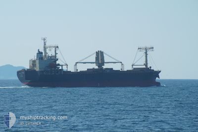
The vessel MARS (IMO: 9370551, MMSI: 372116000) is a Ro-Ro Cargo that was built in 2006 ( 20 Jaar oud ). It's sailing under the flag of [PA] Panama.
In this page you can find informations about the vessels current position, last detected port calls, and current voyage information. If the vessels is not in coverage by AIS you will find the latest position.
The current position of MARS is detected by our AIS receivers and we are not responsible for the reliability of the data. The last position was recorded while the vessel was in Coverage by the Ais receivers of our vessel tracking app.
The current draught of MARS as reported by AIS is 5.4 meters
Weather
| Temperature | 26.9°C / 80.42°F |
|---|---|
| Wind Speed | 9 knots |
| Direction | 259° W |
| Pressure | 1012.4 hPa |
| Humidity | 77.2 % |
| Cloud Coverage | 26 % |
Featured Company
Last Port Calls
| Port | Arrival | Departure | Time In Port |
|---|---|---|---|
| 2025-12-22 21:31 | 2025-12-26 04:07 | 3 d | |
| 2025-12-07 23:53 | 2025-12-10 03:45 | 2 d | |
| 2025-11-22 18:29 | 2025-11-23 22:46 | 1 d | |
| 2025-11-14 04:32 | 2025-11-15 19:24 | 1 d |
Last Trips
| Origin | Departure | Destination | Arrival | Distance | |
|---|---|---|---|---|---|
| 2025-12-10 03:45 | 2025-12-22 21:31 | 3168.44 nm | |||
| 2025-11-23 22:46 | 2025-12-07 23:53 | 1422.46 nm | |||
| 2025-11-15 19:24 | 2025-11-22 18:29 | 249.13 nm | |||
| 2025-10-15 23:43 | 2025-11-14 04:32 | 4447.97 nm |
Events
| Tijd | Evenement | Details | Positie / Bestemming | Info |
|---|---|---|---|---|
| 2026-01-10 15:06 | Status Changed | Under way using engine Default |
-5.80526 / 105.50906
TARAHAN
|
Snelheid: 11.2 kn Koers: 132° |
| 2026-01-10 15:03 | Status Changed | Default Under way using engine |
-5.80058 / 105.50334
TARAHAN
|
Snelheid: 11.2 kn Koers: 135.3° |
| 2026-01-10 14:57 | Status Changed | Under way using engine Default |
-5.78597 / 105.49143
TARAHAN
|
Snelheid: 11.1 kn Koers: 142° |
| 2026-01-10 14:40 | Status Changed | Default Under way using engine |
-5.74226 / 105.45689
TARAHAN
|
Snelheid: 11 kn Koers: 143.3° |
| 2026-01-10 14:28 | Status Changed | Under way using engine Default |
-5.71360 / 105.43477
TARAHAN
|
Snelheid: 11 kn Koers: 140° |
| 2026-01-10 14:16 | Status Changed | Default Under way using engine |
-5.68375 / 105.41125
TARAHAN
|
Snelheid: 11 kn Koers: 142.4° |
| 2026-01-10 14:08 | Status Changed | Under way using engine Default |
-5.66524 / 105.39652
TARAHAN
|
Snelheid: 11 kn Koers: 140° |
| 2026-01-10 14:04 | Binnenbereik |
-5.66524 / 105.39652
Java Sea
|
Snelheid: 11 kn Koers: 142.4° |
|
| 2026-01-10 12:59 | Start beweging | 4.72 nm, South East of PANJANG |
-5.51583 / 105.33223
TARAHAN
|
Snelheid: 5.1 kn Koers: 220° |
| 2026-01-08 21:24 | Stop beweging | 4.71 nm, South East of PANJANG |
-5.50968 / 105.33667
TARAHAN
|
Snelheid: 0.3 kn Koers: 139° |