
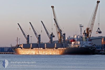
MED ISLAND
Bulk Carrier
Current Trip
EG DAM
| Time Travelled | 1 day |
|---|---|
| Remaining Time | --- |
| Distance Travelled | 12.50 nm |
| Remaining Distance | --- |
| AVG Speed | 7.6 Knopen |
| MAX Speed | 8.8 Knopen |
| AVG Wind | 8.9 knots |
| MAX Wind | 15 knots |
| MIN Temp | 17.8°C / 64.04°F |
| MAX Temp | 18.8°C / 65.84°F |
| Diepgang | 9.7 M |
| Positie ontvangen | 3 d geleden |
Current Position
| Lengtegraad | 26.72996° |
|---|---|
| Breedtegraat | 36.48399° |
| Status | Under way using engine |
| Snelheid | 9.9 Knopen |
| Koers | 140.1° |
| Gebied | Aegean Sea |
| Station | T-AIS |
| Positie ontvangen | 3 d geleden |
Info
Information
The current position of MED ISLAND is in Aegean Sea with coordinates 36.48399° / 26.72996° as reported on 2026-01-02 18:06 by AIS to our vessel tracker app. The vessel's current speed is 9.9 Knopen
The vessel MED ISLAND (IMO: 9322748, MMSI: 256155000) is a Bulk Carrier that was built in 2005 ( 21 Jaar oud ). It's sailing under the flag of [MT] Malta.
In this page you can find informations about the vessels current position, last detected port calls, and current voyage information. If the vessels is not in coverage by AIS you will find the latest position.
The current position of MED ISLAND is detected by our AIS receivers and we are not responsible for the reliability of the data. The last position was recorded while the vessel was in Coverage by the Ais receivers of our vessel tracking app.
The current draught of MED ISLAND as reported by AIS is 9.7 meters
Weather
| Temperature | 17.8°C / 64.04°F |
|---|---|
| Wind Speed | 4 knots |
| Direction | 269° W |
| Pressure | 1021.3 hPa |
| Humidity | 67 % |
| Cloud Coverage | 38 % |
Featured Company
Most Visited Ports (Last year)
| Port | Arrivals | |
|---|---|---|
| 6 | ||
| 4 | ||
| 2 | ||
| 2 | ||
| 2 | ||
| 1 |
Events
| Tijd | Evenement | Details | Positie / Bestemming | Info |
|---|---|---|---|---|
| 2026-01-04 17:47 | Stop beweging | 10.51 nm, North of DAMIETTA |
31.64014 / 31.72183
EG DAM
|
Snelheid: 0.1 kn Koers: 71° |
| 2026-01-04 15:42 | Vertrekhaven |
|
31.49880 / 31.76087
EG DAM
|
Snelheid: 7.6 kn Koers: 12° |
| 2026-01-04 15:22 | Start beweging |
31.46660 / 31.76169
[EG] DAMIETTA
|
Snelheid: 3.2 kn Koers: 299° |
|
| 2026-01-04 09:37 | Stop beweging |
31.46476 / 31.76139
[EG] DAMIETTA
|
Snelheid: 0.3 kn Koers: 102° |
|
| 2026-01-04 08:52 | Aankomsthaven |
|
31.49053 / 31.75948
[EG] DAMIETTA
|
Snelheid: 4.9 kn Koers: 190° |
| 2026-01-02 18:30 | Status Changed | Default Under way using engine |
36.43614 / 26.78167
EG DAM
|
Snelheid: 9.9 kn Koers: 140.1° |
| 2026-01-02 18:06 | Buitenbereik |
36.48399 / 26.72996
Aegean Sea
EG DAM
|
Snelheid: 9.9 kn Koers: 140.1° |
|
| 2026-01-02 17:54 | Status Changed | Under way using engine Default |
36.51006 / 26.70248
EG DAM
|
Snelheid: 10.1 kn Koers: 137° |
| 2026-01-02 17:37 | Status Changed | Default Under way using engine |
36.54544 / 26.66269
EG DAM
|
Snelheid: 10.2 kn Koers: 136° |
| 2026-01-02 14:30 | Status Changed | Under way using engine Default |
36.94304 / 26.21212
EG DAM
|
Snelheid: 10.5 kn Koers: 148° |