
MEDKON LIA
Container Ship
Current Trip
| Trip Time | 4 days |
|---|---|
| Trip Distance | 927.31 nm |
| AVG Speed | 12.1 Knopen |
| MAX Speed | 13.5 Knopen |
| Diepgang | 8.3 M |
| AVG Wind | 16.8 knots |
| MAX Wind | 28 knots |
| MIN Temp | 3.6°C / 38.48°F |
| MAX Temp | 16.1°C / 60.98°F |
| Positie ontvangen | 1 d geleden |
Current Position
| Lengtegraad | 13.75742° |
|---|---|
| Breedtegraat | 36.39090° |
| Status | Under way using engine |
| Snelheid | 11.6 Knopen |
| Koers | 298.3° |
| Gebied | Mediterranean Sea - Eastern Basin |
| Station | T-AIS |
| Positie ontvangen | 1 d geleden |
Info
Information
The current position of MEDKON LIA is in Mediterranean Sea - Eastern Basin with coordinates 36.39090° / 13.75742° as reported on 2025-02-12 23:26 by AIS to our vessel tracker app. The vessel's current speed is 11.6 Knopen and is currently inside the port of RADES.
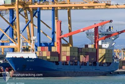
The vessel MEDKON LIA (IMO: 9139646, MMSI: 352002790) is a Container Ship that was built in 1998 ( 27 Jaar oud ). It's sailing under the flag of [PA] Panama.
In this page you can find informations about the vessels current position, last detected port calls, and current voyage information. If the vessels is not in coverage by AIS you will find the latest position.
The current position of MEDKON LIA is detected by our AIS receivers and we are not responsible for the reliability of the data. The last position was recorded while the vessel was in Coverage by the Ais receivers of our vessel tracking app.
The current draught of MEDKON LIA as reported by AIS is 8.3 meters
Weather
| Temperature | 11°C / 51.8°F |
|---|---|
| Wind Speed | 9 knots |
| Direction | 243° WSW |
| Pressure | 1016.4 hPa |
| Humidity | 87.1 % |
| Cloud Coverage | 48 % |
Featured Company
Last Port Calls
| Port | Arrival | Departure | Time In Port |
|---|---|---|---|
| 2025-02-14 08:36 | |||
| 2025-02-09 09:56 | 2025-02-09 21:07 | 11 h | |
| 2025-02-08 03:38 | 2025-02-08 15:38 | 12 h | |
| 2025-02-07 07:03 | 2025-02-07 22:47 | 15 h | |
| 2025-02-03 12:34 | 2025-02-04 12:48 | 1 d | |
| 2025-02-03 08:12 | 2025-02-03 12:28 | 4 h | |
| 2025-01-25 02:01 | 2025-01-28 01:05 | 2 d | |
| 2025-01-20 15:12 | 2025-01-22 00:30 | 1 d | |
| 2025-01-17 13:08 | 2025-01-18 05:11 | 16 h | |
| 2025-01-16 08:47 | 2025-01-16 17:30 | 8 h |
Last Trips
| Origin | Departure | Destination | Arrival | Distance | |
|---|---|---|---|---|---|
| 2025-02-09 21:07 | 2025-02-14 08:36 | 927.31 nm | |||
| 2025-02-08 15:38 | 2025-02-09 09:56 | 234.27 nm | |||
| 2025-02-07 22:47 | 2025-02-08 03:38 | 47.87 nm | |||
| 2025-02-04 12:48 | 2025-02-07 07:03 | 814.59 nm | |||
| 2025-02-03 12:28 | 2025-02-03 12:34 | 1.51 nm | |||
| 2025-01-28 01:05 | 2025-02-03 08:12 | 819.24 nm | |||
| 2025-01-22 00:30 | 2025-01-25 02:01 | 249.86 nm | |||
| 2025-01-18 05:11 | 2025-01-20 15:12 | 725.00 nm | |||
| 2025-01-16 17:30 | 2025-01-17 13:08 | 233.64 nm | |||
| 2025-01-16 03:31 | 2025-01-16 08:47 | 46.97 nm |
Events
| Tijd | Evenement | Details | Positie / Bestemming | Info |
|---|---|---|---|---|
| 2025-02-14 08:07 | Stop beweging |
36.80332 / 10.26928
[TN] RADES
|
Snelheid: Koers: 78° |
|
| 2025-02-14 07:36 | Aankomsthaven |
|
36.81072 / 10.28053
[TN] RADES
|
Snelheid: 7.6 kn Koers: 288° |
| 2025-02-14 06:06 | Start beweging | 5.81 nm, South East of SIDI BOU SAID |
36.79455 / 10.43220
TNRDS
|
Snelheid: 5.4 kn Koers: 263° |
| 2025-02-13 16:26 | Stop beweging | 6.79 nm, South East of SIDI BOU SAID |
36.79121 / 10.45671
TNRDS
|
Snelheid: Koers: 14° |
| 2025-02-12 23:32 | Status Changed | Default Under way using engine |
36.39960 / 13.73766
TNRDS
|
Snelheid: 11.6 kn Koers: 298.3° |
| 2025-02-12 23:26 | Buitenbereik |
36.39090 / 13.75742
Mediterranean Sea - Eastern Basin
TNRDS
|
Snelheid: 11.6 kn Koers: 298.3° |
|
| 2025-02-12 19:36 | Draught Changed | 8.3 8.6 |
36.01268 / 14.60400
TNRDS
|
Snelheid: 12.1 kn Koers: 304.2° |
| 2025-02-12 19:36 | Destination Changed | TNRDS DZALG |
36.01268 / 14.60400
TNRDS
|
Snelheid: 12.1 kn Koers: 304.2° |
| 2025-02-12 19:36 | ETA Changed | 2025/02/13 10:00 2025/02/14 10:00 |
36.01268 / 14.60400
TNRDS
|
Snelheid: 12.1 kn Koers: 304.2° |
| 2025-02-12 19:11 | Status Changed | Under way using engine Default |
35.96724 / 14.68821
DZALG
|
Snelheid: 12.6 kn Koers: 288° |