

MEUSE RIVER
Dredging or underwater ops
Current Trip
| Time Travelled | 8 days |
|---|---|
| Remaining Time | --- |
| Distance Travelled | 1694.43 nm |
| Remaining Distance | --- |
| AVG Speed | 9 Knopen |
| MAX Speed | 16.8 Knopen |
| AVG Wind | 7.3 knots |
| MAX Wind | 24 knots |
| MIN Temp | 3.7°C / 38.66°F |
| MAX Temp | 16°C / 60.8°F |
| Diepgang | 8.8 M |
| Positie ontvangen | Nu |
Current Position
| Lengtegraad | 8.62456° |
|---|---|
| Breedtegraat | 53.95021° |
| Status | Restricted manoeuverability |
| Snelheid | 1.7 Knopen |
| Koers | 126° |
| Gebied | North Sea |
| Station | T-AIS |
| Positie ontvangen | Nu |
Information
The current position of MEUSE RIVER is in North Sea with coordinates 53.95021° / 8.62456° as reported on 2025-04-26 05:14 by AIS to our vessel tracker app. The vessel's current speed is 1.7 Knopen and is heading at the port of LAUENBURG. The estimated time of arrival as calculated by MyShipTracking vessel tracking app is 2025-06-01 08:00 LT
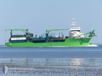
The vessel MEUSE RIVER (IMO: 9866988, MMSI: 253747000) is a Dredging or underwater ops It's sailing under the flag of [LU] Luxembourg.
In this page you can find informations about the vessels current position, last detected port calls, and current voyage information. If the vessels is not in coverage by AIS you will find the latest position.
The current position of MEUSE RIVER is detected by our AIS receivers and we are not responsible for the reliability of the data. The last position was recorded while the vessel was in Coverage by the Ais receivers of our vessel tracking app.
The current draught of MEUSE RIVER as reported by AIS is 8.8 meters
Weather
| Temperature | 8.8°C / 47.84°F |
|---|---|
| Wind Speed | 11 knots |
| Direction | 118° ESE |
| Pressure | 1024.6 hPa |
| Humidity | 77.3 % |
| Cloud Coverage | 9 % |
Featured Company
Last Port Calls
| Port | Arrival | Departure | Time In Port |
|---|---|---|---|
| 2025-04-17 05:50 | 2025-04-17 16:18 | 10 h | |
| 2025-04-03 06:11 | 2025-04-03 18:14 | 12 h | |
| 2025-03-20 06:16 | 2025-03-21 06:03 | 23 h | |
| 2025-03-06 06:10 | 2025-03-06 19:10 | 13 h | |
| 2025-02-20 06:04 | 2025-02-20 21:38 | 15 h | |
| 2025-02-05 05:46 | 2025-02-05 19:14 | 13 h |
Most Visited Ports (Last year)
| Port | Arrivals | |
|---|---|---|
| 48 | ||
| 22 | ||
| 4 | ||
| 4 | ||
| 3 | ||
| 1 |
Last Trips
| Origin | Departure | Destination | Arrival | Distance | |
|---|---|---|---|---|---|
| 2025-04-03 18:14 | 2025-04-17 05:50 | 3252.44 nm | |||
| 2025-03-21 06:03 | 2025-04-03 06:11 | 2434.50 nm | |||
| 2025-03-06 19:10 | 2025-03-20 06:16 | 1745.52 nm | |||
| 2025-02-20 21:38 | 2025-03-06 06:10 | 1640.88 nm | |||
| 2025-02-05 19:14 | 2025-02-20 06:04 | 2023.88 nm | |||
| 2025-01-23 17:53 | 2025-02-05 05:46 | 1898.41 nm |
Events
| Tijd | Evenement | Details | Positie / Bestemming | Info |
|---|---|---|---|---|
| 2025-04-26 04:35 | Start beweging | 5.95 nm, North West of CUXHAVEN |
53.95187 / 8.62189
ELBE DREDGING
|
Snelheid: 3.1 kn Koers: 127° |
| 2025-04-26 04:33 | Stop beweging | 6.05 nm, North West of CUXHAVEN |
53.95297 / 8.61940
ELBE DREDGING
|
Snelheid: 0.1 kn Koers: 139° |
| 2025-04-26 03:13 | Start beweging | 12.36 nm, North West of CUXHAVEN |
53.97945 / 8.41740
ELBE DREDGING
|
Snelheid: 8.1 kn Koers: 86.8° |
| 2025-04-26 02:58 | Stop beweging | 12.46 nm, North West of CUXHAVEN |
53.97906 / 8.41352
ELBE DREDGING
|
Snelheid: 0.2 kn Koers: 104° |
| 2025-04-26 00:07 | Start beweging | 12.42 nm, North West of CUXHAVEN |
53.97845 / 8.41436
ELBE DREDGING
|
Snelheid: 6.2 kn Koers: 96.3° |
| 2025-04-25 23:54 | Stop beweging | 12.53 nm, North West of CUXHAVEN |
53.97900 / 8.41127
ELBE DREDGING
|
Snelheid: 0.3 kn Koers: 106° |
| 2025-04-25 21:07 | Start beweging | 12.56 nm, North West of CUXHAVEN |
53.98064 / 8.41174
ELBE DREDGING
|
Snelheid: 6.6 kn Koers: 35.4° |
| 2025-04-25 20:54 | Stop beweging | 12.47 nm, North West of CUXHAVEN |
53.97896 / 8.41297
ELBE DREDGING
|
Snelheid: 0.2 kn Koers: 280° |
| 2025-04-25 18:55 | Start beweging | 6.01 nm, North West of CUXHAVEN |
53.95263 / 8.62067
ELBE DREDGING
|
Snelheid: 3.4 kn Koers: 244° |
| 2025-04-25 18:36 | Stop beweging | 5.5 nm, North West of CUXHAVEN |
53.94736 / 8.63387
ELBE DREDGING
|
Snelheid: 0.3 kn Koers: 23° |