
MIRROR
Container Ship
Current Trip
| Time Travelled | 2 days |
|---|---|
| Remaining Time | 1 day |
| Distance Travelled | 825.77 nm |
| Remaining Distance | 691.86 nm |
| AVG Speed | 14.3 Knopen |
| MAX Speed | 16.9 Knopen |
| AVG Wind | 19.1 knots |
| MAX Wind | 28 knots |
| MIN Temp | 11.2°C / 52.16°F |
| MAX Temp | 16.8°C / 62.24°F |
| Diepgang | 7.1 M |
| Positie ontvangen | 19 h, 9 m geleden |
Current Position
| Lengtegraad | -6.02098° |
|---|---|
| Breedtegraat | 35.82716° |
| Status | Under way using engine |
| Snelheid | 15.7 Knopen |
| Koers | 234° |
| Gebied | North Atlantic Ocean |
| Station | T-AIS |
| Positie ontvangen | 19 h, 9 m geleden |
Info
Information
The current position of MIRROR is in North Atlantic Ocean with coordinates 35.82716° / -6.02098° as reported on 2025-03-03 00:39 by AIS to our vessel tracker app. The vessel's current speed is 15.7 Knopen and is heading at the port of TENERIFE. The estimated time of arrival as calculated by MyShipTracking vessel tracking app is 2025-03-04 21:29 LT
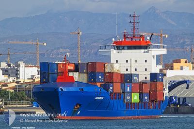
The vessel MIRROR (IMO: 9328041, MMSI: 255805842) is a Container Ship that was built in 2007 ( 18 Jaar oud ). It's sailing under the flag of [PT] Portugal.
In this page you can find informations about the vessels current position, last detected port calls, and current voyage information. If the vessels is not in coverage by AIS you will find the latest position.
The current position of MIRROR is detected by our AIS receivers and we are not responsible for the reliability of the data. The last position was recorded while the vessel was in Coverage by the Ais receivers of our vessel tracking app.
The current draught of MIRROR as reported by AIS is 7.1 meters
Weather
| Temperature | 16.7°C / 62.06°F |
|---|---|
| Wind Speed | 11 knots |
| Direction | 6° N |
| Pressure | 1009.1 hPa |
| Humidity | 75.4 % |
| Cloud Coverage | 8 % |
Featured Company
Last Port Calls
| Port | Arrival | Departure | Time In Port |
|---|---|---|---|
| 2025-02-28 11:22 | 2025-03-01 10:50 | 23 h | |
| 2025-02-26 11:09 | 2025-02-27 20:22 | 1 d | |
| 2025-02-16 16:56 | 2025-02-17 05:49 | 12 h | |
| 2025-02-13 11:59 | 2025-02-13 19:07 | 7 h | |
| 2025-02-12 17:42 | 2025-02-13 02:33 | 8 h | |
| 2025-02-12 06:34 | 2025-02-12 13:21 | 6 h | |
| 2025-02-08 05:28 | 2025-02-09 01:20 | 19 h | |
| 2025-02-06 22:11 | 2025-02-07 12:13 | 14 h | |
| 2025-01-27 15:48 | 2025-01-28 08:23 | 16 h | |
| 2025-01-24 14:39 | 2025-01-24 20:12 | 5 h |
Last Trips
| Origin | Departure | Destination | Arrival | Distance | |
|---|---|---|---|---|---|
| 2025-02-27 21:22 | 2025-02-28 12:22 | 230.15 nm | |||
| 2025-02-17 06:49 | 2025-02-26 12:09 | 3073.82 nm | |||
| 2025-02-13 19:07 | 2025-02-16 17:56 | 1128.07 nm | |||
| 2025-02-13 02:33 | 2025-02-13 11:59 | 114.43 nm | |||
| 2025-02-12 13:21 | 2025-02-12 17:42 | 55.97 nm | |||
| 2025-02-09 02:20 | 2025-02-12 06:34 | 1241.42 nm | |||
| 2025-02-07 13:13 | 2025-02-08 06:28 | 228.30 nm | |||
| 2025-01-28 09:23 | 2025-02-06 23:11 | 3104.24 nm | |||
| 2025-01-24 20:12 | 2025-01-27 16:48 | 1120.70 nm | |||
| 2025-01-24 02:36 | 2025-01-24 14:39 | 2.53 nm |
Events
| Tijd | Evenement | Details | Positie / Bestemming | Info |
|---|---|---|---|---|
| 2025-03-03 00:43 | Status Changed | Default Under way using engine |
35.81859 / -6.03530
TENERIFE
|
Snelheid: 15.7 kn Koers: 234° |
| 2025-03-03 00:39 | Buitenbereik |
35.82716 / -6.02098
North Atlantic Ocean
TENERIFE
|
Snelheid: 15.7 kn Koers: 234° |
|
| 2025-03-03 00:32 | Gevonden in zee | Moroccan part of the North Atlantic Ocean |
35.84497 / -5.99129
North Atlantic Ocean
TENERIFE
|
Snelheid: 15.7 kn Koers: 233.6° |
| 2025-03-03 00:32 | Status Changed | Under way using engine Default |
35.84497 / -5.99129
TENERIFE
|
Snelheid: 16.1 kn Koers: 237° |
| 2025-03-03 00:13 | Status Changed | Default Under way using engine |
35.89239 / -5.90262
TENERIFE
|
Snelheid: 15.5 kn Koers: 238.6° |
| 2025-03-02 23:57 | Status Changed | Under way using engine Default |
35.92664 / -5.82845
TENERIFE
|
Snelheid: 15.6 kn Koers: 247° |
| 2025-03-02 23:52 | Status Changed | Default Under way using engine |
35.93623 / -5.80078
TENERIFE
|
Snelheid: 15.6 kn Koers: 247.2° |
| 2025-03-02 23:51 | Wijzig zee gebeid | Moroccan part of the Strait of Gibraltar Spanish part of the Strait of Gibraltar |
35.93674 / -5.79929
Strait of Gibraltar
TENERIFE
|
Snelheid: 15.6 kn Koers: 247.2° |
| 2025-03-02 22:14 | Wijzig zee gebeid | Spanish part of the Strait of Gibraltar Gibraltarian part of the Strait of Gibraltar |
36.01553 / -5.34131
Strait of Gibraltar
TENERIFE
|
Snelheid: 13.1 kn Koers: 253.4° |
| 2025-03-02 22:10 | Wijzig zee gebeid | Gibraltarian part of the Strait of Gibraltar Gibraltarian part of the Alboran Sea |
36.01854 / -5.32763
Strait of Gibraltar
TENERIFE
|
Snelheid: 13 kn Koers: 251.6° |