
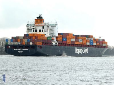
MONTREAL EXPRESS
Container Ship
Current Trip
| Time Travelled | 1 day |
|---|---|
| Remaining Time | 10 days |
| Distance Travelled | 548.58 nm |
| Remaining Distance | 3022.52 nm |
| AVG Speed | 13.5 Knopen |
| MAX Speed | 18.5 Knopen |
| AVG Wind | 10.9 knots |
| MAX Wind | 23.3 knots |
| MIN Temp | 4.4°C / 39.92°F |
| MAX Temp | 8.7°C / 47.66°F |
| Diepgang | 10.8 M |
| Positie ontvangen | 3 h, 58 m geleden |
Current Position
| Lengtegraad | -1.45533° |
|---|---|
| Breedtegraat | 50.26324° |
| Status | Under way using engine |
| Snelheid | 11.5 Knopen |
| Koers | 253.5° |
| Gebied | English Channel |
| Station | T-AIS |
| Positie ontvangen | 3 h, 58 m geleden |
Info
Information
The current position of MONTREAL EXPRESS is in English Channel with coordinates 50.26324° / -1.45533° as reported on 2025-02-28 05:01 by AIS to our vessel tracker app. The vessel's current speed is 11.5 Knopen and is heading at the port of MONTREAL. The estimated time of arrival as calculated by MyShipTracking vessel tracking app is 2025-03-10 17:52 LT
The vessel MONTREAL EXPRESS (IMO: 9253741, MMSI: 310750000) is a Container Ship that was built in 2003 ( 22 Jaar oud ). It's sailing under the flag of [BM] Bermuda.
In this page you can find informations about the vessels current position, last detected port calls, and current voyage information. If the vessels is not in coverage by AIS you will find the latest position.
The current position of MONTREAL EXPRESS is detected by our AIS receivers and we are not responsible for the reliability of the data. The last position was recorded while the vessel was in Coverage by the Ais receivers of our vessel tracking app.
The current draught of MONTREAL EXPRESS as reported by AIS is 10.8 meters
Weather
| Temperature | 7.3°C / 45.14°F |
|---|---|
| Wind Speed | 10 knots |
| Direction | 46° NE |
| Pressure | 1028.5 hPa |
| Humidity | 75.4 % |
| Cloud Coverage | --- |
Featured Company
Last Port Calls
| Port | Arrival | Departure | Time In Port |
|---|---|---|---|
| 2025-02-25 13:27 | 2025-02-26 15:09 | 1 d | |
| 2025-02-21 02:42 | 2025-02-21 22:29 | 19 h | |
| 2025-02-19 13:47 | 2025-02-20 06:40 | 16 h | |
| 2025-02-03 19:54 | 2025-02-07 07:24 | 3 d | |
| 2025-01-19 16:01 | 2025-01-21 07:27 | 1 d | |
| 2025-01-17 03:29 | 2025-01-18 05:34 | 1 d | |
| 2025-01-14 19:01 | 2025-01-16 07:36 | 1 d | |
| 2024-12-22 22:09 | 2024-12-28 11:02 | 5 d | |
| 2024-12-09 02:45 | 2024-12-10 15:49 | 1 d | |
| 2024-12-05 20:25 | 2024-12-06 22:33 | 1 d |
Most Visited Ports (Last year)
| Port | Arrivals | |
|---|---|---|
| 10 | ||
| 10 | ||
| 10 | ||
| 10 |
Last Trips
| Origin | Departure | Destination | Arrival | Distance | |
|---|---|---|---|---|---|
| 2025-02-21 22:29 | 2025-02-25 13:27 | 414.45 nm | |||
| 2025-02-20 06:40 | 2025-02-21 02:42 | 267.14 nm | |||
| 2025-02-07 07:24 | 2025-02-19 13:47 | 4015.79 nm | |||
| 2025-01-21 07:27 | 2025-02-03 19:54 | 3594.26 nm | |||
| 2025-01-18 05:34 | 2025-01-19 16:01 | 398.45 nm | |||
| 2025-01-16 07:36 | 2025-01-17 03:29 | 266.74 nm | |||
| 2024-12-28 11:02 | 2025-01-14 19:01 | 3318.61 nm | |||
| 2024-12-10 15:49 | 2024-12-22 22:09 | 3550.95 nm | |||
| 2024-12-06 22:33 | 2024-12-09 02:45 | 460.02 nm | |||
| 2024-12-04 21:50 | 2024-12-05 20:25 | 263.17 nm |
Events
| Tijd | Evenement | Details | Positie / Bestemming | Info |
|---|---|---|---|---|
| 2025-02-28 05:07 | Status Changed | Default Under way using engine |
50.25777 / -1.48365
DEHAM>>>CAMTR
|
Snelheid: 11.5 kn Koers: 253.5° |
| 2025-02-28 05:01 | Buitenbereik |
50.26324 / -1.45533
English Channel
DEHAM>>>CAMTR
|
Snelheid: 11.5 kn Koers: 253.5° |
|
| 2025-02-27 18:53 | Wijzig zee gebeid | United Kingdom part of the English Channel United Kingdom part of the North Sea |
51.06413 / 1.48049
English Channel
DEHAM>>>CAMTR
|
Snelheid: 14.3 kn Koers: 235.8° |
| 2025-02-27 13:19 | Gevonden in zee | United Kingdom part of the North Sea |
51.89877 / 2.55984
North Sea
DEHAM>>>CAMTR
|
Snelheid: 12.5 kn Koers: 221.5° |
| 2025-02-27 11:41 | Status Changed | Under way using engine Default |
52.15868 / 2.94588
DEHAM>>>CAMTR
|
Snelheid: 14 kn Koers: 221° |
| 2025-02-27 11:24 | Binnenbereik |
52.15868 / 2.94588
North Sea
DEHAM>>>CAMTR
|
Snelheid: 13.9 kn Koers: 221.1° |
|
| 2025-02-27 10:35 | Status Changed | Default Under way using engine |
52.36330 / 3.22794
DEHAM>>>CAMTR
|
Snelheid: 15.3 kn Koers: 215.1° |
| 2025-02-27 10:30 | Status Changed | Under way using engine Default |
52.37962 / 3.24652
DEHAM>>>CAMTR
|
Snelheid: 15.5 kn Koers: 206° |
| 2025-02-27 10:30 | Binnenbereik |
52.37962 / 3.24652
North Sea
DEHAM>>>CAMTR
|
Snelheid: 15.3 kn Koers: 215.1° |
|
| 2025-02-27 10:30 | Buitenbereik |
52.37962 / 3.24652
North Sea
DEHAM>>>CAMTR
|
Snelheid: 15.3 kn Koers: 215.1° |