
MONZA
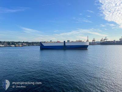
Vehicles Carrier
Current Trip
CA NAM
| Time Travelled | 1 day |
|---|---|
| Remaining Time | --- |
| Distance Travelled | 420.43 nm |
| Remaining Distance | --- |
| AVG Speed | 12.2 Knopen |
| MAX Speed | 17.4 Knopen |
| AVG Wind | 18.8 knots |
| MAX Wind | 31.8 knots |
| MIN Temp | 3.3°C / 37.94°F |
| MAX Temp | 12.6°C / 54.68°F |
| Diepgang | 8.5 M |
| Positie ontvangen | Nu |
Current Position
| Lengtegraad | 140.17915° |
|---|---|
| Breedtegraat | 34.81246° |
| Status | Under way using engine |
| Snelheid | 10.3 Knopen |
| Koers | 74.6° |
| Gebied | Philippine Sea |
| Station | T-AIS |
| Positie ontvangen | Nu |
Info
Information
The current position of MONZA is in Philippine Sea with coordinates 34.81246° / 140.17915° as reported on 2025-02-12 01:52 by AIS to our vessel tracker app. The vessel's current speed is 10.3 Knopen
The vessel MONZA (IMO: 9358888, MMSI: 636020347) is a Vehicles Carrier that was built in 2008 ( 17 Jaar oud ). It's sailing under the flag of [LR] Liberia.
In this page you can find informations about the vessels current position, last detected port calls, and current voyage information. If the vessels is not in coverage by AIS you will find the latest position.
The current position of MONZA is detected by our AIS receivers and we are not responsible for the reliability of the data. The last position was recorded while the vessel was in Coverage by the Ais receivers of our vessel tracking app.
The current draught of MONZA as reported by AIS is 8.5 meters
Weather
| Temperature | 12.4°C / 54.32°F |
|---|---|
| Wind Speed | 11 knots |
| Direction | 192° SSW |
| Pressure | 1021.3 hPa |
| Humidity | 58.3 % |
| Cloud Coverage | 100 % |
Featured Company
Most Visited Ports (Last year)
| Port | Arrivals | |
|---|---|---|
| 6 | ||
| 6 | ||
| 4 | ||
| 3 | ||
| 2 | ||
| 1 |
Last Trips
| Origin | Departure | Destination | Arrival | Distance | |
|---|---|---|---|---|---|
| 2025-02-08 19:38 | 2025-02-10 06:41 | 352.68 nm | |||
| 2025-01-20 22:59 | 2025-02-08 07:24 | 4524.86 nm | |||
| 2024-12-17 01:18 | 2025-01-20 10:29 | 12031.97 nm | |||
| 2024-12-01 16:09 | 2024-12-16 17:48 | 52.59 nm | |||
| 2024-11-15 23:48 | 2024-12-01 05:33 | 1249.57 nm |
Events
| Tijd | Evenement | Details | Positie / Bestemming | Info |
|---|---|---|---|---|
| 2025-02-12 01:39 | Status Changed | Under way using engine Default |
34.79990 / 140.13629
CA NAM
|
Snelheid: 10.2 kn Koers: 68° |
| 2025-02-12 01:37 | Status Changed | Default Under way using engine |
34.79797 / 140.13034
CA NAM
|
Snelheid: 10.1 kn Koers: 67.6° |
| 2025-02-12 01:37 | Status Changed | Under way using engine Default |
34.79708 / 140.12773
CA NAM
|
Snelheid: 10.1 kn Koers: 67° |
| 2025-02-12 01:37 | Wijzig zee gebeid | Japanese part of the North Pacific Ocean Japanese part of the Philippine Sea |
34.79708 / 140.12773
North Pacific Ocean
CA NAM
|
Snelheid: 10.1 kn Koers: 67.6° |
| 2025-02-12 01:17 | Binnenbereik |
34.79708 / 140.12773
North Pacific Ocean
CA NAM
|
Snelheid: 10.1 kn Koers: 67.6° |
|
| 2025-02-10 20:05 | Status Changed | Default Under way using engine |
33.84665 / 134.91157
CA NAM
|
Snelheid: 15 kn Koers: 189.9° |
| 2025-02-10 19:58 | Buitenbereik |
33.87460 / 134.90389
Philippine Sea
CA NAM
|
Snelheid: 15 kn Koers: 189.9° |
|
| 2025-02-10 19:48 | Destination Changed | CA NAM CA NNO |
33.91608 / 134.91211
CA NAM
|
Snelheid: 14.9 kn Koers: 189.8° |
| 2025-02-10 19:48 | ETA Changed | 2025/02/25 00:01 2025/02/25 06:00 |
33.91608 / 134.91211
CA NAM
|
Snelheid: 14.9 kn Koers: 189.8° |
| 2025-02-10 18:22 | Wijzig zee gebeid | Japanese part of the Philippine Sea Japanese part of the Inland Sea |
34.26405 / 134.96920
Philippine Sea
CA NNO
|
Snelheid: 14.2 kn Koers: 190.1° |