
MOSTAFA B
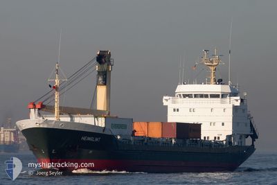
General Cargo
Current Trip
| Trip Time | 7 days |
|---|---|
| Trip Distance | 894.98 nm |
| AVG Speed | 8.3 Knopen |
| MAX Speed | 10.7 Knopen |
| Diepgang | 6.4 M |
| AVG Wind | 10.9 knots |
| MAX Wind | 28.8 knots |
| MIN Temp | 5.6°C / 42.08°F |
| MAX Temp | 20°C / 68°F |
| Positie ontvangen | 1 d geleden |
Current Position
| Lengtegraad | 34.06620° |
|---|---|
| Breedtegraat | 27.41094° |
| Status | Under way using engine |
| Snelheid | 8.2 Knopen |
| Koers | 67.4° |
| Gebied | Red Sea |
| Station | T-AIS |
| Positie ontvangen | 1 d geleden |
Info
Information
The current position of MOSTAFA B is in Red Sea with coordinates 27.41094° / 34.06620° as reported on 2025-02-13 09:24 by AIS to our vessel tracker app. The vessel's current speed is 8.2 Knopen and is currently inside the port of AQABA INDUSTRIAL.
The vessel MOSTAFA B (IMO: 8403545, MMSI: 667002008) is a General Cargo that was built in 1985 ( 40 Jaar oud ). It's sailing under the flag of [SL] Sierra Leone.
In this page you can find informations about the vessels current position, last detected port calls, and current voyage information. If the vessels is not in coverage by AIS you will find the latest position.
The current position of MOSTAFA B is detected by our AIS receivers and we are not responsible for the reliability of the data. The last position was recorded while the vessel was in Coverage by the Ais receivers of our vessel tracking app.
The current draught of MOSTAFA B as reported by AIS is 6.4 meters
Weather
| Temperature | 18.2°C / 64.76°F |
|---|---|
| Wind Speed | 14 knots |
| Direction | 339° NNW |
| Pressure | 1016.4 hPa |
| Humidity | 26.1 % |
| Cloud Coverage | --- |
Featured Company
Last Port Calls
| Port | Arrival | Departure | Time In Port |
|---|---|---|---|
| 2025-02-14 11:27 | |||
| 2025-02-10 23:29 | 2025-02-11 21:03 | 21 h | |
| 2025-02-07 10:41 | |||
| 2025-01-26 15:48 | 2025-01-28 08:32 | 1 d | |
| 2024-12-25 12:21 | |||
| 2024-12-16 07:54 | 2024-12-16 20:02 | 12 h | |
| 2024-12-13 12:28 | 2024-12-15 11:56 | 1 d | |
| 2024-12-05 14:55 |
Last Trips
| Origin | Departure | Destination | Arrival | Distance | |
|---|---|---|---|---|---|
| 2025-02-07 13:41 | 2025-02-14 13:27 | 894.98 nm | |||
| 2025-02-07 13:41 | 2025-02-11 01:29 | 473.96 nm | |||
| 2024-12-25 13:21 | 2025-01-26 18:48 | 905.54 nm | |||
| 2024-12-15 14:56 | 2024-12-16 10:54 | 3.84 nm | |||
| 2024-12-05 15:55 | 2024-12-13 15:28 | 1028.47 nm |
Events
| Tijd | Evenement | Details | Positie / Bestemming | Info |
|---|---|---|---|---|
| 2025-02-14 11:27 | Stop beweging |
29.36259 / 34.96311
[JO] AQABA INDUSTRIAL
|
Snelheid: Koers: 324° |
|
| 2025-02-14 11:27 | Aankomsthaven |
|
29.36259 / 34.96311
[JO] AQABA INDUSTRIAL
|
Snelheid: 1.8 kn Koers: 38° |
| 2025-02-13 09:31 | Status Changed | Default Under way using engine |
27.41733 / 34.08107
JOR AQABA
|
Snelheid: 8.2 kn Koers: 67.4° |
| 2025-02-13 09:24 | Status Changed | Under way using engine Default |
27.41094 / 34.06620
JOR AQABA
|
Snelheid: 8.3 kn Koers: 61° |
| 2025-02-13 09:24 | Buitenbereik |
27.41094 / 34.06620
Red Sea
JOR AQABA
|
Snelheid: 8.2 kn Koers: 67.4° |
|
| 2025-02-13 09:21 | Status Changed | Default Under way using engine |
27.40727 / 34.05862
JOR AQABA
|
Snelheid: 8.7 kn Koers: 76.9° |
| 2025-02-13 09:13 | Draught Changed | 6.4 6.3 |
27.40151 / 34.03702
JOR AQABA
|
Snelheid: 8.8 kn Koers: 84.6° |
| 2025-02-13 09:13 | Destination Changed | JOR AQABA POR SAID EG |
27.40151 / 34.03702
JOR AQABA
|
Snelheid: 8.8 kn Koers: 84.6° |
| 2025-02-13 09:13 | ETA Changed | 2025/02/13 12:00 2025/02/10 09:00 |
27.40151 / 34.03702
JOR AQABA
|
Snelheid: 8.8 kn Koers: 84.6° |
| 2025-02-13 09:00 | Wijzig zee gebeid | Egyptian part of the Red Sea Egyptian part of the Gulf of Suez |
27.41273 / 34.00596
Red Sea
|
Snelheid: 9.1 kn Koers: 128.6° |