

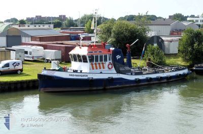
MRD-NAVIGATOR
Other Type

Current Trip
ROTTERDAM
| Time Travelled | 3 days |
|---|---|
| Remaining Time | --- |
| Distance Travelled | 74.96 nm |
| Remaining Distance | --- |
| AVG Speed | 8.4 Knopen |
| MAX Speed | 9.9 Knopen |
| AVG Wind | 12.2 knots |
| MAX Wind | 16 knots |
| MIN Temp | 12.8°C / 55.04°F |
| MAX Temp | 16.9°C / 62.42°F |
| Diepgang | 0 M |
| Positie ontvangen | 2 d geleden |
Current Position
| Lengtegraad | 6.17634° |
|---|---|
| Breedtegraat | 52.09077° |
| Status | Under way using engine |
| Snelheid | 8.5 Knopen |
| Koers | 53.5° |
| Gebied | North Sea |
| Station | T-AIS |
| Positie ontvangen | 2 d geleden |
Information
The current position of MRD-NAVIGATOR is in North Sea with coordinates 52.09077° / 6.17634° as reported on 2025-06-06 06:54 by AIS to our vessel tracker app. The vessel's current speed is 8.5 Knopen
The vessel MRD-NAVIGATOR (MMSI: 244170971) is a Other Type It's sailing under the flag of [NL] Netherlands.
In this page you can find informations about the vessels current position, last detected port calls, and current voyage information. If the vessels is not in coverage by AIS you will find the latest position.
The current position of MRD-NAVIGATOR is detected by our AIS receivers and we are not responsible for the reliability of the data. The last position was recorded while the vessel was in Coverage by the Ais receivers of our vessel tracking app.
Weather
| Temperature | 13.8°C / 56.84°F |
|---|---|
| Wind Speed | 16 knots |
| Direction | 238° WSW |
| Pressure | 1005.4 hPa |
| Humidity | 88.7 % |
| Cloud Coverage | 88 % |


Featured Company
Last Port Calls
| Port | Arrival | Departure | Time In Port |
|---|---|---|---|
| 2025-06-02 13:45 | 2025-06-05 13:18 | 2 d | |
| 2025-05-31 13:56 | 2025-06-02 06:47 | 1 d | |
| 2025-05-28 19:20 | 2025-05-31 11:02 | 2 d | |
| 2025-04-28 17:36 | 2025-05-28 16:20 | 29 d | |
| 2025-04-28 16:50 | 2025-04-28 16:56 | 5 m | |
| 2025-04-28 09:01 | 2025-04-28 09:25 | 24 m | |
| 2025-04-26 23:10 | 2025-04-28 07:24 | 1 d | |
| 2025-04-26 22:51 | 2025-04-26 22:59 | 7 m | |
| 2025-04-26 21:11 | 2025-04-26 22:16 | 1 h | |
| 2025-04-24 13:56 | 2025-04-26 21:00 | 2 d |
Most Visited Ports (Last year)
| Port | Arrivals | |
|---|---|---|
| 20 | ||
| 18 | ||
| 16 | ||
| 14 | ||
| 8 | ||
| 7 |
Last Trips
| Origin | Departure | Destination | Arrival | Distance | |
|---|---|---|---|---|---|
| 2025-06-02 06:47 | 2025-06-02 13:45 | 15.84 nm | |||
| 2025-05-31 11:02 | 2025-05-31 13:56 | 23.88 nm | |||
| 2025-05-28 16:20 | 2025-05-28 19:20 | 27.51 nm | |||
| 2025-04-28 16:56 | 2025-04-28 17:36 | 5.59 nm | |||
| 2025-04-28 09:25 | 2025-04-28 16:50 | 23.94 nm | |||
| 2025-04-28 07:24 | 2025-04-28 09:01 | 15.32 nm | |||
| 2025-04-26 22:59 | 2025-04-26 23:10 | 0.92 nm | |||
| 2025-04-26 22:16 | 2025-04-26 22:51 | 1.03 nm | |||
| 2025-04-26 21:00 | 2025-04-26 21:11 | 0.96 nm | |||
| 2025-04-24 12:24 | 2025-04-24 13:56 | 11.03 nm |
Events
| Tijd | Evenement | Details | Positie / Bestemming | Info |
|---|---|---|---|---|
| 2025-06-06 06:54 | Buitenbereik |
52.09077 / 6.17634
North Sea
|
Snelheid: 8.5 kn Koers: 53.5° |
|
| 2025-06-06 03:57 | Start beweging | 0.4 nm, North West of DRIEL |
51.96860 / 5.80939
ROTTERDAM
|
Snelheid: 3.2 kn Koers: 65.8° |
| 2025-06-05 18:22 | Stop beweging | 0.44 nm, North West of DRIEL |
51.96746 / 5.80669
ROTTERDAM
|
Snelheid: 0.3 kn Koers: 511° |
| 2025-06-05 16:25 | Start beweging | 0.48 nm, North of MAURIK |
51.97725 / 5.41353
ROTTERDAM
|
Snelheid: 8 kn Koers: 74.3° |
| 2025-06-05 16:09 | Stop beweging | 0.45 nm, North of MAURIK |
51.97675 / 5.41070
ROTTERDAM
|
Snelheid: 0.1 kn Koers: 511° |
| 2025-06-05 14:39 | Start beweging | 1.42 nm, East of VIANEN |
51.99121 / 5.13587
ROTTERDAM
|
Snelheid: 5.6 kn Koers: 145° |
| 2025-06-05 14:20 | Stop beweging | 1.36 nm, East of VIANEN |
51.99276 / 5.13408
ROTTERDAM
|
Snelheid: 0.2 kn Koers: 511° |
| 2025-06-05 14:16 | Start beweging | 1.25 nm, East of VIANEN |
51.99547 / 5.13065
ROTTERDAM
|
Snelheid: 3.5 kn Koers: 142.1° |
| 2025-06-05 14:08 | Stop beweging | 1.19 nm, East of VIANEN |
51.99669 / 5.12840
ROTTERDAM
|
Snelheid: 0.1 kn Koers: 511° |
| 2025-06-05 11:18 | Vertrekhaven |
|
51.85921 / 4.65261
ROTTERDAM
|
Snelheid: 7 kn Koers: 327.8° |