
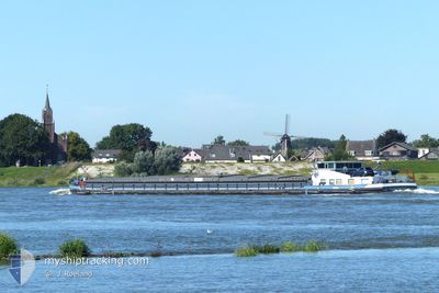
MS ZOE
Cargo
Current Trip
Unknown
| Time Travelled | 3 days |
|---|---|
| Remaining Time | --- |
| Distance Travelled | 20.53 nm |
| Remaining Distance | --- |
| AVG Speed | 7.1 Knopen |
| MAX Speed | 7.8 Knopen |
| AVG Wind | 11.9 knots |
| MAX Wind | 13 knots |
| MIN Temp | 1.1°C / 33.98°F |
| MAX Temp | 4.5°C / 40.1°F |
| Diepgang | 1.3 M |
| Positie ontvangen | 3 d geleden |
Current Position
| Lengtegraad | 11.43799° |
|---|---|
| Breedtegraat | 52.27132° |
| Status | Restricted manoeuverability |
| Snelheid | 7.4 Knopen |
| Koers | 288° |
| Gebied | North Sea |
| Station | T-AIS |
| Positie ontvangen | 3 d geleden |
Info
Information
The current position of MS ZOE is in North Sea with coordinates 52.27132° / 11.43799° as reported on 2025-02-11 13:26 by AIS to our vessel tracker app. The vessel's current speed is 7.4 Knopen
The vessel MS ZOE (MMSI: 211776650) is a Cargo It's sailing under the flag of [DE] Germany.
In this page you can find informations about the vessels current position, last detected port calls, and current voyage information. If the vessels is not in coverage by AIS you will find the latest position.
The current position of MS ZOE is detected by our AIS receivers and we are not responsible for the reliability of the data. The last position was recorded while the vessel was in Coverage by the Ais receivers of our vessel tracking app.
The current draught of MS ZOE as reported by AIS is 1.3 meters
Weather
| Temperature | 4.6°C / 40.28°F |
|---|---|
| Wind Speed | 12 knots |
| Direction | 114° ESE |
| Pressure | 1025.3 hPa |
| Humidity | 47.4 % |
| Cloud Coverage | 100 % |
Featured Company
Last Port Calls
| Port | Arrival | Departure | Time In Port |
|---|---|---|---|
| 2025-02-11 06:23 | |||
| 2025-02-02 14:19 | 2025-02-04 04:42 | 1 d | |
| 2025-01-29 15:22 | 2025-02-02 10:16 | 3 d | |
| 2025-01-28 16:21 | 2025-01-29 07:04 | 14 h | |
| 2025-01-27 17:52 | 2025-01-27 19:03 | 1 h | |
| 2025-01-24 07:48 | 2025-01-24 08:57 | 1 h | |
| 2025-01-20 15:41 | 2025-01-22 05:08 | 1 d | |
| 2025-01-19 13:55 | 2025-01-20 12:06 | 22 h | |
| 2025-01-17 12:27 | |||
| 2025-01-16 09:43 | 2025-01-16 11:45 | 2 h |
Last Trips
| Origin | Departure | Destination | Arrival | Distance | |
|---|---|---|---|---|---|
| 2025-02-02 11:16 | 2025-02-02 15:19 | 47.80 nm | |||
| 2025-01-29 08:04 | 2025-01-29 16:22 | 42.03 nm | |||
| 2025-01-27 20:03 | 2025-01-28 17:21 | 44.52 nm | |||
| 2025-01-24 09:57 | 2025-01-27 18:52 | 93.21 nm | |||
| 2025-01-22 06:08 | 2025-01-24 08:48 | 121.75 nm | |||
| 2025-01-20 13:06 | 2025-01-20 16:41 | 38.82 nm | |||
| 2025-01-17 13:27 | 2025-01-19 14:55 | 105.48 nm | |||
| 2025-01-15 07:44 | 2025-01-16 10:43 | 54.69 nm | |||
| 2025-01-14 15:08 | 2025-01-14 19:49 | 33.01 nm | |||
| 2025-01-14 08:09 | 2025-01-14 11:05 | 26.56 nm |
Events
| Tijd | Evenement | Details | Positie / Bestemming | Info |
|---|---|---|---|---|
| 2025-02-11 13:31 | Status Changed | Default Restricted manoeuverability |
52.27500 / 11.41997
|
Snelheid: 7.4 kn Koers: 288° |
| 2025-02-11 13:26 | Status Changed | Restricted manoeuverability Default |
52.27132 / 11.43799
|
Snelheid: 7.4 kn Koers: 297° |
| 2025-02-11 13:26 | Buitenbereik |
52.27132 / 11.43799
North Sea
|
Snelheid: 7.4 kn Koers: 288° |
|
| 2025-02-11 13:06 | Status Changed | Default Restricted manoeuverability |
52.25272 / 11.49668
|
Snelheid: 5.7 kn Koers: 310.7° |
| 2025-02-11 11:49 | Start beweging | 7.82 nm, North East of MAGDEBURG |
52.23995 / 11.73625
|
Snelheid: 6.3 kn Koers: 234.2° |
| 2025-02-11 11:46 | Binnenbereik |
52.24135 / 11.73922
North Sea
|
Snelheid: Koers: 25.4° |
|
| 2025-02-11 10:21 | Buitenbereik |
52.26972 / 11.80589
North Sea
|
Snelheid: 7 kn Koers: 232.6° |
|
| 2025-02-11 09:47 | Status Changed | Restricted manoeuverability Default |
52.30651 / 11.88812
|
Snelheid: 7 kn Koers: 227° |
| 2025-02-11 09:39 | Binnenbereik |
52.30651 / 11.88770
North Sea
|
Snelheid: 7 kn Koers: 272.5° |
|
| 2025-02-11 06:23 | Vertrekhaven |
|
52.31150 / 11.91226
|
Snelheid: 0.1 kn Koers: 251° |