
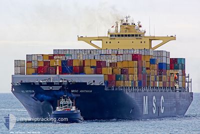
MSC ANTIGUA
Container Ship
Current Trip
| Time Travelled | 8 days |
|---|---|
| Remaining Time | 3 days |
| Distance Travelled | 3895.26 nm |
| Remaining Distance | 1726.19 nm |
| AVG Speed | 19.2 Knopen |
| MAX Speed | 21.6 Knopen |
| AVG Wind | 11 knots |
| MAX Wind | 24.7 knots |
| MIN Temp | 10.3°C / 50.54°F |
| MAX Temp | 27.9°C / 82.22°F |
| Diepgang | 11.2 M |
| Positie ontvangen | 6 d geleden |
Current Position
| Lengtegraad | -14.02660° |
|---|---|
| Breedtegraat | 27.56935° |
| Status | Under way using engine |
| Snelheid | 18.8 Knopen |
| Koers | 216° |
| Gebied | North Atlantic Ocean |
| Station | T-AIS |
| Positie ontvangen | 6 d geleden |
Info
Information
The current position of MSC ANTIGUA is in North Atlantic Ocean with coordinates 27.56935° / -14.02660° as reported on 2025-02-06 03:25 by AIS to our vessel tracker app. The vessel's current speed is 18.8 Knopen and is heading at the port of COEGA. The estimated time of arrival as calculated by MyShipTracking vessel tracking app is 2025-02-16 04:31 LT
The vessel MSC ANTIGUA (IMO: 9619476, MMSI: 477305900) is a Container Ship that was built in 2013 ( 12 Jaar oud ). It's sailing under the flag of [HK] Hong Kong.
In this page you can find informations about the vessels current position, last detected port calls, and current voyage information. If the vessels is not in coverage by AIS you will find the latest position.
The current position of MSC ANTIGUA is detected by our AIS receivers and we are not responsible for the reliability of the data. The last position was recorded while the vessel was in Coverage by the Ais receivers of our vessel tracking app.
The current draught of MSC ANTIGUA as reported by AIS is 11.2 meters
Weather
| Temperature | 22.5°C / 72.5°F |
|---|---|
| Wind Speed | 12 knots |
| Direction | 144° SE |
| Pressure | 1010.3 hPa |
| Humidity | 72.7 % |
| Cloud Coverage | 45 % |
Featured Company
Last Port Calls
| Port | Arrival | Departure | Time In Port |
|---|---|---|---|
| 2025-02-03 11:18 | 2025-02-04 09:42 | 22 h | |
| 2025-01-26 13:31 | 2025-01-27 17:24 | 1 d | |
| 2025-01-23 19:16 | 2025-01-25 13:34 | 1 d | |
| 2025-01-20 08:09 | 2025-01-22 12:55 | 2 d | |
| 2025-01-18 20:50 | 2025-01-19 22:44 | 1 d | |
| 2025-01-18 15:55 | 2025-01-18 20:21 | 4 h | |
| 2025-01-16 03:05 | 2025-01-17 12:37 | 1 d | |
| 2025-01-09 23:19 | 2025-01-12 07:18 | 2 d | |
| 2024-12-03 02:02 | 2024-12-04 15:50 | 1 d |
Most Visited Ports (Last year)
| Port | Arrivals | |
|---|---|---|
| 3 | ||
| 3 | ||
| 3 | ||
| 3 | ||
| 2 | ||
| 2 |
Last Trips
| Origin | Departure | Destination | Arrival | Distance | |
|---|---|---|---|---|---|
| 2025-01-27 18:24 | 2025-02-03 11:18 | 1688.40 nm | |||
| 2025-01-25 14:34 | 2025-01-26 14:31 | 280.14 nm | |||
| 2025-01-22 13:55 | 2025-01-23 20:16 | 378.84 nm | |||
| 2025-01-19 23:44 | 2025-01-20 09:09 | 133.35 nm | |||
| 2025-01-18 21:21 | 2025-01-18 21:50 | 2.00 nm | |||
| 2025-01-17 13:37 | 2025-01-18 16:55 | 323.52 nm | |||
| 2025-01-12 07:18 | 2025-01-16 04:05 | 172.68 nm | |||
| 2024-12-04 21:20 | 2025-01-09 23:19 | 11028.83 nm | |||
| 2024-11-30 23:54 | 2024-12-03 07:32 | 559.46 nm |
Events
| Tijd | Evenement | Details | Positie / Bestemming | Info |
|---|---|---|---|---|
| 2025-02-06 03:31 | Status Changed | Default Under way using engine |
27.54324 / -14.04867
PTSIE>ZAZBA
|
Snelheid: 18.8 kn Koers: 216° |
| 2025-02-06 03:25 | Buitenbereik |
27.56935 / -14.02660
North Atlantic Ocean
PTSIE>ZAZBA
|
Snelheid: 18.8 kn Koers: 216° |
|
| 2025-02-06 03:08 | Status Changed | Under way using engine Default |
27.64135 / -13.96884
PTSIE>ZAZBA
|
Snelheid: 18.8 kn Koers: 220° |
| 2025-02-06 03:00 | Status Changed | Default Under way using engine |
27.67571 / -13.93880
PTSIE>ZAZBA
|
Snelheid: 19 kn Koers: 220.3° |
| 2025-02-06 02:29 | Status Changed | Under way using engine Default |
27.80553 / -13.82992
PTSIE>ZAZBA
|
Snelheid: 18.8 kn Koers: 210° |
| 2025-02-06 02:22 | Status Changed | Default Under way using engine |
27.83755 / -13.80758
PTSIE>ZAZBA
|
Snelheid: 18.9 kn Koers: 229° |
| 2025-02-06 01:29 | Wijzig zee gebeid | Spanish (Canary Islands) part of the North Atlantic Ocean Moroccan part of the North Atlantic Ocean |
27.98913 / -13.55181
North Atlantic Ocean
PTSIE>ZAZBA
|
Snelheid: 18.8 kn Koers: 241.9° |
| 2025-02-06 01:29 | Status Changed | Under way using engine Default |
27.98913 / -13.55181
PTSIE>ZAZBA
|
Snelheid: 18.9 kn Koers: 242° |
| 2025-02-06 01:22 | Status Changed | Default Under way using engine |
28.00655 / -13.51593
PTSIE>ZAZBA
|
Snelheid: 19 kn Koers: 241° |
| 2025-02-06 00:52 | Status Changed | Under way using engine Default |
28.08323 / -13.36008
PTSIE>ZAZBA
|
Snelheid: 18.8 kn Koers: 241° |