
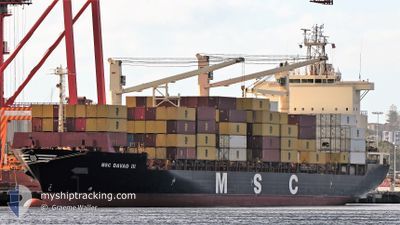
MSC DAVAO III
Container Ship
Current Trip
| Time Travelled | 15 h, 55 mins |
|---|---|
| Remaining Time | 1 day |
| Distance Travelled | 232.42 nm |
| Remaining Distance | 601.35 nm |
| AVG Speed | 15.6 Knopen |
| MAX Speed | 18.1 Knopen |
| AVG Wind | 9 knots |
| MAX Wind | 16.9 knots |
| MIN Temp | 25.7°C / 78.26°F |
| MAX Temp | 26.2°C / 79.16°F |
| Diepgang | 9.2 M |
| Positie ontvangen | 11 h, 29 m geleden |
Current Position
| Lengtegraad | 153.57608° |
|---|---|
| Breedtegraat | -26.58736° |
| Status | Under way using engine |
| Snelheid | 14.3 Knopen |
| Koers | 70.9° |
| Gebied | Coral Sea |
| Station | T-AIS |
| Positie ontvangen | 11 h, 29 m geleden |
Info
Information
The current position of MSC DAVAO III is in Coral Sea with coordinates -26.58736° / 153.57608° as reported on 2025-02-10 06:46 by AIS to our vessel tracker app. The vessel's current speed is 14.3 Knopen and is heading at the port of NOUMEA. The estimated time of arrival as calculated by MyShipTracking vessel tracking app is 2025-02-12 09:48 LT
The vessel MSC DAVAO III (IMO: 9243241, MMSI: 370928000) is a Container Ship that was built in 2002 ( 23 Jaar oud ). It's sailing under the flag of [PA] Panama.
In this page you can find informations about the vessels current position, last detected port calls, and current voyage information. If the vessels is not in coverage by AIS you will find the latest position.
The current position of MSC DAVAO III is detected by our AIS receivers and we are not responsible for the reliability of the data. The last position was recorded while the vessel was in Coverage by the Ais receivers of our vessel tracking app.
The current draught of MSC DAVAO III as reported by AIS is 9.2 meters
Weather
| Temperature | 26°C / 78.8°F |
|---|---|
| Wind Speed | 17 knots |
| Direction | 104° ESE |
| Pressure | 1007.8 hPa |
| Humidity | 75.6 % |
| Cloud Coverage | 87 % |
Featured Company
Last Port Calls
| Port | Arrival | Departure | Time In Port |
|---|---|---|---|
| 2025-02-08 19:08 | 2025-02-10 02:20 | 1 d | |
| 2025-02-05 07:37 | 2025-02-07 03:14 | 1 d | |
| 2025-01-27 19:16 | 2025-01-28 12:21 | 17 h | |
| 2025-01-21 20:39 | 2025-01-22 15:15 | 18 h | |
| 2025-01-18 21:57 | 2025-01-20 00:45 | 1 d | |
| 2025-01-12 19:45 | 2025-01-14 15:20 | 1 d | |
| 2024-12-27 04:00 | 2024-12-30 13:42 | 3 d | |
| 2024-12-14 05:14 | 2024-12-16 06:58 | 2 d | |
| 2024-12-07 08:19 | 2024-12-08 12:55 | 1 d | |
| 2024-12-01 08:31 |
Last Trips
| Origin | Departure | Destination | Arrival | Distance | |
|---|---|---|---|---|---|
| 2025-02-07 14:14 | 2025-02-09 05:08 | 549.68 nm | |||
| 2025-01-28 23:21 | 2025-02-05 18:37 | 844.45 nm | |||
| 2025-01-23 04:15 | 2025-01-28 06:16 | 1707.68 nm | |||
| 2025-01-20 13:45 | 2025-01-22 09:39 | 629.25 nm | |||
| 2025-01-15 01:20 | 2025-01-19 10:57 | 1582.13 nm | |||
| 2024-12-31 00:42 | 2025-01-13 05:45 | 961.95 nm | |||
| 2024-12-16 14:58 | 2024-12-27 15:00 | 2972.04 nm | |||
| 2024-12-08 19:55 | 2024-12-14 13:14 | 1800.62 nm | |||
| 2024-12-01 16:31 | 2024-12-07 15:19 | 1823.07 nm |
Events
| Tijd | Evenement | Details | Positie / Bestemming | Info |
|---|---|---|---|---|
| 2025-02-10 06:52 | Status Changed | Default Under way using engine |
-26.57828 / 153.60460
NCNOU
|
Snelheid: 14.3 kn Koers: 70.9° |
| 2025-02-10 06:46 | Buitenbereik |
-26.58736 / 153.57608
Coral Sea
NCNOU
|
Snelheid: 14.3 kn Koers: 70.9° |
|
| 2025-02-10 02:20 | Vertrekhaven |
|
-27.34272 / 153.18663
NCNOU
|
Snelheid: 13 kn Koers: 32° |
| 2025-02-10 02:10 | Start beweging |
-27.36686 / 153.17309
[AU] BRISBANE
|
Snelheid: 3.4 kn Koers: 21° |
|
| 2025-02-10 02:04 | Status Changed | Under way using engine Moored |
-27.36862 / 153.17305
[AU] BRISBANE
|
Snelheid: Koers: 32° |
| 2025-02-10 02:04 | Draught Changed | 9.2 9.8 |
-27.36864 / 153.17300
[AU] BRISBANE
|
Snelheid: Koers: 32° |
| 2025-02-10 02:04 | Destination Changed | NCNOU AUSYD |
-27.36864 / 153.17300
[AU] BRISBANE
|
Snelheid: Koers: 32° |
| 2025-02-10 02:04 | ETA Changed | 2025/02/13 18:00 2025/02/05 07:00 |
-27.36864 / 153.17300
[AU] BRISBANE
|
Snelheid: Koers: 32° |
| 2025-02-09 23:17 | Status Changed | Moored Default |
-27.36859 / 153.17301
[AU] BRISBANE
|
Snelheid: Koers: 32° |
| 2025-02-09 23:14 | Status Changed | Default Moored |
-27.36865 / 153.17305
[AU] BRISBANE
|
Snelheid: Koers: 32° |