

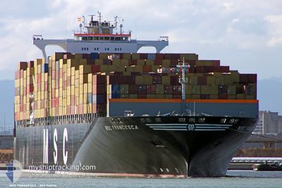
MSC FRANCESCA
Container Ship
Current Trip
| Time Travelled | 3 days |
|---|---|
| Remaining Time | --- |
| Distance Travelled | 1591.27 nm |
| Remaining Distance | --- |
| AVG Speed | 16.8 Knopen |
| MAX Speed | 22.5 Knopen |
| AVG Wind | 10.7 knots |
| MAX Wind | 25.1 knots |
| MIN Temp | 5.4°C / 41.72°F |
| MAX Temp | 20.4°C / 68.72°F |
| Diepgang | 14.6 M |
| Positie ontvangen | 2 d geleden |
Current Position
| Lengtegraad | 141.69029° |
|---|---|
| Breedtegraat | 41.64651° |
| Status | Under way using engine |
| Snelheid | 18.4 Knopen |
| Koers | 93° |
| Gebied | North Pacific Ocean |
| Station | T-AIS |
| Positie ontvangen | 2 d geleden |
Information
The current position of MSC FRANCESCA is in North Pacific Ocean with coordinates 41.64651° / 141.69029° as reported on 2025-06-08 02:57 by AIS to our vessel tracker app. The vessel's current speed is 18.4 Knopen and is heading at the port of SEATTLE. The estimated time of arrival as calculated by MyShipTracking vessel tracking app is 2025-06-17 14:00 LT
The vessel MSC FRANCESCA (IMO: 9401116, MMSI: 370993000) is a Container Ship that was built in 2008 ( 17 Jaar oud ). It's sailing under the flag of [PA] Panama.
In this page you can find informations about the vessels current position, last detected port calls, and current voyage information. If the vessels is not in coverage by AIS you will find the latest position.
The current position of MSC FRANCESCA is detected by our AIS receivers and we are not responsible for the reliability of the data. The last position was recorded while the vessel was in Coverage by the Ais receivers of our vessel tracking app.
The current draught of MSC FRANCESCA as reported by AIS is 14.6 meters
Weather
| Temperature | 5.5°C / 41.9°F |
|---|---|
| Wind Speed | 23 knots |
| Direction | 224° SW |
| Pressure | 1003.8 hPa |
| Humidity | 97.9 % |
| Cloud Coverage | 100 % |
Featured Company
Last Port Calls
| Port | Arrival | Departure | Time In Port |
|---|---|---|---|
| 2025-06-05 14:58 | 2025-06-06 15:52 | 1 d | |
| 2025-06-02 08:38 | 2025-06-02 23:22 | 14 h | |
| 2025-05-31 10:32 | 2025-05-31 21:58 | 11 h | |
| 2025-05-25 04:22 | 2025-05-26 03:46 | 23 h | |
| 2025-05-10 11:17 | 2025-05-10 20:10 | 8 h | |
| 2025-04-24 15:18 | 2025-04-25 17:22 | 1 d | |
| 2025-04-16 02:15 | 2025-04-22 06:01 | 6 d |
Most Visited Ports (Last year)
| Port | Arrivals | |
|---|---|---|
| 6 | ||
| 4 | ||
| 4 | ||
| 4 | ||
| 4 | ||
| 2 |
Last Trips
| Origin | Departure | Destination | Arrival | Distance | |
|---|---|---|---|---|---|
| 2025-06-02 23:22 | 2025-06-05 14:58 | 518.61 nm | |||
| 2025-05-31 21:58 | 2025-06-02 08:38 | 460.29 nm | |||
| 2025-05-26 03:46 | 2025-05-31 10:32 | 842.17 nm | |||
| 2025-05-10 20:10 | 2025-05-25 04:22 | 2261.08 nm | |||
| 2025-04-25 17:22 | 2025-05-10 11:17 | 6197.94 nm | |||
| 2025-04-22 06:01 | 2025-04-24 15:18 | 446.31 nm | |||
| 2025-03-30 05:49 | 2025-04-16 02:15 | 6588.87 nm |
Events
| Tijd | Evenement | Details | Positie / Bestemming | Info |
|---|---|---|---|---|
| 2025-06-08 03:05 | Status Changed | Default Under way using engine |
41.64523 / 141.74049
USSEA
|
Snelheid: 18.4 kn Koers: 93° |
| 2025-06-08 02:57 | Buitenbereik |
41.64651 / 141.69029
North Pacific Ocean
USSEA
|
Snelheid: 18.4 kn Koers: 93° |
|
| 2025-06-08 02:53 | Status Changed | Under way using engine Default |
41.64747 / 141.66368
USSEA
|
Snelheid: 18.7 kn Koers: 92° |
| 2025-06-08 02:49 | Status Changed | Default Under way using engine |
41.64834 / 141.63062
USSEA
|
Snelheid: 19.8 kn Koers: 89.2° |
| 2025-06-08 02:36 | Wijzig zee gebeid | Japanese part of the North Pacific Ocean Japanese part of the Japan Sea |
41.64827 / 141.54209
North Pacific Ocean
USSEA
|
Snelheid: 19.8 kn Koers: 89.2° |
| 2025-06-08 02:36 | Status Changed | Under way using engine Default |
41.64827 / 141.54209
USSEA
|
Snelheid: 19.6 kn Koers: 89° |
| 2025-06-08 02:11 | Status Changed | Default Under way using engine |
41.64595 / 141.35747
USSEA
|
Snelheid: 20.1 kn Koers: 89.2° |
| 2025-06-08 01:58 | ETA Changed | 2025/06/17 21:00 2025/06/17 19:00 |
41.64578 / 141.26794
USSEA
|
Snelheid: 20.1 kn Koers: 89.2° |
| 2025-06-08 01:45 | Status Changed | Under way using engine Default |
41.64405 / 141.16048
USSEA
|
Snelheid: 21.9 kn Koers: 92° |
| 2025-06-08 01:37 | Binnenbereik |
41.64429 / 141.17640
Japan Sea
USSEA
|
Snelheid: 21.3 kn Koers: 89° |