
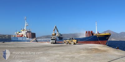
MYKONOS I
General Cargo
Current Trip
| Time Travelled | 5 days |
|---|---|
| Remaining Time | --- |
| Distance Travelled | 107.10 nm |
| Remaining Distance | --- |
| AVG Speed | 8.9 Knopen |
| MAX Speed | 10.5 Knopen |
| AVG Wind | 5.4 knots |
| MAX Wind | 8.5 knots |
| MIN Temp | 11.2°C / 52.16°F |
| MAX Temp | 15.2°C / 59.36°F |
| Diepgang | 5 M |
| Positie ontvangen | 4 d geleden |
Current Position
| Lengtegraad | 24.16374° |
|---|---|
| Breedtegraat | 38.10797° |
| Status | Under way using engine |
| Snelheid | 8.6 Knopen |
| Koers | 333.5° |
| Gebied | Aegean Sea |
| Station | T-AIS |
| Positie ontvangen | 4 d geleden |
Info
Information
The current position of MYKONOS I is in Aegean Sea with coordinates 38.10797° / 24.16374° as reported on 2025-02-04 01:20 by AIS to our vessel tracker app. The vessel's current speed is 8.6 Knopen
The vessel MYKONOS I (IMO: 7104336, MMSI: 240524000) is a General Cargo that was built in 1971 ( 54 Jaar oud ). It's sailing under the flag of [GR] Greece.
In this page you can find informations about the vessels current position, last detected port calls, and current voyage information. If the vessels is not in coverage by AIS you will find the latest position.
The current position of MYKONOS I is detected by our AIS receivers and we are not responsible for the reliability of the data. The last position was recorded while the vessel was in Coverage by the Ais receivers of our vessel tracking app.
The current draught of MYKONOS I as reported by AIS is 5 meters
Weather
| Temperature | 11.4°C / 52.52°F |
|---|---|
| Wind Speed | 3 knots |
| Direction | 37° NE |
| Pressure | 1018.1 hPa |
| Humidity | 91.2 % |
| Cloud Coverage | 100 % |
Featured Company
Last Port Calls
| Port | Arrival | Departure | Time In Port |
|---|---|---|---|
| 2025-02-02 20:01 | 2025-02-03 12:47 | 16 h | |
| 2025-02-02 03:07 | 2025-02-02 14:41 | 11 h | |
| 2025-02-01 18:15 | 2025-02-01 20:39 | 2 h | |
| 2025-02-01 08:21 | 2025-02-01 13:45 | 5 h | |
| 2025-01-28 12:23 | 2025-01-31 15:00 | 3 d | |
| 2025-01-26 07:20 | 2025-01-27 05:16 | 21 h | |
| 2025-01-24 04:15 | 2025-01-24 11:48 | 7 h | |
| 2025-01-22 05:18 | 2025-01-22 13:39 | 8 h | |
| 2025-01-19 07:17 | 2025-01-19 14:38 | 7 h | |
| 2025-01-14 14:18 | 2025-01-15 06:55 | 16 h |
Last Trips
| Origin | Departure | Destination | Arrival | Distance | |
|---|---|---|---|---|---|
| 2025-02-02 16:41 | 2025-02-02 22:01 | 47.12 nm | |||
| 2025-02-01 22:39 | 2025-02-02 05:07 | 43.44 nm | |||
| 2025-02-01 15:45 | 2025-02-01 20:15 | 34.01 nm | |||
| 2025-01-31 17:00 | 2025-02-01 10:21 | 139.17 nm | |||
| 2025-01-27 07:16 | 2025-01-28 14:23 | 93.45 nm | |||
| 2025-01-24 13:48 | 2025-01-26 09:20 | 191.13 nm | |||
| 2025-01-22 15:39 | 2025-01-24 06:15 | 134.57 nm | |||
| 2025-01-19 16:38 | 2025-01-22 07:18 | 159.30 nm | |||
| 2025-01-15 08:55 | 2025-01-19 09:17 | 156.16 nm | |||
| 2025-01-11 13:47 | 2025-01-14 16:18 | 172.25 nm |
Events
| Tijd | Evenement | Details | Positie / Bestemming | Info |
|---|---|---|---|---|
| 2025-02-04 01:31 | Status Changed | Default Under way using engine |
38.13063 / 24.14869
GRMYL
|
Snelheid: 8.6 kn Koers: 333.5° |
| 2025-02-04 01:20 | Buitenbereik |
38.10797 / 24.16374
Aegean Sea
GRMYL
|
Snelheid: 8.6 kn Koers: 333.5° |
|
| 2025-02-03 19:39 | ETA Changed | 2025/02/04 03:30 2025/02/04 03:00 |
37.67401 / 24.95234
GRMYL
|
Snelheid: 10.5 kn Koers: 255.1° |
| 2025-02-03 19:38 | Binnenbereik |
37.67265 / 24.94800
Aegean Sea
GRMYL
|
Snelheid: 10.3 kn Koers: 249.7° |
|
| 2025-02-03 17:13 | Status Changed | Default Under way using engine |
37.68072 / 25.39486
GRMYL
|
Snelheid: 8.4 kn Koers: 268.7° |
| 2025-02-03 17:02 | Buitenbereik |
37.68101 / 25.42819
Aegean Sea
GRMYL
|
Snelheid: 8.4 kn Koers: 268.7° |
|
| 2025-02-03 15:52 | Destination Changed | GRMYL GREYD |
37.67525 / 25.63915
GRMYL
|
Snelheid: 8.4 kn Koers: 275.6° |
| 2025-02-03 15:52 | ETA Changed | 2025/02/04 03:00 2025/02/02 20:00 |
37.67525 / 25.63915
GRMYL
|
Snelheid: 8.4 kn Koers: 275.6° |
| 2025-02-03 13:24 | Status Changed | Under way using engine Default |
37.64903 / 26.07293
GREYD
|
Snelheid: 9.1 kn Koers: 279° |
| 2025-02-03 13:24 | Binnenbereik |
37.64903 / 26.07293
Aegean Sea
|
Snelheid: 8.8 kn Koers: 271.9° |