
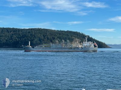
NACC POROS
Bulk Carrier
Current Trip
| Time Travelled | 19 days |
|---|---|
| Remaining Time | --- |
| Distance Travelled | 3624.14 nm |
| Remaining Distance | --- |
| AVG Speed | 10.3 Knopen |
| MAX Speed | 14 Knopen |
| AVG Wind | 11 knots |
| MAX Wind | 28 knots |
| MIN Temp | 2.7°C / 36.86°F |
| MAX Temp | 11.7°C / 53.06°F |
| Diepgang | 4.9 M |
| Positie ontvangen | 13 d geleden |
Current Position
| Lengtegraad | -127.27074° |
|---|---|
| Breedtegraat | 49.33684° |
| Status | Under way using engine |
| Snelheid | 9.5 Knopen |
| Koers | 296.9° |
| Gebied | North Pacific Ocean |
| Station | T-AIS |
| Positie ontvangen | 13 d geleden |
Information
The current position of NACC POROS is in North Pacific Ocean with coordinates 49.33684° / -127.27074° as reported on 2025-05-21 13:05 by AIS to our vessel tracker app. The vessel's current speed is 9.5 Knopen and is heading at the port of DUTCH HARBOR. The estimated time of arrival as calculated by MyShipTracking vessel tracking app is 2025-05-28 23:00 LT
The vessel NACC POROS (IMO: 9600592, MMSI: 255801370) is a Bulk Carrier that was built in 2012 ( 13 Jaar oud ). It's sailing under the flag of [PT] Portugal.
In this page you can find informations about the vessels current position, last detected port calls, and current voyage information. If the vessels is not in coverage by AIS you will find the latest position.
The current position of NACC POROS is detected by our AIS receivers and we are not responsible for the reliability of the data. The last position was recorded while the vessel was in Coverage by the Ais receivers of our vessel tracking app.
The current draught of NACC POROS as reported by AIS is 4.9 meters
Weather
| Temperature | 8.4°C / 47.12°F |
|---|---|
| Wind Speed | 24 knots |
| Direction | 107° ESE |
| Pressure | 995 hPa |
| Humidity | 98.8 % |
| Cloud Coverage | 100 % |
Featured Company
Most Visited Ports (Last year)
| Port | Arrivals | |
|---|---|---|
| 39 | ||
| 1 | ||
| 1 |
Last Trips
| Origin | Departure | Destination | Arrival | Distance | |
|---|---|---|---|---|---|
| 2025-05-03 23:42 | 2025-05-15 18:32 | 327.52 nm | |||
| 2025-04-23 02:18 | 2025-05-03 22:40 | 296.96 nm | |||
| 2025-04-14 05:43 | 2025-04-23 00:48 | 342.92 nm | |||
| 2025-04-06 05:21 | 2025-04-14 04:28 | 321.17 nm | |||
| 2025-03-28 04:36 | 2025-04-06 04:09 | 319.70 nm |
Events
| Tijd | Evenement | Details | Positie / Bestemming | Info |
|---|---|---|---|---|
| 2025-05-27 19:08 | Start beweging | 1.24 nm, South West of DUTCH HARBOR |
53.86855 / -166.57310
US DUT
|
Snelheid: 8.8 kn Koers: 13° |
| 2025-05-27 15:04 | Stop beweging | 2.01 nm, South West of DUTCH HARBOR |
53.85176 / -166.57352
US DUT
|
Snelheid: 0.1 kn Koers: 51° |