
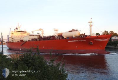
NAVIGATOR GUSTO
Lpg Tanker
Current Trip
| Time Travelled | 3 days |
|---|---|
| Remaining Time | 1 day |
| Distance Travelled | 1080.11 nm |
| Remaining Distance | 405.57 nm |
| AVG Speed | 14 Knopen |
| MAX Speed | 15.2 Knopen |
| AVG Wind | 7.3 knots |
| MAX Wind | 26.5 knots |
| MIN Temp | 11°C / 51.8°F |
| MAX Temp | 17.4°C / 63.32°F |
| Diepgang | 7 M |
| Positie ontvangen | 17 h, 24 m geleden |
Current Position
| Lengtegraad | 11.74222° |
|---|---|
| Breedtegraat | 37.23761° |
| Status | Under way using engine |
| Snelheid | 14.3 Knopen |
| Koers | 291.8° |
| Gebied | Mediterranean Sea - Eastern Basin |
| Station | T-AIS |
| Positie ontvangen | 17 h, 24 m geleden |
Information
The current position of NAVIGATOR GUSTO is in Mediterranean Sea - Eastern Basin with coordinates 37.23761° / 11.74222° as reported on 2025-03-09 00:04 by AIS to our vessel tracker app. The vessel's current speed is 14.3 Knopen and is heading at the port of ARZEW. The estimated time of arrival as calculated by MyShipTracking vessel tracking app is 2025-03-10 18:34 LT
The vessel NAVIGATOR GUSTO (IMO: 9531507, MMSI: 636015944) is a Lpg Tanker that was built in 2011 ( 14 Jaar oud ). It's sailing under the flag of [LR] Liberia.
In this page you can find informations about the vessels current position, last detected port calls, and current voyage information. If the vessels is not in coverage by AIS you will find the latest position.
The current position of NAVIGATOR GUSTO is detected by our AIS receivers and we are not responsible for the reliability of the data. The last position was recorded while the vessel was in Coverage by the Ais receivers of our vessel tracking app.
The current draught of NAVIGATOR GUSTO as reported by AIS is 7 meters
Weather
| Temperature | 14.7°C / 58.46°F |
|---|---|
| Wind Speed | 13 knots |
| Direction | 333° NNW |
| Pressure | 1006.3 hPa |
| Humidity | 77.1 % |
| Cloud Coverage | 62 % |
Featured Company
Last Port Calls
| Port | Arrival | Departure | Time In Port |
|---|---|---|---|
| 2025-03-04 18:37 | 2025-03-06 10:22 | 1 d | |
| 2025-02-22 09:56 | 2025-02-24 06:00 | 1 d | |
| 2025-02-16 19:51 | 2025-02-18 11:07 | 1 d | |
| 2025-02-06 20:33 | 2025-02-08 09:56 | 1 d | |
| 2025-01-31 10:07 | 2025-02-02 02:22 | 1 d | |
| 2025-01-21 07:53 | 2025-01-22 10:05 | 1 d | |
| 2025-01-14 18:11 | 2025-01-16 11:52 | 1 d | |
| 2025-01-06 06:32 | 2025-01-07 08:21 | 1 d | |
| 2025-01-01 02:54 |
Last Trips
| Origin | Departure | Destination | Arrival | Distance | |
|---|---|---|---|---|---|
| 2025-02-24 07:00 | 2025-03-04 19:37 | 1107.92 nm | |||
| 2025-02-18 12:07 | 2025-02-22 10:56 | 1085.58 nm | |||
| 2025-02-08 10:56 | 2025-02-16 20:51 | 1202.79 nm | |||
| 2025-02-02 03:22 | 2025-02-06 21:33 | 1090.57 nm | |||
| 2025-01-22 11:05 | 2025-01-31 11:07 | 1528.43 nm | |||
| 2025-01-16 12:52 | 2025-01-21 08:53 | 1486.38 nm | |||
| 2025-01-07 09:21 | 2025-01-14 19:11 | 1646.74 nm | |||
| 2025-01-01 03:54 | 2025-01-06 07:32 | 1521.87 nm |
Events
| Tijd | Evenement | Details | Positie / Bestemming | Info |
|---|---|---|---|---|
| 2025-03-09 00:09 | Status Changed | Default Under way using engine |
37.24580 / 11.71741
DZAZW
|
Snelheid: 14.3 kn Koers: 291.8° |
| 2025-03-09 00:04 | Buitenbereik |
37.23761 / 11.74222
Mediterranean Sea - Eastern Basin
DZAZW
|
Snelheid: 14.3 kn Koers: 291.8° |
|
| 2025-03-09 00:04 | Status Changed | Under way using engine Default |
37.23733 / 11.74311
DZAZW
|
Snelheid: 14.2 kn Koers: 292° |
| 2025-03-08 23:36 | Status Changed | Default Under way using engine |
37.19247 / 11.87715
DZAZW
|
Snelheid: 14.3 kn Koers: 293° |
| 2025-03-08 23:31 | Wijzig zee gebeid | Tunisian part of the Mediterranean Sea - Eastern Basin Italian part of the Mediterranean Sea - Eastern Basin |
37.18520 / 11.89841
Mediterranean Sea - Eastern Basin
DZAZW
|
Snelheid: 14.3 kn Koers: 292.7° |
| 2025-03-08 23:04 | Status Changed | Under way using engine Default |
37.14194 / 12.02758
DZAZW
|
Snelheid: 14.5 kn Koers: 292° |
| 2025-03-08 22:57 | Status Changed | Default Under way using engine |
37.13095 / 12.06067
DZAZW
|
Snelheid: 14.5 kn Koers: 292.5° |
| 2025-03-08 21:43 | Status Changed | Under way using engine Default |
37.02793 / 12.41024
DZAZW
|
Snelheid: 14 kn Koers: 288° |
| 2025-03-08 21:25 | Status Changed | Default Under way using engine |
37.00549 / 12.49466
DZAZW
|
Snelheid: 14.1 kn Koers: 287.9° |
| 2025-03-08 21:06 | Status Changed | Under way using engine Default |
36.98157 / 12.58622
DZAZW
|
Snelheid: 13.7 kn Koers: 291° |