
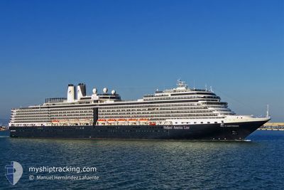
NIEUW AMSTERDAM
Not available
Current Trip
| Time Travelled | 9 h, 31 mins |
|---|---|
| Remaining Time | 4 h, 38 mins |
| Distance Travelled | 178.79 nm |
| Remaining Distance | 103.79 nm |
| AVG Speed | 19.1 Knopen |
| MAX Speed | 21.3 Knopen |
| AVG Wind | 10.3 knots |
| MAX Wind | 12.9 knots |
| MIN Temp | 23.2°C / 73.76°F |
| MAX Temp | 24.2°C / 75.56°F |
| Diepgang | 8 M |
| Positie ontvangen | 16 m geleden |
Current Position
| Lengtegraad | -78.35361° |
|---|---|
| Breedtegraat | 26.09606° |
| Status | Under way using engine |
| Snelheid | 19.9 Knopen |
| Koers | 284.7° |
| Gebied | North Atlantic Ocean |
| Station | T-AIS |
| Positie ontvangen | 16 m geleden |
Info
Information
The current position of NIEUW AMSTERDAM is in North Atlantic Ocean with coordinates 26.09606° / -78.35361° as reported on 2025-02-09 04:27 by AIS to our vessel tracker app. The vessel's current speed is 19.9 Knopen and is heading at the port of PORT EVERGLADES. The estimated time of arrival as calculated by MyShipTracking vessel tracking app is 2025-02-09 09:21 LT
The vessel NIEUW AMSTERDAM (MMSI: 246648000) is a Not available It's sailing under the flag of [NL] Netherlands.
In this page you can find informations about the vessels current position, last detected port calls, and current voyage information. If the vessels is not in coverage by AIS you will find the latest position.
The current position of NIEUW AMSTERDAM is detected by our AIS receivers and we are not responsible for the reliability of the data. The last position was recorded while the vessel was in Coverage by the Ais receivers of our vessel tracking app.
The current draught of NIEUW AMSTERDAM as reported by AIS is 8 meters
Weather
| Temperature | 23.4°C / 74.12°F |
|---|---|
| Wind Speed | 8 knots |
| Direction | 105° ESE |
| Pressure | 1022.2 hPa |
| Humidity | 80.5 % |
| Cloud Coverage | --- |
Featured Company
Last Port Calls
| Port | Arrival | Departure | Time In Port |
|---|---|---|---|
| 2025-02-08 12:31 | 2025-02-08 19:12 | 6 h | |
| 2025-02-06 10:18 | 2025-02-06 20:13 | 9 h | |
| 2025-02-05 15:38 | 2025-02-06 02:37 | 10 h | |
| 2025-02-04 11:23 | 2025-02-04 19:50 | 8 h | |
| 2025-02-02 09:48 | 2025-02-02 21:00 | 11 h | |
| 2025-01-30 17:35 | 2025-01-31 02:27 | 8 h | |
| 2025-01-29 12:28 | 2025-01-30 02:53 | 14 h | |
| 2025-01-28 12:23 | 2025-01-28 23:02 | 10 h | |
| 2025-01-26 10:26 | 2025-01-26 22:16 | 11 h | |
| 2025-01-25 11:50 | 2025-01-25 22:52 | 11 h |
Most Visited Ports (Last year)
| Port | Arrivals | |
|---|---|---|
| 28 | ||
| 21 | ||
| 20 | ||
| 18 | ||
| 18 | ||
| 15 |
Last Trips
| Origin | Departure | Destination | Arrival | Distance | |
|---|---|---|---|---|---|
| 2025-02-06 16:13 | 2025-02-08 07:31 | 733.59 nm | |||
| 2025-02-05 22:37 | 2025-02-06 06:18 | 84.04 nm | |||
| 2025-02-04 14:50 | 2025-02-05 11:38 | 353.51 nm | |||
| 2025-02-02 16:00 | 2025-02-04 06:23 | 590.36 nm | |||
| 2025-01-30 20:27 | 2025-02-02 04:48 | 761.63 nm | |||
| 2025-01-29 21:53 | 2025-01-30 11:35 | 239.06 nm | |||
| 2025-01-28 18:02 | 2025-01-29 07:28 | 121.06 nm | |||
| 2025-01-26 17:16 | 2025-01-28 07:23 | 651.48 nm | |||
| 2025-01-25 17:52 | 2025-01-26 05:26 | 184.53 nm | |||
| 2025-01-22 22:53 | 2025-01-25 06:50 | 709.08 nm |
Events
| Tijd | Evenement | Details | Positie / Bestemming | Info |
|---|---|---|---|---|
| 2025-02-09 04:28 | Status Changed | Default Under way using engine |
26.09858 / -78.36433
US PEF
|
Snelheid: 19.9 kn Koers: 284.7° |
| 2025-02-09 04:27 | Status Changed | Under way using engine Default |
26.09606 / -78.35361
US PEF
|
Snelheid: 20.1 kn Koers: 290° |
| 2025-02-09 04:12 | Status Changed | Default Under way using engine |
26.07333 / -78.26642
US PEF
|
Snelheid: 19.9 kn Koers: 290° |
| 2025-02-09 01:13 | Draught Changed | 8 8.1 |
25.71744 / -77.21246
US PEF
|
Snelheid: 20.9 kn Koers: 277° |
| 2025-02-09 01:13 | Destination Changed | US PEF BS HMC |
25.71744 / -77.21246
US PEF
|
Snelheid: 20.9 kn Koers: 277° |
| 2025-02-09 01:13 | Status Changed | Under way using engine Default |
25.71726 / -77.21105
BS HMC
|
Snelheid: 21.3 kn Koers: 270° |
| 2025-02-09 01:13 | Binnenbereik |
25.71744 / -77.21246
North Atlantic Ocean
|
Snelheid: 20.9 kn Koers: 277° |
|
| 2025-02-09 00:20 | Status Changed | Default Under way using engine |
25.69469 / -76.87640
BS HMC
|
Snelheid: 18.9 kn Koers: 276.2° |
| 2025-02-09 00:06 | Buitenbereik |
25.68692 / -76.78983
North Atlantic Ocean
|
Snelheid: 18.9 kn Koers: 276.2° |
|
| 2025-02-08 23:49 | Status Changed | Under way using engine Default |
25.67707 / -76.68788
BS HMC
|
Snelheid: 18.7 kn Koers: 278° |