
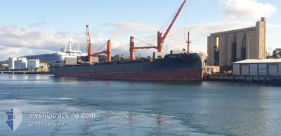
NORDRHONE
Cargo
Current Trip
| Time Travelled | 19 h, 30 mins |
|---|---|
| Remaining Time | 13 h, 32 mins |
| Distance Travelled | 267.12 nm |
| Remaining Distance | 213.99 nm |
| AVG Speed | 11.9 Knopen |
| MAX Speed | 15.9 Knopen |
| AVG Wind | 10 knots |
| MAX Wind | 13.6 knots |
| MIN Temp | 25.1°C / 77.18°F |
| MAX Temp | 26.3°C / 79.34°F |
| Diepgang | 9.1 M |
| Positie ontvangen | 1 h, 18 m geleden |
Current Position
| Lengtegraad | 153.67775° |
|---|---|
| Breedtegraat | -29.83818° |
| Status | Under way using engine |
| Snelheid | 15.3 Knopen |
| Koers | 192.4° |
| Gebied | Coral Sea |
| Station | T-AIS |
| Positie ontvangen | 1 h, 18 m geleden |
Info
Information
The current position of NORDRHONE is in Coral Sea with coordinates -29.83818° / 153.67775° as reported on 2025-02-10 16:15 by AIS to our vessel tracker app. The vessel's current speed is 15.3 Knopen and is heading at the port of NEWCASTLE. The estimated time of arrival as calculated by MyShipTracking vessel tracking app is 2025-02-11 07:05 LT
The vessel NORDRHONE (IMO: 9596040, MMSI: 255806296) is a Cargo It's sailing under the flag of [PT] Portugal.
In this page you can find informations about the vessels current position, last detected port calls, and current voyage information. If the vessels is not in coverage by AIS you will find the latest position.
The current position of NORDRHONE is detected by our AIS receivers and we are not responsible for the reliability of the data. The last position was recorded while the vessel was in Coverage by the Ais receivers of our vessel tracking app.
The current draught of NORDRHONE as reported by AIS is 9.1 meters
Weather
| Temperature | 25.1°C / 77.18°F |
|---|---|
| Wind Speed | 13 knots |
| Direction | --- N |
| Pressure | 1009.6 hPa |
| Humidity | 78.2 % |
| Cloud Coverage | 81 % |
Featured Company
Last Port Calls
| Port | Arrival | Departure | Time In Port |
|---|---|---|---|
| 2025-02-07 20:52 | 2025-02-09 22:03 | 2 d | |
| 2025-01-18 21:01 | 2025-01-22 06:29 | 3 d | |
| 2024-12-14 14:09 | 2024-12-15 20:15 | 1 d | |
| 2024-12-08 05:56 | 2024-12-09 13:28 | 1 d |
Last Trips
| Origin | Departure | Destination | Arrival | Distance | |
|---|---|---|---|---|---|
| 2025-01-22 14:29 | 2025-02-08 06:52 | 4655.33 nm | |||
| 2024-12-16 05:15 | 2025-01-19 05:01 | 1333.28 nm | |||
| 2024-12-09 21:28 | 2024-12-14 23:09 | 602.49 nm | |||
| 2024-11-23 21:52 | 2024-12-08 13:56 | 4021.11 nm |
Events
| Tijd | Evenement | Details | Positie / Bestemming | Info |
|---|---|---|---|---|
| 2025-02-10 16:19 | Status Changed | Default Under way using engine |
-29.85547 / 153.67360
AU NTL
|
Snelheid: 15.3 kn Koers: 192.4° |
| 2025-02-10 16:15 | Status Changed | Under way using engine Default |
-29.83818 / 153.67775
AU NTL
|
Snelheid: 15.4 kn Koers: 193° |
| 2025-02-10 16:15 | Buitenbereik |
-29.83818 / 153.67775
Coral Sea
AU NTL
|
Snelheid: 15.3 kn Koers: 192.4° |
|
| 2025-02-10 16:07 | Binnenbereik |
-29.83818 / 153.67775
Coral Sea
AU NTL
|
Snelheid: 15.3 kn Koers: 192.4° |
|
| 2025-02-10 03:56 | Status Changed | Default Under way using engine |
-26.94775 / 153.57871
AU NTL
|
Snelheid: 12.2 kn Koers: 145.8° |
| 2025-02-10 03:50 | Buitenbereik |
-26.92891 / 153.56771
Coral Sea
AU NTL
|
Snelheid: 12.2 kn Koers: 145.8° |
|
| 2025-02-10 03:44 | Status Changed | Under way using engine Default |
-26.91320 / 153.55260
AU NTL
|
Snelheid: 12.2 kn Koers: 120° |
| 2025-02-10 03:28 | Status Changed | Default Under way using engine |
-26.88589 / 153.50156
AU NTL
|
Snelheid: 12 kn Koers: 121.1° |
| 2025-02-10 02:36 | Destination Changed | AU NTL AU NEWCASTLE |
-26.79396 / 153.33110
AU NTL
|
Snelheid: 12.2 kn Koers: 122.7° |
| 2025-02-10 02:36 | ETA Changed | 2025/02/11 12:30 2025/02/11 12:00 |
-26.79396 / 153.33110
AU NTL
|
Snelheid: 12.2 kn Koers: 122.7° |