
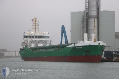
NOREN
Cargo
Current Trip
| Time Travelled | 5 days |
|---|---|
| Remaining Time | 7 h, 40 mins |
| Distance Travelled | 1127.40 nm |
| Remaining Distance | 93.28 nm |
| AVG Speed | 7.9 Knopen |
| MAX Speed | 12.3 Knopen |
| AVG Wind | 19.2 knots |
| MAX Wind | 34.3 knots |
| MIN Temp | -3.7°C / 25.34°F |
| MAX Temp | 5°C / 41°F |
| Diepgang | 5.8 M |
| Positie ontvangen | 11 h, 54 m geleden |
Current Position
| Lengtegraad | 4.31473° |
|---|---|
| Breedtegraat | 53.36367° |
| Status | Under way using engine |
| Snelheid | 6.5 Knopen |
| Koers | 254.7° |
| Gebied | North Sea |
| Station | T-AIS |
| Positie ontvangen | 11 h, 54 m geleden |
Info
Information
The current position of NOREN is in North Sea with coordinates 53.36367° / 4.31473° as reported on 2026-01-04 06:27 by AIS to our vessel tracker app. The vessel's current speed is 6.5 Knopen and is heading at the port of HULL. The estimated time of arrival as calculated by MyShipTracking vessel tracking app is 2026-01-05 02:01 LT
The vessel NOREN (IMO: 9968255, MMSI: 218055220) is a Cargo It's sailing under the flag of [DE] Germany.
In this page you can find informations about the vessels current position, last detected port calls, and current voyage information. If the vessels is not in coverage by AIS you will find the latest position.
The current position of NOREN is detected by our AIS receivers and we are not responsible for the reliability of the data. The last position was recorded while the vessel was in Coverage by the Ais receivers of our vessel tracking app.
The current draught of NOREN as reported by AIS is 5.8 meters
Weather
| Temperature | 3.8°C / 38.84°F |
|---|---|
| Wind Speed | 21 knots |
| Direction | 291° WNW |
| Pressure | 1008 hPa |
| Humidity | 58.1 % |
| Cloud Coverage | 81 % |
Featured Company
Last Port Calls
| Port | Arrival | Departure | Time In Port |
|---|---|---|---|
| 2025-12-29 04:36 | 2025-12-30 05:25 | 1 d | |
| 2025-12-25 07:36 | 2025-12-28 03:14 | 2 d | |
| 2025-12-16 17:44 | 2025-12-24 11:43 | 7 d | |
| 2025-12-13 05:25 | 2025-12-14 08:41 | 1 d | |
| 2025-12-07 12:58 | 2025-12-08 23:10 | 1 d | |
| 2025-12-03 19:44 | 2025-12-04 20:33 | 1 d | |
| 2025-11-30 23:20 | 2025-12-02 15:15 | 1 d | |
| 2025-11-29 00:53 | 2025-11-29 02:06 | 1 h | |
| 2025-11-21 09:40 | 2025-11-24 23:44 | 3 d | |
| 2025-11-19 19:54 | 2025-11-20 11:25 | 15 h |
Most Visited Ports (Last year)
| Port | Arrivals | |
|---|---|---|
| 9 | ||
| 7 | ||
| 6 | ||
| 5 | ||
| 4 | ||
| 3 |
Last Trips
| Origin | Departure | Destination | Arrival | Distance | |
|---|---|---|---|---|---|
| 2025-12-28 04:14 | 2025-12-29 05:36 | 242.17 nm | |||
| 2025-12-24 12:43 | 2025-12-25 08:36 | 180.97 nm | |||
| 2025-12-14 09:41 | 2025-12-16 18:44 | 245.23 nm | |||
| 2025-12-09 00:10 | 2025-12-13 06:25 | 1000.25 nm | |||
| 2025-12-04 20:33 | 2025-12-07 13:58 | 662.59 nm | |||
| 2025-12-02 15:15 | 2025-12-03 19:44 | 277.93 nm | |||
| 2025-11-29 03:06 | 2025-11-30 23:20 | 355.22 nm | |||
| 2025-11-25 00:44 | 2025-11-29 01:53 | 892.05 nm | |||
| 2025-11-20 12:25 | 2025-11-21 10:40 | 241.82 nm | |||
| 2025-11-05 20:48 | 2025-11-19 20:54 | 1800.63 nm |
Events
| Tijd | Evenement | Details | Positie / Bestemming | Info |
|---|---|---|---|---|
| 2026-01-04 06:32 | Status Changed | Default Under way using engine |
53.36120 / 4.29785
GBHUL
|
Snelheid: 6.5 kn Koers: 254.7° |
| 2026-01-04 06:27 | Buitenbereik |
53.36367 / 4.31473
North Sea
GBHUL
|
Snelheid: 6.5 kn Koers: 254.7° |
|
| 2026-01-04 06:16 | Status Changed | Under way using engine Default |
53.36893 / 4.34681
GBHUL
|
Snelheid: 7 kn Koers: 256° |
| 2026-01-04 06:12 | Status Changed | Default Under way using engine |
53.37056 / 4.35785
GBHUL
|
Snelheid: 6.8 kn Koers: 256.3° |
| 2026-01-04 06:12 | Status Changed | Under way using engine Default |
53.37085 / 4.36007
GBHUL
|
Snelheid: 6.5 kn Koers: 258° |
| 2026-01-04 06:04 | Binnenbereik |
53.37085 / 4.36007
North Sea
GBHUL
|
Snelheid: 6.8 kn Koers: 256.3° |
|
| 2026-01-04 04:59 | Status Changed | Default Under way using engine |
53.45672 / 4.55700
GBHUL
|
Snelheid: 7.2 kn Koers: 233.5° |
| 2026-01-04 04:57 | Status Changed | Under way using engine Default |
53.45866 / 4.56108
GBHUL
|
Snelheid: 7.2 kn Koers: 228° |
| 2026-01-04 04:57 | Buitenbereik |
53.45866 / 4.56108
North Sea
GBHUL
|
Snelheid: 7.2 kn Koers: 233.5° |
|
| 2026-01-04 04:43 | Status Changed | Default Under way using engine |
53.47722 / 4.59621
GBHUL
|
Snelheid: 7.4 kn Koers: 248.2° |