
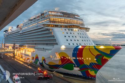
NORWEGIAN ENCORE
Passenger
Current Trip
USJUN
| Time Travelled | 5 h, 17 mins |
|---|---|
| Remaining Time | --- |
| Distance Travelled | 61.99 nm |
| Remaining Distance | --- |
| AVG Speed | 12.8 Knopen |
| MAX Speed | 14.1 Knopen |
| AVG Wind | 2.1 knots |
| MAX Wind | 3 knots |
| MIN Temp | 5.8°C / 42.44°F |
| MAX Temp | 8.3°C / 46.94°F |
| Diepgang | 8.7 M |
| Positie ontvangen | 2 d geleden |
Current Position
| Lengtegraad | -132.35415° |
|---|---|
| Breedtegraat | 52.39919° |
| Status | Under way using engine |
| Snelheid | 20.4 Knopen |
| Koers | 321.2° |
| Gebied | North Pacific Ocean |
| Station | T-AIS |
| Positie ontvangen | 2 d geleden |
Information
The current position of NORWEGIAN ENCORE is in North Pacific Ocean with coordinates 52.39919° / -132.35415° as reported on 2025-06-10 01:00 by AIS to our vessel tracker app. The vessel's current speed is 20.4 Knopen
The vessel NORWEGIAN ENCORE (IMO: 9751511, MMSI: 311000879) is a Passenger It's sailing under the flag of [BS] Bahamas.
In this page you can find informations about the vessels current position, last detected port calls, and current voyage information. If the vessels is not in coverage by AIS you will find the latest position.
The current position of NORWEGIAN ENCORE is detected by our AIS receivers and we are not responsible for the reliability of the data. The last position was recorded while the vessel was in Coverage by the Ais receivers of our vessel tracking app.
The current draught of NORWEGIAN ENCORE as reported by AIS is 8.7 meters
Weather
| Temperature | 8.3°C / 46.94°F |
|---|---|
| Wind Speed | 3 knots |
| Direction | 190° S |
| Pressure | 1017.7 hPa |
| Humidity | 84.2 % |
| Cloud Coverage | 100 % |
Featured Company
Last Port Calls
| Port | Arrival | Departure | Time In Port |
|---|---|---|---|
| 2025-06-11 13:45 | 2025-06-12 04:28 | 14 h | |
| 2025-06-10 21:08 | 2025-06-11 06:36 | 9 h | |
| 2025-06-08 12:03 | 2025-06-08 23:12 | 11 h | |
| 2025-06-08 02:04 | 2025-06-08 07:18 | 5 h | |
| 2025-06-04 13:52 | 2025-06-05 04:24 | 14 h | |
| 2025-06-03 21:08 | 2025-06-04 06:24 | 9 h | |
| 2025-06-01 12:02 | 2025-06-01 23:13 | 11 h | |
| 2025-06-01 02:01 | 2025-06-01 07:11 | 5 h | |
| 2025-05-28 13:56 | 2025-05-29 04:25 | 14 h | |
| 2025-05-27 21:08 | 2025-05-28 06:36 | 9 h |
Last Trips
| Origin | Departure | Destination | Arrival | Distance | |
|---|---|---|---|---|---|
| 2025-06-10 22:36 | 2025-06-11 05:45 | 97.82 nm | |||
| 2025-06-08 16:12 | 2025-06-10 13:08 | 888.23 nm | |||
| 2025-06-08 00:18 | 2025-06-08 05:03 | 80.55 nm | |||
| 2025-06-04 20:24 | 2025-06-07 19:04 | 1133.54 nm | |||
| 2025-06-03 22:24 | 2025-06-04 05:52 | 98.18 nm | |||
| 2025-06-01 16:13 | 2025-06-03 13:08 | 887.54 nm | |||
| 2025-06-01 00:11 | 2025-06-01 05:02 | 84.18 nm | |||
| 2025-05-28 20:25 | 2025-05-31 19:01 | 1134.63 nm | |||
| 2025-05-27 22:36 | 2025-05-28 05:56 | 98.60 nm | |||
| 2025-05-25 16:13 | 2025-05-27 13:08 | 887.12 nm |
Events
| Tijd | Evenement | Details | Positie / Bestemming | Info |
|---|---|---|---|---|
| 2025-06-12 04:28 | Vertrekhaven |
|
59.44062 / -135.33821
USJUN
|
Snelheid: 4.8 kn Koers: 29° |
| 2025-06-12 04:25 | Start beweging |
59.44607 / -135.33229
[US] SKAGWAY
|
Snelheid: 4.8 kn Koers: 29° |
|
| 2025-06-11 13:53 | Stop beweging |
59.44955 / -135.32800
[US] SKAGWAY
|
Snelheid: 0.3 kn Koers: 43° |
|
| 2025-06-11 13:45 | Aankomsthaven |
|
59.44833 / -135.33002
[US] SKAGWAY
|
Snelheid: 3.2 kn Koers: 35° |
| 2025-06-11 06:36 | Vertrekhaven |
|
58.27277 / -134.36960
USJUN
|
Snelheid: 7 kn Koers: 128° |
| 2025-06-11 06:25 | Start beweging |
58.28502 / -134.39873
[US] JUNEAU
|
Snelheid: 3.2 kn Koers: 163° |
|
| 2025-06-10 21:29 | Stop beweging |
58.29384 / -134.40332
[US] JUNEAU
|
Snelheid: 0.3 kn Koers: 96° |
|
| 2025-06-10 21:08 | Aankomsthaven |
|
58.27950 / -134.38577
[US] JUNEAU
|
Snelheid: 7.1 kn Koers: 312° |
| 2025-06-10 01:04 | Status Changed | Default Under way using engine |
52.41774 / -132.38014
USJUN
|
Snelheid: 20.4 kn Koers: 321.2° |
| 2025-06-10 01:00 | Buitenbereik |
52.39919 / -132.35415
North Pacific Ocean
USJUN
|
Snelheid: 20.4 kn Koers: 321.2° |