
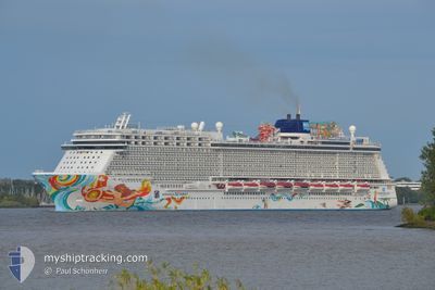
NORWEGIAN GETAWAY
Passengers Ship
Current Trip
COSTA MAYA
| Time Travelled | 14 h, 45 mins |
|---|---|
| Remaining Time | --- |
| Distance Travelled | 226.29 nm |
| Remaining Distance | --- |
| AVG Speed | 16.5 Knopen |
| MAX Speed | 18.5 Knopen |
| AVG Wind | 12.7 knots |
| MAX Wind | 22 knots |
| MIN Temp | 22.6°C / 72.68°F |
| MAX Temp | 26.4°C / 79.52°F |
| Diepgang | 8.6 M |
| Positie ontvangen | 2 d geleden |
Current Position
| Lengtegraad | -89.99228° |
|---|---|
| Breedtegraat | 29.83229° |
| Status | Under way using engine |
| Snelheid | 12.9 Knopen |
| Koers | 215° |
| Gebied | Caribbean Sea |
| Station | T-AIS |
| Positie ontvangen | 2 d geleden |
Info
Information
The current position of NORWEGIAN GETAWAY is in Caribbean Sea with coordinates 29.83229° / -89.99228° as reported on 2025-02-10 00:17 by AIS to our vessel tracker app. The vessel's current speed is 12.9 Knopen
The vessel NORWEGIAN GETAWAY (IMO: 9606924, MMSI: 311050900) is a Passengers Ship that was built in 2014 ( 11 Jaar oud ). It's sailing under the flag of [BS] Bahamas.
In this page you can find informations about the vessels current position, last detected port calls, and current voyage information. If the vessels is not in coverage by AIS you will find the latest position.
The current position of NORWEGIAN GETAWAY is detected by our AIS receivers and we are not responsible for the reliability of the data. The last position was recorded while the vessel was in Coverage by the Ais receivers of our vessel tracking app.
The current draught of NORWEGIAN GETAWAY as reported by AIS is 8.6 meters
Weather
| Temperature | 22.7°C / 72.86°F |
|---|---|
| Wind Speed | 2 knots |
| Direction | 8° N |
| Pressure | 1010.7 hPa |
| Humidity | 98.9 % |
| Cloud Coverage | 39 % |
Featured Company
Last Port Calls
| Port | Arrival | Departure | Time In Port |
|---|---|---|---|
| 2025-02-11 09:19 | 2025-02-11 18:57 | 9 h | |
| 2025-02-09 02:51 | 2025-02-09 18:39 | 15 h | |
| 2025-02-07 06:07 | 2025-02-07 13:22 | 7 h | |
| 2025-02-06 07:14 | 2025-02-06 18:11 | 10 h | |
| 2025-02-04 08:05 | 2025-02-04 16:12 | 8 h | |
| 2025-02-02 02:49 | 2025-02-02 17:59 | 15 h | |
| 2025-01-31 07:46 | 2025-01-31 18:30 | 10 h | |
| 2025-01-30 07:18 | 2025-01-30 16:26 | 9 h | |
| 2025-01-28 10:19 | 2025-01-28 18:56 | 8 h | |
| 2025-01-26 03:31 | 2025-01-26 17:59 | 14 h |
Most Visited Ports (Last year)
| Port | Arrivals | |
|---|---|---|
| 17 | ||
| 16 | ||
| 16 | ||
| 15 | ||
| 13 | ||
| 13 |
Last Trips
| Origin | Departure | Destination | Arrival | Distance | |
|---|---|---|---|---|---|
| 2025-02-09 18:39 | 2025-02-11 09:19 | 735.75 nm | |||
| 2025-02-07 13:22 | 2025-02-09 02:51 | 719.45 nm | |||
| 2025-02-06 18:11 | 2025-02-07 06:07 | 163.91 nm | |||
| 2025-02-04 16:12 | 2025-02-06 07:14 | 473.66 nm | |||
| 2025-02-02 17:59 | 2025-02-04 08:05 | 617.58 nm | |||
| 2025-01-31 18:30 | 2025-02-02 02:49 | 619.20 nm | |||
| 2025-01-30 16:26 | 2025-01-31 07:46 | 266.17 nm | |||
| 2025-01-28 18:56 | 2025-01-30 07:18 | 359.57 nm | |||
| 2025-01-26 17:59 | 2025-01-28 10:19 | 734.34 nm | |||
| 2025-01-24 13:04 | 2025-01-26 03:31 | 732.92 nm |
Events
| Tijd | Evenement | Details | Positie / Bestemming | Info |
|---|---|---|---|---|
| 2025-02-12 13:37 | Stop beweging | 0.15 nm, South of HARVEST CAYE |
16.47206 / -88.40601
COSTA MAYA
|
Snelheid: 0.1 kn Koers: 351° |
| 2025-02-11 23:57 | Start beweging | 0.77 nm, South East of COSTA MAYA |
18.71824 / -87.68223
COSTA MAYA
|
Snelheid: 10 kn Koers: 158° |
| 2025-02-11 23:57 | Vertrekhaven |
|
18.71824 / -87.68223
COSTA MAYA
|
Snelheid: Koers: 142° |
| 2025-02-11 14:19 | Aankomsthaven |
|
18.72885 / -87.68922
[MX] COSTA MAYA
|
Snelheid: 15.1 kn Koers: 227° |
| 2025-02-10 00:39 | Vertrekhaven |
|
29.75479 / -90.02250
COSTA MAYA
|
Snelheid: 13.9 kn Koers: 194° |
| 2025-02-10 00:23 | Status Changed | Default Under way using engine |
29.81293 / -90.00289
[US] NEW ORLEANS
|
Snelheid: 12.9 kn Koers: 215° |
| 2025-02-10 00:17 | Buitenbereik |
29.83229 / -89.99228
Caribbean Sea
COSTA MAYA
|
Snelheid: 12.9 kn Koers: 215.2° |
|
| 2025-02-09 22:47 | Destination Changed | COSTA MAYA NEW ORLEANS |
29.94381 / -90.05728
[US] NEW ORLEANS
|
Snelheid: 4.8 kn Koers: 85° |
| 2025-02-09 22:47 | ETA Changed | 2025/02/11 05:00 2025/02/09 03:00 |
29.94381 / -90.05728
[US] NEW ORLEANS
|
Snelheid: 4.8 kn Koers: 85° |
| 2025-02-09 22:46 | Start beweging |
29.94273 / -90.05847
[US] NEW ORLEANS
|
Snelheid: 3.6 kn Koers: 133° |