

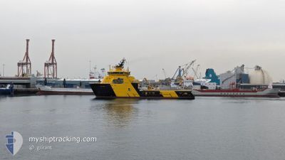
ODIN VIKING
Anchor Handling Vessel

Current Trip
| Trip Time | 2 days |
|---|---|
| Trip Distance | 390.56 nm |
| AVG Speed | 10.5 Knopen |
| MAX Speed | 12.8 Knopen |
| Diepgang | 7 M |
| AVG Wind | 2.5 knots |
| MAX Wind | 8 knots |
| MIN Temp | 4.7°C / 40.46°F |
| MAX Temp | 8.1°C / 46.58°F |
| Positie ontvangen | 2 m geleden |
Current Position
| Lengtegraad | 5.31692° |
|---|---|
| Breedtegraat | 60.39884° |
| Status | Moored |
| Snelheid | |
| Koers | 322° |
| Gebied | North Sea |
| Station | T-AIS |
| Positie ontvangen | 2 m geleden |
Information
The current position of ODIN VIKING is in North Sea with coordinates 60.39884° / 5.31692° as reported on 2025-04-10 16:40 by AIS to our vessel tracker app. The vessel's current speed is 0 Knopen and is currently inside the port of BERGEN.
The vessel ODIN VIKING (IMO: 9631759, MMSI: 257085000) is a Anchor Handling Vessel that was built in 2013 ( 12 Jaar oud ). It's sailing under the flag of [NO] Norway.
In this page you can find informations about the vessels current position, last detected port calls, and current voyage information. If the vessels is not in coverage by AIS you will find the latest position.
The current position of ODIN VIKING is detected by our AIS receivers and we are not responsible for the reliability of the data. The last position was recorded while the vessel was in Coverage by the Ais receivers of our vessel tracking app.
The current draught of ODIN VIKING as reported by AIS is 7 meters
Weather
| Temperature | 6.3°C / 43.34°F |
|---|---|
| Wind Speed | 6 knots |
| Direction | 185° S |
| Pressure | 1018.4 hPa |
| Humidity | 90.2 % |
| Cloud Coverage | 100 % |


Featured Company
Last Trips
| Origin | Departure | Destination | Arrival | Distance | |
|---|---|---|---|---|---|
| 2025-04-05 23:04 | 2025-04-08 09:32 | 390.56 nm | |||
| 2025-04-05 10:48 | 2025-04-05 15:49 | 44.17 nm | |||
| 2025-04-03 15:27 | 2025-04-03 15:33 | 0.59 nm | |||
| 2025-03-30 13:11 | 2025-03-31 19:10 | 197.83 nm | |||
| 2025-01-31 16:24 | 2025-02-01 10:13 | 182.40 nm |
Events
| Tijd | Evenement | Details | Positie / Bestemming | Info |
|---|---|---|---|---|
| 2025-04-08 08:16 | Status Changed | Moored Under way using engine |
60.39901 / 5.31694
[NO] BERGEN
|
Snelheid: Koers: 323° |
| 2025-04-08 07:33 | Stop beweging |
60.40227 / 5.30321
[NO] BERGEN
|
Snelheid: 0.3 kn Koers: 39° |
|
| 2025-04-08 07:32 | Aankomsthaven |
|
60.40220 / 5.30239
[NO] BERGEN
|
Snelheid: 2.6 kn Koers: 97° |
| 2025-04-07 21:05 | Destination Changed | BERGEN DEEPSEA ATLANTIC |
58.92876 / 2.59689
BERGEN
|
Snelheid: 11.8 kn Koers: 45.9° |
| 2025-04-07 21:05 | ETA Changed | 2025/04/08 09:59 2025/04/06 20:00 |
58.92876 / 2.59689
BERGEN
|
Snelheid: 11.8 kn Koers: 45.9° |
| 2025-04-07 17:12 | Start beweging |
58.39060 / 1.55376
DEEPSEA ATLANTIC
|
Snelheid: 6.4 kn Koers: 57.6° |
|
| 2025-04-07 14:14 | Stop beweging |
58.39099 / 1.54429
DEEPSEA ATLANTIC
|
Snelheid: 0.2 kn Koers: 58° |
|
| 2025-04-07 13:57 | Start beweging |
58.37846 / 1.53988
DEEPSEA ATLANTIC
|
Snelheid: 7.7 kn Koers: 0.4° |
|
| 2025-04-07 09:58 | Stop beweging |
58.37446 / 1.54317
DEEPSEA ATLANTIC
|
Snelheid: 0.2 kn Koers: 154° |
|
| 2025-04-07 09:34 | Start beweging |
58.37136 / 1.54586
DEEPSEA ATLANTIC
|
Snelheid: 6.3 kn Koers: 343.9° |