
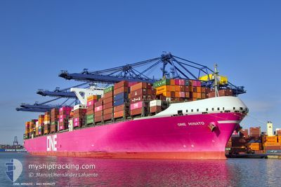
ONE MINATO
Cargo C
Current Trip
| Time Travelled | 12 days |
|---|---|
| Remaining Time | --- |
| Distance Travelled | 4789.00 nm |
| Remaining Distance | --- |
| AVG Speed | 15.8 Knopen |
| MAX Speed | 20.7 Knopen |
| AVG Wind | 14.7 knots |
| MAX Wind | 34.8 knots |
| MIN Temp | 19.2°C / 66.56°F |
| MAX Temp | 29.7°C / 85.46°F |
| Diepgang | 14.3 M |
| Positie ontvangen | 23 h, 22 m geleden |
Current Position
| Lengtegraad | 17.84102° |
|---|---|
| Breedtegraat | -34.39596° |
| Status | Under way using engine |
| Snelheid | 17.9 Knopen |
| Koers | 308.6° |
| Gebied | South Atlantic Ocean |
| Station | T-AIS |
| Positie ontvangen | 23 h, 22 m geleden |
Information
The current position of ONE MINATO is in South Atlantic Ocean with coordinates -34.39596° / 17.84102° as reported on 2025-02-25 02:53 by AIS to our vessel tracker app. The vessel's current speed is 17.9 Knopen and is heading at the port of HALIFAX. The estimated time of arrival as calculated by MyShipTracking vessel tracking app is 2025-03-14 08:30 LT
The vessel ONE MINATO (IMO: 9805477, MMSI: 431929000) is a Cargo C It's sailing under the flag of [JP] Japan.
In this page you can find informations about the vessels current position, last detected port calls, and current voyage information. If the vessels is not in coverage by AIS you will find the latest position.
The current position of ONE MINATO is detected by our AIS receivers and we are not responsible for the reliability of the data. The last position was recorded while the vessel was in Coverage by the Ais receivers of our vessel tracking app.
The current draught of ONE MINATO as reported by AIS is 14.3 meters
Weather
| Temperature | 20°C / 68°F |
|---|---|
| Wind Speed | 20 knots |
| Direction | 158° SSE |
| Pressure | 1016.4 hPa |
| Humidity | 72.7 % |
| Cloud Coverage | 94 % |
Featured Company
Last Port Calls
| Port | Arrival | Departure | Time In Port |
|---|---|---|---|
| 2025-02-12 11:57 | 2025-02-13 11:25 | 23 h | |
| 2025-02-05 11:48 | 2025-02-07 03:57 | 1 d | |
| 2025-02-01 20:28 | 2025-02-03 11:16 | 1 d | |
| 2025-01-27 06:01 | 2025-01-30 23:53 | 3 d | |
| 2025-01-23 10:51 | 2025-01-24 12:06 | 1 d | |
| 2024-12-21 00:21 | 2024-12-23 09:44 | 2 d | |
| 2024-12-17 15:09 | 2024-12-18 19:13 | 1 d | |
| 2024-12-07 14:06 | 2024-12-08 20:16 | 1 d | |
| 2024-12-02 09:30 | 2024-12-03 22:45 | 1 d |
Most Visited Ports (Last year)
| Port | Arrivals | |
|---|---|---|
| 6 | ||
| 3 | ||
| 2 | ||
| 2 | ||
| 2 | ||
| 2 |
Last Trips
| Origin | Departure | Destination | Arrival | Distance | |
|---|---|---|---|---|---|
| 2025-02-07 11:57 | 2025-02-12 17:27 | 1621.99 nm | |||
| 2025-02-03 18:16 | 2025-02-05 19:48 | 651.75 nm | |||
| 2025-01-31 06:53 | 2025-02-02 03:28 | 695.47 nm | |||
| 2025-01-24 20:06 | 2025-01-27 13:01 | 840.24 nm | |||
| 2024-12-23 04:44 | 2025-01-23 18:51 | 12423.81 nm | |||
| 2024-12-18 15:13 | 2024-12-20 19:21 | 637.60 nm | |||
| 2024-12-08 15:16 | 2024-12-17 11:09 | 1413.81 nm | |||
| 2024-12-03 17:45 | 2024-12-07 09:06 | 361.36 nm | |||
| 2024-11-30 14:16 | 2024-12-02 04:30 | 513.39 nm |
Events
| Tijd | Evenement | Details | Positie / Bestemming | Info |
|---|---|---|---|---|
| 2025-02-25 03:00 | Status Changed | Default Under way using engine |
-34.37544 / 17.80988
CA HAL
|
Snelheid: 17.9 kn Koers: 308.6° |
| 2025-02-25 02:53 | Buitenbereik |
-34.39596 / 17.84102
South Atlantic Ocean
CA HAL
|
Snelheid: 17.9 kn Koers: 308.6° |
|
| 2025-02-25 02:48 | Status Changed | Under way using engine Default |
-34.41245 / 17.86718
CA HAL
|
Snelheid: 18.1 kn Koers: 309° |
| 2025-02-25 02:40 | Status Changed | Default Under way using engine |
-34.43672 / 17.90343
CA HAL
|
Snelheid: 18.2 kn Koers: 307.8° |
| 2025-02-25 02:35 | Status Changed | Under way using engine Default |
-34.45205 / 17.92702
CA HAL
|
Snelheid: 18.3 kn Koers: 308° |
| 2025-02-25 01:51 | Status Changed | Default Under way using engine |
-34.56278 / 18.15516
CA HAL
|
Snelheid: 17.7 kn Koers: 289.5° |
| 2025-02-25 01:19 | Status Changed | Under way using engine Default |
-34.61357 / 18.33109
CA HAL
|
Snelheid: 17.4 kn Koers: 288° |
| 2025-02-25 00:34 | Status Changed | Default Under way using engine |
-34.67868 / 18.58805
CA HAL
|
Snelheid: 17.8 kn Koers: 287.8° |
| 2025-02-25 00:21 | Status Changed | Under way using engine Default |
-34.69783 / 18.65906
CA HAL
|
Snelheid: 17.9 kn Koers: 289° |
| 2025-02-25 00:15 | Status Changed | Default Under way using engine |
-34.70844 / 18.69685
CA HAL
|
Snelheid: 17.7 kn Koers: 288.1° |