

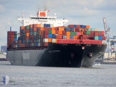
OSAKA EXPRESS
Container Ship
Current Trip
| Trip Time | 4 days |
|---|---|
| Trip Distance | 1164.09 nm |
| AVG Speed | 12 Knopen |
| MAX Speed | 12 Knopen |
| Diepgang | 12.9 M |
| AVG Wind | 11.9 knots |
| MAX Wind | 21 knots |
| MIN Temp | 13.3°C / 55.94°F |
| MAX Temp | 29.2°C / 84.56°F |
| Positie ontvangen | 3 d geleden |
Current Position
| Lengtegraad | -105.51175° |
|---|---|
| Breedtegraat | 19.37672° |
| Status | Under way using engine |
| Snelheid | 13.3 Knopen |
| Koers | 135° |
| Gebied | North Pacific Ocean |
| Station | T-AIS |
| Positie ontvangen | 3 d geleden |
Information
The current position of OSAKA EXPRESS is in North Pacific Ocean with coordinates 19.37672° / -105.51175° as reported on 2025-06-08 15:35 by AIS to our vessel tracker app. The vessel's current speed is 13.3 Knopen and is currently inside the port of MANZANILLO.
The vessel OSAKA EXPRESS (IMO: 9320697, MMSI: 636093178) is a Container Ship that was built in 2007 ( 18 Jaar oud ). It's sailing under the flag of [LR] Liberia.
In this page you can find informations about the vessels current position, last detected port calls, and current voyage information. If the vessels is not in coverage by AIS you will find the latest position.
The current position of OSAKA EXPRESS is detected by our AIS receivers and we are not responsible for the reliability of the data. The last position was recorded while the vessel was in Coverage by the Ais receivers of our vessel tracking app.
The current draught of OSAKA EXPRESS as reported by AIS is 12.9 meters
Weather
| Temperature | 27.7°C / 81.86°F |
|---|---|
| Wind Speed | 12 knots |
| Direction | 271° W |
| Pressure | 1009.6 hPa |
| Humidity | 76.1 % |
| Cloud Coverage | 100 % |
Featured Company
Last Port Calls
| Port | Arrival | Departure | Time In Port |
|---|---|---|---|
| 2025-06-09 17:49 | |||
| 2025-06-04 09:01 | 2025-06-05 05:58 | 20 h | |
| 2025-05-23 16:31 | 2025-05-24 11:20 | 18 h | |
| 2025-05-19 01:10 | 2025-05-20 09:06 | 1 d | |
| 2025-05-11 09:42 | 2025-05-12 09:34 | 23 h | |
| 2025-04-20 05:34 | 2025-04-20 19:16 | 13 h | |
| 2025-04-17 17:00 | 2025-04-18 08:27 | 15 h | |
| 2025-04-11 21:53 | 2025-04-13 02:04 | 1 d |
Most Visited Ports (Last year)
| Port | Arrivals | |
|---|---|---|
| 5 | ||
| 4 | ||
| 4 | ||
| 4 | ||
| 3 | ||
| 3 |
Last Trips
| Origin | Departure | Destination | Arrival | Distance | |
|---|---|---|---|---|---|
| 2025-06-05 05:58 | 2025-06-09 17:49 | 1164.09 nm | |||
| 2025-05-24 11:20 | 2025-06-04 09:01 | 5165.88 nm | |||
| 2025-05-20 09:06 | 2025-05-23 16:31 | 944.97 nm | |||
| 2025-05-12 09:34 | 2025-05-19 01:10 | 552.32 nm | |||
| 2025-04-20 19:16 | 2025-05-11 09:42 | 5474.70 nm | |||
| 2025-04-18 08:27 | 2025-04-20 05:34 | 487.10 nm | |||
| 2025-04-13 02:04 | 2025-04-17 17:00 | 1047.58 nm | |||
| 2025-03-17 15:07 | 2025-04-11 21:53 | 11174.39 nm |
Events
| Tijd | Evenement | Details | Positie / Bestemming | Info |
|---|---|---|---|---|
| 2025-06-09 23:35 | Stop beweging |
19.06928 / -104.37917
[MX] MANZANILLO
|
Snelheid: 0.3 kn Koers: 250° |
|
| 2025-06-09 22:49 | Aankomsthaven |
|
19.06393 / -104.39388
[MX] MANZANILLO
|
Snelheid: 7.9 kn Koers: 97° |
| 2025-06-09 17:00 | Start beweging | 13.82 nm, South West of BARRA DE NAVIDAD |
18.98997 / -104.78929
MXESE >> MXZLO
|
Snelheid: 6.4 kn Koers: 263° |
| 2025-06-09 14:51 | Stop beweging | 16.88 nm, South of BARRA DE NAVIDAD |
18.92671 / -104.76708
MXESE >> MXZLO
|
Snelheid: 0.3 kn Koers: 158° |
| 2025-06-09 08:32 | Start beweging | 18.2 nm, South West of BARRA DE NAVIDAD |
18.95011 / -104.86867
MXESE >> MXZLO
|
Snelheid: 4 kn Koers: 109° |
| 2025-06-09 07:04 | Stop beweging | 17.88 nm, South West of BARRA DE NAVIDAD |
18.94467 / -104.85005
MXESE >> MXZLO
|
Snelheid: 0.3 kn Koers: 89° |
| 2025-06-08 20:30 | Start beweging |
19.04687 / -105.20087
MXESE >> MXZLO
|
Snelheid: 5.1 kn Koers: 108° |
|
| 2025-06-08 20:03 | Stop beweging |
19.05349 / -105.20651
MXESE >> MXZLO
|
Snelheid: 0.3 kn Koers: 217° |
|
| 2025-06-08 15:41 | Status Changed | Default Under way using engine |
19.36039 / -105.49477
MXESE >> MXZLO
|
Snelheid: 13.3 kn Koers: 135° |
| 2025-06-08 15:35 | Buitenbereik |
19.37672 / -105.51175
North Pacific Ocean
MXESE >> MXZLO
|
Snelheid: 13.3 kn Koers: 135° |