
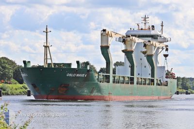
OSLO WAVE 4
General Cargo
Current Trip
| Time Travelled | 22 days |
|---|---|
| Remaining Time | --- |
| Distance Travelled | 4648.28 nm |
| Remaining Distance | --- |
| AVG Speed | 12.6 Knopen |
| MAX Speed | 16.7 Knopen |
| AVG Wind | 14.3 knots |
| MAX Wind | 50 knots |
| MIN Temp | -8.9°C / 15.98°F |
| MAX Temp | 18.3°C / 64.94°F |
| Diepgang | 9.4 M |
| Positie ontvangen | 5 h, 27 m geleden |
Current Position
| Lengtegraad | 21.28438° |
|---|---|
| Breedtegraat | 61.58493° |
| Status | At anchor |
| Snelheid | |
| Koers | 200° |
| Gebied | Gulf of Bothnia |
| Station | T-AIS |
| Positie ontvangen | 5 h, 27 m geleden |
Info
Information
The current position of OSLO WAVE 4 is in Gulf of Bothnia with coordinates 61.58493° / 21.28438° as reported on 2025-02-07 03:24 by AIS to our vessel tracker app. The vessel's current speed is 0 Knopen
The vessel OSLO WAVE 4 (IMO: 9208203, MMSI: 257127140) is a General Cargo that was built in 2000 ( 25 Jaar oud ). It's sailing under the flag of [NO] Norway.
In this page you can find informations about the vessels current position, last detected port calls, and current voyage information. If the vessels is not in coverage by AIS you will find the latest position.
The current position of OSLO WAVE 4 is detected by our AIS receivers and we are not responsible for the reliability of the data. The last position was recorded while the vessel was in Coverage by the Ais receivers of our vessel tracking app.
The current draught of OSLO WAVE 4 as reported by AIS is 9.4 meters
Weather
| Temperature | 0.2°C / 32.36°F |
|---|---|
| Wind Speed | 15 knots |
| Direction | 185° S |
| Pressure | 1049.3 hPa |
| Humidity | 91.9 % |
| Cloud Coverage | 20 % |
Featured Company
Last Port Calls
| Port | Arrival | Departure | Time In Port |
|---|---|---|---|
| 2025-01-10 15:09 | 2025-01-16 09:04 | 5 d | |
| 2024-12-30 14:37 | 2025-01-07 08:13 | 7 d | |
| 2024-12-06 18:09 | 2024-12-13 10:04 | 6 d | |
| 2024-12-03 14:00 | 2024-12-05 19:12 | 2 d | |
| 2024-12-02 22:12 |
Most Visited Ports (Last year)
| Port | Arrivals | |
|---|---|---|
| 6 | ||
| 3 | ||
| 3 | ||
| 2 | ||
| 2 | ||
| 2 |
Last Trips
| Origin | Departure | Destination | Arrival | Distance | |
|---|---|---|---|---|---|
| 2025-01-07 08:13 | 2025-01-10 15:09 | 888.42 nm | |||
| 2024-12-13 10:04 | 2024-12-30 14:37 | 4834.71 nm | |||
| 2024-12-05 19:12 | 2024-12-06 18:09 | 152.66 nm | |||
| 2024-12-02 22:12 | 2024-12-03 14:00 | 176.94 nm |
Events
| Tijd | Evenement | Details | Positie / Bestemming | Info |
|---|---|---|---|---|
| 2025-02-07 03:27 | Status Changed | Default At anchor |
61.58490 / 21.28427
FIPOR
|
Snelheid: Koers: 200° |
| 2025-02-07 03:24 | Status Changed | At anchor Default |
61.58493 / 21.28438
FIPOR
|
Snelheid: Koers: 198° |
| 2025-02-07 03:24 | Buitenbereik |
61.58493 / 21.28438
Gulf of Bothnia
|
Snelheid: Koers: 57.8° |
|
| 2025-02-07 03:09 | Binnenbereik |
61.58493 / 21.28438
Gulf of Bothnia
|
Snelheid: Koers: 57.8° |
|
| 2025-02-05 01:40 | Status Changed | Default At anchor |
61.58511 / 21.28196
FIPOR
|
Snelheid: Koers: 179° |
| 2025-02-05 01:34 | Status Changed | At anchor Default |
61.58514 / 21.28167
FIPOR
|
Snelheid: 0.1 kn Koers: 188° |
| 2025-02-05 01:34 | Buitenbereik |
61.58514 / 21.28167
Gulf of Bothnia
|
Snelheid: Koers: 288.1° |
|
| 2025-02-05 01:31 | Binnenbereik |
61.58514 / 21.28167
Gulf of Bothnia
|
Snelheid: Koers: 288.1° |
|
| 2025-02-01 05:17 | Stop beweging | 4.75 nm, South West of PORI |
61.58250 / 21.28330
FIPOR
|
Snelheid: Koers: 306° |
| 2025-02-01 03:53 | Buitenbereik |
61.47719 / 20.98993
Gulf of Bothnia
FIPOR
|
Snelheid: 9.7 kn Koers: 50.9° |