
PAGNA
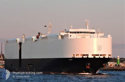
Vehicles Carrier
Current Trip
JP YOK>JPNGO
| Time Travelled | 6 days |
|---|---|
| Remaining Time | --- |
| Distance Travelled | 2355.97 nm |
| Remaining Distance | --- |
| AVG Speed | 15.4 Knopen |
| MAX Speed | 18.8 Knopen |
| AVG Wind | 15.7 knots |
| MAX Wind | 28.7 knots |
| MIN Temp | 4.5°C / 40.1°F |
| MAX Temp | 29.2°C / 84.56°F |
| Diepgang | 8.2 M |
| Positie ontvangen | 6 d geleden |
Current Position
| Lengtegraad | 137.16644° |
|---|---|
| Breedtegraat | 34.28424° |
| Status | Under way using engine |
| Snelheid | 17.1 Knopen |
| Koers | 160° |
| Gebied | Philippine Sea |
| Station | T-AIS |
| Positie ontvangen | 6 d geleden |
Info
Information
The current position of PAGNA is in Philippine Sea with coordinates 34.28424° / 137.16644° as reported on 2025-02-06 11:43 by AIS to our vessel tracker app. The vessel's current speed is 17.1 Knopen
The vessel PAGNA (IMO: 9427952, MMSI: 538090644) is a Vehicles Carrier that was built in 2010 ( 15 Jaar oud ). It's sailing under the flag of [MH] Marshall Is.
In this page you can find informations about the vessels current position, last detected port calls, and current voyage information. If the vessels is not in coverage by AIS you will find the latest position.
The current position of PAGNA is detected by our AIS receivers and we are not responsible for the reliability of the data. The last position was recorded while the vessel was in Coverage by the Ais receivers of our vessel tracking app.
The current draught of PAGNA as reported by AIS is 8.2 meters
Weather
| Temperature | 28.1°C / 82.58°F |
|---|---|
| Wind Speed | 9 knots |
| Direction | 46° NE |
| Pressure | 1010.2 hPa |
| Humidity | 67.5 % |
| Cloud Coverage | 49 % |
Featured Company
Last Port Calls
| Port | Arrival | Departure | Time In Port |
|---|---|---|---|
| 2025-02-06 06:31 | 2025-02-06 17:45 | 11 h | |
| 2025-02-02 10:30 | 2025-02-03 17:14 | 1 d | |
| 2025-02-01 06:57 | 2025-02-01 16:13 | 9 h | |
| 2025-01-30 06:03 | 2025-01-30 19:28 | 13 h | |
| 2025-01-17 03:12 | 2025-01-18 21:37 | 1 d | |
| 2024-12-20 12:42 | 2024-12-21 17:20 | 1 d | |
| 2024-12-15 08:38 | 2024-12-17 12:23 | 2 d | |
| 2024-12-02 09:23 | 2024-12-06 13:52 | 4 d |
Most Visited Ports (Last year)
| Port | Arrivals | |
|---|---|---|
| 5 | ||
| 4 | ||
| 4 | ||
| 3 | ||
| 3 | ||
| 2 |
Last Trips
| Origin | Departure | Destination | Arrival | Distance | |
|---|---|---|---|---|---|
| 2025-02-03 17:14 | 2025-02-06 06:31 | 233.04 nm | |||
| 2025-02-01 16:13 | 2025-02-02 10:30 | 138.08 nm | |||
| 2025-01-30 19:28 | 2025-02-01 06:57 | 188.25 nm | |||
| 2025-01-18 21:37 | 2025-01-30 06:03 | 3957.54 nm | |||
| 2024-12-21 17:20 | 2025-01-17 03:12 | 1127.07 nm | |||
| 2024-12-17 12:23 | 2024-12-20 12:42 | 338.42 nm | |||
| 2024-12-06 13:52 | 2024-12-15 08:38 | 612.19 nm | |||
| 2024-11-17 19:03 | 2024-12-02 09:23 | 4991.29 nm |
Events
| Tijd | Evenement | Details | Positie / Bestemming | Info |
|---|---|---|---|---|
| 2025-02-09 00:00 | Start beweging |
19.95177 / 146.21600
JP YOK>JPNGO
|
Snelheid: 4 kn Koers: 119° |
|
| 2025-02-08 23:39 | Stop beweging |
19.94955 / 146.21591
JP YOK>JPNGO
|
Snelheid: 0.3 kn Koers: 327° |
|
| 2025-02-06 11:45 | Status Changed | Default Under way using engine |
34.27657 / 137.16985
JP YOK>JPNGO
|
Snelheid: 17.1 kn Koers: 160° |
| 2025-02-06 11:43 | Status Changed | Under way using engine Default |
34.28424 / 137.16644
JP YOK>JPNGO
|
Snelheid: 17.2 kn Koers: 157° |
| 2025-02-06 11:43 | Buitenbereik |
34.28424 / 137.16644
Philippine Sea
|
Snelheid: 17.1 kn Koers: 160° |
|
| 2025-02-06 11:15 | Status Changed | Default Under way using engine |
34.41061 / 137.10248
JP YOK>JPNGO
|
Snelheid: 16.6 kn Koers: 155.2° |
| 2025-02-06 11:02 | Status Changed | Under way using engine Default |
34.46256 / 137.07168
JP YOK>JPNGO
|
Snelheid: 15.7 kn Koers: 153° |
| 2025-02-06 10:58 | Binnenbereik |
34.46256 / 137.07168
Philippine Sea
|
Snelheid: 16.2 kn Koers: 153.5° |
|
| 2025-02-06 09:54 | Status Changed | Default Under way using engine |
34.65888 / 136.84900
JP YOK>JPNGO
|
Snelheid: 17.1 kn Koers: 126.7° |
| 2025-02-06 09:54 | Buitenbereik |
34.66002 / 136.84713
Philippine Sea
|
Snelheid: 17.1 kn Koers: 126.7° |