
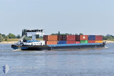
PELAGUS
Cargo
Current Trip
| Time Travelled | 9 h, 19 mins |
|---|---|
| Remaining Time | 4 h, 21 mins |
| Distance Travelled | 48.52 nm |
| Remaining Distance | 28.66 nm |
| AVG Speed | 6.7 Knopen |
| MAX Speed | 7.9 Knopen |
| AVG Wind | 9.4 knots |
| MAX Wind | 12 knots |
| MIN Temp | 10.1°C / 50.18°F |
| MAX Temp | 16.2°C / 61.16°F |
| Diepgang | 1.5 M |
| Positie ontvangen | 1 m geleden |
Current Position
| Lengtegraad | 5.19653° |
|---|---|
| Breedtegraat | 51.81039° |
| Status | Under way using engine |
| Snelheid | 5.6 Knopen |
| Koers | 107.3° |
| Gebied | North Sea |
| Station | T-AIS |
| Positie ontvangen | 1 m geleden |
Information
The current position of PELAGUS is in North Sea with coordinates 51.81039° / 5.19653° as reported on 2025-04-22 19:46 by AIS to our vessel tracker app. The vessel's current speed is 5.6 Knopen and is heading at the port of NIJMEGEN. The estimated time of arrival as calculated by MyShipTracking vessel tracking app is 2025-04-23 02:08 LT
The vessel PELAGUS (MMSI: 205540690) is a Cargo It's sailing under the flag of [BE] Belgium.
In this page you can find informations about the vessels current position, last detected port calls, and current voyage information. If the vessels is not in coverage by AIS you will find the latest position.
The current position of PELAGUS is detected by our AIS receivers and we are not responsible for the reliability of the data. The last position was recorded while the vessel was in Coverage by the Ais receivers of our vessel tracking app.
The current draught of PELAGUS as reported by AIS is 1.5 meters
Weather
| Temperature | 10.8°C / 51.44°F |
|---|---|
| Wind Speed | 6 knots |
| Direction | 294° WNW |
| Pressure | 1017.6 hPa |
| Humidity | 77.6 % |
| Cloud Coverage | 100 % |
Featured Company
Last Port Calls
| Port | Arrival | Departure | Time In Port |
|---|---|---|---|
| 2025-04-22 01:39 | 2025-04-22 12:28 | 10 h | |
| 2025-04-21 09:29 | 2025-04-21 10:19 | 50 m | |
| 2025-04-20 10:20 | 2025-04-21 06:08 | 19 h | |
| 2025-04-20 06:13 | 2025-04-20 07:08 | 55 m | |
| 2025-04-18 23:50 | 2025-04-19 13:42 | 13 h | |
| 2025-04-18 06:43 | 2025-04-18 07:22 | 38 m | |
| 2025-04-17 15:30 | 2025-04-18 02:36 | 11 h | |
| 2025-04-16 21:53 | 2025-04-17 12:20 | 14 h | |
| 2025-04-16 05:09 | 2025-04-16 08:53 | 3 h | |
| 2025-04-15 04:07 | 2025-04-15 15:21 | 11 h |
Most Visited Ports (Last year)
| Port | Arrivals | |
|---|---|---|
| 210 | ||
| 117 | ||
| 114 | ||
| 36 | ||
| 20 | ||
| 6 |
Last Trips
| Origin | Departure | Destination | Arrival | Distance | |
|---|---|---|---|---|---|
| 2025-04-21 10:19 | 2025-04-22 01:39 | 75.29 nm | |||
| 2025-04-21 06:08 | 2025-04-21 09:29 | 23.97 nm | |||
| 2025-04-20 07:08 | 2025-04-20 10:20 | 21.74 nm | |||
| 2025-04-19 13:42 | 2025-04-20 06:13 | 76.14 nm | |||
| 2025-04-18 07:22 | 2025-04-18 23:50 | 77.01 nm | |||
| 2025-04-18 02:36 | 2025-04-18 06:43 | 23.99 nm | |||
| 2025-04-17 12:20 | 2025-04-17 15:30 | 23.77 nm | |||
| 2025-04-16 08:53 | 2025-04-16 21:53 | 42.28 nm | |||
| 2025-04-15 15:21 | 2025-04-16 05:09 | 77.62 nm | |||
| 2025-04-14 13:31 | 2025-04-15 04:07 | 77.18 nm |
Events
| Tijd | Evenement | Details | Positie / Bestemming | Info |
|---|---|---|---|---|
| 2025-04-22 18:47 | Status Changed | Under way using engine Default |
51.81699 / 5.04852
ALBLASSERDAM
|
Snelheid: 6.6 kn Koers: 92° |
| 2025-04-22 18:32 | Status Changed | Default Under way using engine |
51.82090 / 5.00434
ALBLASSERDAM
|
Snelheid: 7 kn Koers: 94.4° |
| 2025-04-22 17:45 | Status Changed | Under way using engine Default |
51.81733 / 4.86591
ALBLASSERDAM
|
Snelheid: 6.4 kn Koers: 96° |
| 2025-04-22 17:34 | Status Changed | Default Under way using engine |
51.81884 / 4.83306
ALBLASSERDAM
|
Snelheid: 6.5 kn Koers: 80.8° |
| 2025-04-22 16:24 | Start beweging | 0.67 nm, South East of HENDRIK IDO AMBACHT |
51.84552 / 4.66714
ALBLASSERDAM
|
Snelheid: 5.3 kn Koers: 160.3° |
| 2025-04-22 14:18 | Stop beweging | 0.58 nm, South East of HENDRIK IDO AMBACHT |
51.84723 / 4.66618
ALBLASSERDAM
|
Snelheid: 0.3 kn Koers: 511° |
| 2025-04-22 10:28 | Vertrekhaven |
|
51.96213 / 4.08300
ALBLASSERDAM
|
Snelheid: 8.7 kn Koers: 109.7° |
| 2025-04-22 09:59 | Start beweging |
51.96269 / 4.00067
[NL] MAASVLAKTE - ROTTERDAM
|
Snelheid: 6.4 kn Koers: 3.4° |
|
| 2025-04-22 00:15 | Stop beweging |
51.96157 / 3.99543
[NL] MAASVLAKTE - ROTTERDAM
|
Snelheid: 0.2 kn Koers: 511° |
|
| 2025-04-21 23:39 | Aankomsthaven |
|
51.96349 / 4.07971
[NL] MAASVLAKTE - ROTTERDAM
|
Snelheid: 6.3 kn Koers: 257.6° |