

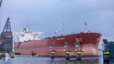
PLATA LUCKY
Crude Oil Tanker

Current Trip
| Time Travelled | --- |
|---|---|
| Remaining Time | 5 days |
| Distance Travelled | 8285.68 nm |
| Remaining Distance | 2562.80 nm |
| AVG Speed | 9.9 Knopen |
| MAX Speed | 15.8 Knopen |
| AVG Wind | 10.7 knots |
| MAX Wind | 25.9 knots |
| MIN Temp | 19.2°C / 66.56°F |
| MAX Temp | 29°C / 84.2°F |
| Diepgang | 21 M |
| Positie ontvangen | 2 d geleden |
Current Position
| Lengtegraad | 57.32070° |
|---|---|
| Breedtegraat | 24.99965° |
| Status | Under way using engine |
| Snelheid | 12.3 Knopen |
| Koers | 120.3° |
| Gebied | Gulf of Oman |
| Station | T-AIS |
| Positie ontvangen | 2 d geleden |
Information
The current position of PLATA LUCKY is in Gulf of Oman with coordinates 24.99965° / 57.32070° as reported on 2025-06-01 22:38 by AIS to our vessel tracker app. The vessel's current speed is 12.3 Knopen and is heading at the port of VISAKHAPATNAM. The estimated time of arrival as calculated by MyShipTracking vessel tracking app is 2025-06-10 17:59 LT
The vessel PLATA LUCKY (IMO: 9358292, MMSI: 636020224) is a Crude Oil Tanker that was built in 2009 ( 16 Jaar oud ). It's sailing under the flag of [LR] Liberia.
In this page you can find informations about the vessels current position, last detected port calls, and current voyage information. If the vessels is not in coverage by AIS you will find the latest position.
The current position of PLATA LUCKY is detected by our AIS receivers and we are not responsible for the reliability of the data. The last position was recorded while the vessel was in Coverage by the Ais receivers of our vessel tracking app.
The current draught of PLATA LUCKY as reported by AIS is 21 meters
Weather
| Temperature | 28.9°C / 84.02°F |
|---|---|
| Wind Speed | 18 knots |
| Direction | 254° WSW |
| Pressure | 1007.3 hPa |
| Humidity | 77.1 % |
| Cloud Coverage | 84 % |


Featured Company
Last Port Calls
Most Visited Ports (Last year)
| Port | Arrivals | |
|---|---|---|
| 1 | ||
| 1 | ||
| 1 |
Last Trips
| Origin | Departure | Destination | Arrival | Distance |
|---|
Events
| Tijd | Evenement | Details | Positie / Bestemming | Info |
|---|---|---|---|---|
| 2025-06-01 22:43 | Status Changed | Default Under way using engine |
24.99088 / 57.33694
VIZAG
|
Snelheid: 12.3 kn Koers: 120.3° |
| 2025-06-01 22:38 | Buitenbereik |
24.99965 / 57.32070
Gulf of Oman
VIZAG
|
Snelheid: 12.3 kn Koers: 120.3° |
|
| 2025-06-01 21:59 | Wijzig zee gebeid | Iranian part of the Gulf of Oman Omani part of the Gulf of Oman |
25.06727 / 57.19049
Gulf of Oman
VIZAG
|
Snelheid: 12.4 kn Koers: 116° |
| 2025-06-01 21:34 | Wijzig zee gebeid | Omani part of the Gulf of Oman United Arab Emirates part of the Gulf of Oman |
25.10303 / 57.10739
Gulf of Oman
VIZAG
|
Snelheid: 12.5 kn Koers: 113.9° |
| 2025-06-01 20:44 | Draught Changed | 21 11 |
25.18605 / 56.93635
VIZAG
|
Snelheid: 12.7 kn Koers: 120.9° |
| 2025-06-01 20:44 | Destination Changed | VIZAG FUJAIRAH |
25.18605 / 56.93635
VIZAG
|
Snelheid: 12.7 kn Koers: 120.9° |
| 2025-06-01 20:44 | ETA Changed | 2025/06/10 06:00 2026/05/28 08:00 |
25.18605 / 56.93635
VIZAG
|
Snelheid: 12.7 kn Koers: 120.9° |
| 2025-06-01 17:27 | Start beweging | 5.64 nm, North of FUJAIRAH |
25.23847 / 56.39723
FUJAIRAH
|
Snelheid: 3.1 kn Koers: 26° |
| 2025-06-01 00:01 | ETA Changed | 2026/05/28 08:00 2025/05/28 08:00 |
25.23176 / 56.39743
FUJAIRAH
|
Snelheid: Koers: 232° |
| 2025-05-30 20:55 | Stop beweging | 5.26 nm, North of FUJAIRAH |
25.23131 / 56.39862
FUJAIRAH
|
Snelheid: 0.3 kn Koers: 241° |