
POETA LOPEZ ANGLADA
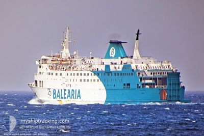
Ro-Ro/Passenger Ship
Current Trip
| Trip Time | 1 h, 21 mins |
|---|---|
| Trip Distance | 19.51 nm |
| AVG Speed | 13.2 Knopen |
| MAX Speed | 16.5 Knopen |
| Diepgang | 4.8 M |
| AVG Wind | 8.3 knots |
| MAX Wind | 12 knots |
| MIN Temp | 6.7°C / 44.06°F |
| MAX Temp | 11.4°C / 52.52°F |
| Positie ontvangen | Nu |
Current Position
| Lengtegraad | -5.43458° |
|---|---|
| Breedtegraat | 36.13204° |
| Status | Under way using engine |
| Snelheid | |
| Koers | 75° |
| Gebied | Strait of Gibraltar |
| Station | T-AIS |
| Positie ontvangen | Nu |
Info
Information
The current position of POETA LOPEZ ANGLADA is in Strait of Gibraltar with coordinates 36.13204° / -5.43458° as reported on 2025-03-15 03:30 by AIS to our vessel tracker app. The vessel's current speed is 0 Knopen and is currently inside the port of ALGECIRAS.
The vessel POETA LOPEZ ANGLADA (IMO: 8208763, MMSI: 209678000) is a Ro-Ro/Passenger Ship that was built in 1984 ( 41 Jaar oud ). It's sailing under the flag of [CY] Cyprus.
In this page you can find informations about the vessels current position, last detected port calls, and current voyage information. If the vessels is not in coverage by AIS you will find the latest position.
The current position of POETA LOPEZ ANGLADA is detected by our AIS receivers and we are not responsible for the reliability of the data. The last position was recorded while the vessel was in Coverage by the Ais receivers of our vessel tracking app.
The current draught of POETA LOPEZ ANGLADA as reported by AIS is 4.8 meters
Weather
| Temperature | 6.7°C / 44.06°F |
|---|---|
| Wind Speed | 4 knots |
| Direction | 278° W |
| Pressure | 1011.2 hPa |
| Humidity | 95.2 % |
| Cloud Coverage | 5 % |
Featured Company
Last Port Calls
| Port | Arrival | Departure | Time In Port |
|---|---|---|---|
| 2025-03-15 04:21 | |||
| 2025-03-14 23:25 | 2025-03-15 02:00 | 2 h | |
| 2025-03-14 19:35 | 2025-03-14 23:04 | 3 h | |
| 2025-03-14 13:44 | 2025-03-14 17:14 | 3 h | |
| 2025-03-13 18:14 | 2025-03-14 12:00 | 17 h | |
| 2025-03-13 07:39 | 2025-03-13 17:38 | 9 h | |
| 2025-03-13 02:58 | 2025-03-13 05:35 | 2 h | |
| 2025-03-13 00:00 | 2025-03-13 02:29 | 2 h | |
| 2025-03-12 18:00 | 2025-03-12 21:50 | 3 h | |
| 2025-03-12 08:45 | 2025-03-12 16:41 | 7 h |
Most Visited Ports (Last year)
| Port | Arrivals | |
|---|---|---|
| 1221 | ||
| 1198 |
Last Trips
| Origin | Departure | Destination | Arrival | Distance | |
|---|---|---|---|---|---|
| 2025-03-15 02:00 | 2025-03-15 04:21 | 19.51 nm | |||
| 2025-03-14 23:04 | 2025-03-14 23:25 | 19.49 nm | |||
| 2025-03-14 17:14 | 2025-03-14 19:35 | 19.36 nm | |||
| 2025-03-14 12:00 | 2025-03-14 13:44 | 22.18 nm | |||
| 2025-03-13 17:38 | 2025-03-13 18:14 | 3.33 nm | |||
| 2025-03-13 05:35 | 2025-03-13 07:39 | 18.26 nm | |||
| 2025-03-13 02:29 | 2025-03-13 02:58 | 19.08 nm | |||
| 2025-03-12 21:50 | 2025-03-13 00:00 | 18.80 nm | |||
| 2025-03-12 16:41 | 2025-03-12 18:00 | 19.55 nm | |||
| 2025-03-12 08:43 | 2025-03-12 08:45 | 1.45 nm |
Events
| Tijd | Evenement | Details | Positie / Bestemming | Info |
|---|---|---|---|---|
| 2025-03-15 03:29 | Stop beweging |
36.13200 / -5.43465
[ES] ALGECIRAS
|
Snelheid: 0.3 kn Koers: 105° |
|
| 2025-03-15 03:21 | Aankomsthaven |
|
36.14820 / -5.43053
[ES] ALGECIRAS
|
Snelheid: 9 kn Koers: 220° |
| 2025-03-15 03:10 | Wijzig zee gebeid | Spanish part of the Strait of Gibraltar Gibraltarian part of the Strait of Gibraltar |
36.13365 / -5.39842
Strait of Gibraltar
ALG-TGM-ALG
|
Snelheid: 16 kn Koers: 346° |
| 2025-03-15 03:01 | Wijzig zee gebeid | Gibraltarian part of the Strait of Gibraltar Spanish part of the Strait of Gibraltar |
36.09325 / -5.38580
Strait of Gibraltar
ALG-TGM-ALG
|
Snelheid: 16.2 kn Koers: 341° |
| 2025-03-15 02:34 | Wijzig zee gebeid | Spanish part of the Strait of Gibraltar Moroccan part of the Strait of Gibraltar |
35.99178 / -5.42211
Strait of Gibraltar
ALG-TGM-ALG
|
Snelheid: 13.2 kn Koers: 18° |
| 2025-03-15 02:27 | ETA Changed | 2025/03/15 04:30 2025/03/15 00:30 |
35.96993 / -5.43607
ALG-TGM-ALG
|
Snelheid: 13.9 kn Koers: 44° |
| 2025-03-15 02:00 | Status Changed | Under way using engine Default |
35.88870 / -5.51855
ALG-TGM-ALG
|
Snelheid: 6.2 kn Koers: 343° |
| 2025-03-15 02:00 | Start beweging | 0.47 nm, North of TANGER MED |
35.88870 / -5.51855
ALG-TGM-ALG
|
Snelheid: 13.5 kn Koers: 20° |
| 2025-03-15 02:00 | Vertrekhaven |
|
35.88870 / -5.51855
ALG-TGM-ALG
|
Snelheid: 6.2 kn Koers: 343° |
| 2025-03-15 01:52 | Status Changed | Default Under way using engine |
35.87794 / -5.51943
[MA] TANGER MED
|
Snelheid: Koers: 343° |