

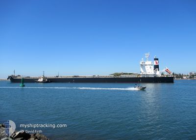
PRAIRIE
Cargo

Current Trip
| Time Travelled | 7 days |
|---|---|
| Remaining Time | 4 days |
| Distance Travelled | 1953.29 nm |
| Remaining Distance | 1290.08 nm |
| AVG Speed | 11.5 Knopen |
| MAX Speed | 13.4 Knopen |
| AVG Wind | 10.2 knots |
| MAX Wind | 16.9 knots |
| MIN Temp | 16.9°C / 62.42°F |
| MAX Temp | 26.6°C / 79.88°F |
| Diepgang | 14.3 M |
| Positie ontvangen | 7 d geleden |
Current Position
| Lengtegraad | -75.87287° |
|---|---|
| Breedtegraat | 36.87366° |
| Status | Under way using engine |
| Snelheid | 10.3 Knopen |
| Koers | 138.8° |
| Gebied | North Atlantic Ocean |
| Station | T-AIS |
| Positie ontvangen | 7 d geleden |
Information
The current position of PRAIRIE is in North Atlantic Ocean with coordinates 36.87366° / -75.87287° as reported on 2025-05-24 15:03 by AIS to our vessel tracker app. The vessel's current speed is 10.3 Knopen and is heading at the port of PECEM. The estimated time of arrival as calculated by MyShipTracking vessel tracking app is 2025-06-05 09:19 LT
The vessel PRAIRIE (IMO: 9860506, MMSI: 538008657) is a Cargo It's sailing under the flag of [MH] Marshall Is.
In this page you can find informations about the vessels current position, last detected port calls, and current voyage information. If the vessels is not in coverage by AIS you will find the latest position.
The current position of PRAIRIE is detected by our AIS receivers and we are not responsible for the reliability of the data. The last position was recorded while the vessel was in Coverage by the Ais receivers of our vessel tracking app.
The current draught of PRAIRIE as reported by AIS is 14.3 meters
Weather
| Temperature | 25.6°C / 78.08°F |
|---|---|
| Wind Speed | 16 knots |
| Direction | 85° E |
| Pressure | 1018.3 hPa |
| Humidity | 79.8 % |
| Cloud Coverage | 100 % |


Featured Company
Last Port Calls
| Port | Arrival | Departure | Time In Port |
|---|---|---|---|
| 2025-05-20 16:52 | 2025-05-24 09:11 | 3 d | |
| 2025-05-07 21:02 | 2025-05-19 07:16 | 11 d | |
| 2025-04-19 21:42 | 2025-04-26 08:14 | 6 d | |
| 2025-04-07 00:57 | 2025-04-11 18:54 | 4 d | |
| 2025-03-22 17:34 | 2025-03-25 12:47 | 2 d | |
| 2025-03-14 20:19 | 2025-03-15 13:30 | 17 h |
Last Trips
| Origin | Departure | Destination | Arrival | Distance | |
|---|---|---|---|---|---|
| 2025-05-19 07:16 | 2025-05-20 16:52 | 275.21 nm | |||
| 2025-04-26 08:14 | 2025-05-07 21:02 | 3400.33 nm | |||
| 2025-04-11 18:54 | 2025-04-19 21:42 | 73.03 nm | |||
| 2025-03-25 12:47 | 2025-04-07 00:57 | 3218.41 nm | |||
| 2025-03-15 13:30 | 2025-03-22 17:34 | 172.88 nm | |||
| 2025-02-26 08:28 | 2025-03-14 20:19 | 3995.38 nm |
Events
| Tijd | Evenement | Details | Positie / Bestemming | Info |
|---|---|---|---|---|
| 2025-05-24 15:08 | Status Changed | Default Under way using engine |
36.86467 / -75.85708
BR PEC
|
Snelheid: 10.3 kn Koers: 138.8° |
| 2025-05-24 15:03 | Buitenbereik |
36.87366 / -75.87287
North Atlantic Ocean
BR PEC
|
Snelheid: 10.3 kn Koers: 138.8° |
|
| 2025-05-24 13:11 | Vertrekhaven |
|
37.00570 / -76.26753
BR PEC
|
Snelheid: 11.7 kn Koers: 76° |
| 2025-05-24 12:17 | Start beweging |
36.96078 / -76.42500
[US] NORFOLK
|
Snelheid: 3.2 kn Koers: 130° |
|
| 2025-05-24 11:50 | Status Changed | Under way using engine Moored |
36.96257 / -76.42365
[US] NORFOLK
|
Snelheid: 0.1 kn Koers: 39° |
| 2025-05-24 11:25 | Status Changed | Moored Default |
36.96254 / -76.42364
[US] NORFOLK
|
Snelheid: Koers: 39° |
| 2025-05-24 11:22 | Status Changed | Default Moored |
36.96254 / -76.42365
[US] NORFOLK
|
Snelheid: Koers: 39° |
| 2025-05-24 10:43 | Draught Changed | 14.3 7.1 |
36.96257 / -76.42362
[US] NORFOLK
|
Snelheid: Koers: 39° |
| 2025-05-24 10:43 | Destination Changed | BR PEC USNNS |
36.96257 / -76.42362
[US] NORFOLK
|
Snelheid: Koers: 39° |
| 2025-05-24 10:43 | ETA Changed | 2025/06/01 12:00 2025/05/20 10:00 |
36.96257 / -76.42362
[US] NORFOLK
|
Snelheid: Koers: 39° |