
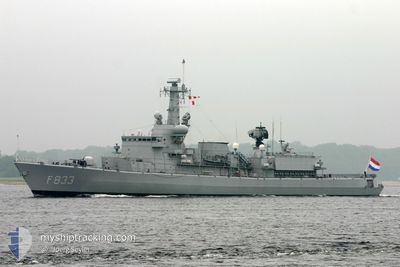
PRT WARSHIP F333
Military ops
Current Trip
Unknown
| Time Travelled | 14 h, 35 mins |
|---|---|
| Remaining Time | --- |
| Distance Travelled | 15.93 nm |
| Remaining Distance | --- |
| AVG Speed | 9.9 Knopen |
| MAX Speed | 16.1 Knopen |
| AVG Wind | 19.1 knots |
| MAX Wind | 22 knots |
| MIN Temp | 12.9°C / 55.22°F |
| MAX Temp | 14.5°C / 58.1°F |
| Diepgang | 6.1 M |
| Positie ontvangen | 12 h, 31 m geleden |
Current Position
| Lengtegraad | -9.37047° |
|---|---|
| Breedtegraat | 38.62318° |
| Status | Under way using engine |
| Snelheid | 11.5 Knopen |
| Koers | 226.3° |
| Gebied | North Atlantic Ocean |
| Station | T-AIS |
| Positie ontvangen | 12 h, 31 m geleden |
Info
Information
The current position of PRT WARSHIP F333 is in North Atlantic Ocean with coordinates 38.62318° / -9.37047° as reported on 2025-03-10 15:06 by AIS to our vessel tracker app. The vessel's current speed is 11.5 Knopen
The vessel PRT WARSHIP F333 (MMSI: 263020000) is a Military ops It's sailing under the flag of [PT] Portugal.
In this page you can find informations about the vessels current position, last detected port calls, and current voyage information. If the vessels is not in coverage by AIS you will find the latest position.
The current position of PRT WARSHIP F333 is detected by our AIS receivers and we are not responsible for the reliability of the data. The last position was recorded while the vessel was in Coverage by the Ais receivers of our vessel tracking app.
The current draught of PRT WARSHIP F333 as reported by AIS is 6.1 meters
Weather
| Temperature | 14.5°C / 58.1°F |
|---|---|
| Wind Speed | 22 knots |
| Direction | 245° WSW |
| Pressure | 997.3 hPa |
| Humidity | 83.1 % |
| Cloud Coverage | 100 % |
Featured Company
Last Port Calls
| Port | Arrival | Departure | Time In Port |
|---|---|---|---|
| 2025-03-07 16:59 | 2025-03-10 13:02 | 2 d | |
| 2025-02-25 17:35 | 2025-03-05 08:48 | 7 d | |
| 2025-02-12 11:54 | 2025-02-25 08:50 | 12 d | |
| 2025-02-07 19:08 |
Most Visited Ports (Last year)
| Port | Arrivals | |
|---|---|---|
| 12 | ||
| 2 | ||
| 1 | ||
| 1 | ||
| 1 |
Last Trips
| Origin | Departure | Destination | Arrival | Distance | |
|---|---|---|---|---|---|
| 2025-03-05 08:48 | 2025-03-07 16:59 | 104.23 nm | |||
| 2025-02-25 08:50 | 2025-02-25 17:35 | 45.51 nm | |||
| 2025-02-07 19:08 | 2025-02-12 11:54 | 36.74 nm |
Events
| Tijd | Evenement | Details | Positie / Bestemming | Info |
|---|---|---|---|---|
| 2025-03-10 15:06 | Buitenbereik |
38.62318 / -9.37047
North Atlantic Ocean
|
Snelheid: 11.5 kn Koers: 226.3° |
|
| 2025-03-10 13:51 | Start beweging | 0.57 nm, South East of LISBOA |
38.70060 / -9.11975
|
Snelheid: 3.4 kn Koers: 259° |
| 2025-03-10 13:33 | Stop beweging | 0.71 nm, South East of LISBOA |
38.70073 / -9.11612
|
Snelheid: 0.3 kn Koers: 262° |
| 2025-03-10 13:02 | Vertrekhaven |
|
38.67316 / -9.14144
|
Snelheid: 6.1 kn Koers: 44° |
| 2025-03-10 12:59 | Binnenbereik |
38.66987 / -9.14556
North Atlantic Ocean
[PT] COVA DA PIEDADE
|
Snelheid: 4.2 kn Koers: 51.7° |
|
| 2025-03-07 17:09 | Buitenbereik |
38.66934 / -9.14650
North Atlantic Ocean
[PT] COVA DA PIEDADE
|
Snelheid: 0.4 kn Koers: 230.9° |
|
| 2025-03-07 17:09 | Status Changed | Moored Under way using engine |
38.66936 / -9.14647
[PT] COVA DA PIEDADE
|
Snelheid: 0.4 kn Koers: 58° |
| 2025-03-07 17:00 | Stop beweging |
38.67181 / -9.14293
[PT] COVA DA PIEDADE
|
Snelheid: 0.3 kn Koers: 159° |
|
| 2025-03-07 16:59 | Aankomsthaven |
|
38.67209 / -9.14271
[PT] COVA DA PIEDADE
|
Snelheid: 1.5 kn Koers: 201° |
| 2025-03-07 15:08 | Binnenbereik |
38.64196 / -9.43401
North Atlantic Ocean
|
Snelheid: 9.7 kn Koers: 159.7° |