

RADCLIFFE R LATIMER
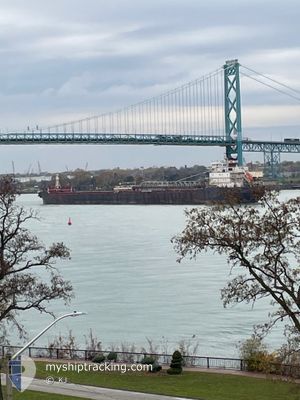
Self Discharging Bulk Carrier
Current Trip
| Time Travelled | 1 day |
|---|---|
| Remaining Time | --- |
| Distance Travelled | 254.44 nm |
| Remaining Distance | --- |
| AVG Speed | 11.8 Knopen |
| MAX Speed | 13.8 Knopen |
| AVG Wind | 15.1 knots |
| MAX Wind | 30 knots |
| MIN Temp | 2.6°C / 36.68°F |
| MAX Temp | 8.8°C / 47.84°F |
| Diepgang | 8.1 M |
| Positie ontvangen | 16 h, 49 m geleden |
Current Position
| Lengtegraad | -76.92683° |
|---|---|
| Breedtegraat | 43.79574° |
| Status | Under way using engine |
| Snelheid | 13.5 Knopen |
| Koers | 69.4° |
| Gebied | North Atlantic Ocean |
| Station | T-AIS |
| Positie ontvangen | 16 h, 49 m geleden |
Information
The current position of RADCLIFFE R LATIMER is in North Atlantic Ocean with coordinates 43.79574° / -76.92683° as reported on 2025-04-26 20:27 by AIS to our vessel tracker app. The vessel's current speed is 13.5 Knopen and is heading at the port of HALIFAX. The estimated time of arrival as calculated by MyShipTracking vessel tracking app is 2025-04-30 23:00 LT
The vessel RADCLIFFE R LATIMER (IMO: 7711725, MMSI: 316013980) is a Self Discharging Bulk Carrier that was built in 1978 ( 47 Jaar oud ). It's sailing under the flag of [CA] Canada.
In this page you can find informations about the vessels current position, last detected port calls, and current voyage information. If the vessels is not in coverage by AIS you will find the latest position.
The current position of RADCLIFFE R LATIMER is detected by our AIS receivers and we are not responsible for the reliability of the data. The last position was recorded while the vessel was in Coverage by the Ais receivers of our vessel tracking app.
The current draught of RADCLIFFE R LATIMER as reported by AIS is 8.1 meters
Weather
| Temperature | 2.8°C / 37.04°F |
|---|---|
| Wind Speed | 9 knots |
| Direction | 314° NW |
| Pressure | 1013.3 hPa |
| Humidity | 98 % |
| Cloud Coverage | 100 % |
Featured Company
Last Port Calls
| Port | Arrival | Departure | Time In Port |
|---|---|---|---|
| 2025-04-26 00:01 | 2025-04-26 08:27 | 8 h | |
| 2025-04-23 16:56 | 2025-04-23 17:51 | 55 m | |
| 2025-04-20 14:43 | 2025-04-22 18:45 | 2 d | |
| 2025-04-17 12:50 | |||
| 2025-04-13 08:05 | 2025-04-13 15:18 | 7 h | |
| 2025-04-11 19:01 | 2025-04-11 20:24 | 1 h | |
| 2025-04-07 13:17 | 2025-04-08 18:03 | 1 d | |
| 2025-04-06 06:37 | 2025-04-07 07:56 | 1 d | |
| 2025-03-28 10:27 | 2025-03-29 17:12 | 1 d |
Most Visited Ports (Last year)
| Port | Arrivals | |
|---|---|---|
| 20 | ||
| 17 | ||
| 16 | ||
| 12 | ||
| 6 | ||
| 5 |
Last Trips
| Origin | Departure | Destination | Arrival | Distance | |
|---|---|---|---|---|---|
| 2025-04-23 17:51 | 2025-04-26 00:01 | 526.49 nm | |||
| 2025-04-22 18:45 | 2025-04-23 16:56 | 232.12 nm | |||
| 2025-04-13 15:18 | 2025-04-17 12:50 | 536.67 nm | |||
| 2025-04-11 20:24 | 2025-04-13 08:05 | 297.02 nm | |||
| 2025-04-08 18:03 | 2025-04-11 19:01 | 410.49 nm | |||
| 2025-04-07 07:56 | 2025-04-07 13:17 | 4.74 nm | |||
| 2025-03-29 17:12 | 2025-04-06 06:37 | 797.03 nm |
Events
| Tijd | Evenement | Details | Positie / Bestemming | Info |
|---|---|---|---|---|
| 2025-04-27 10:06 | Start beweging | 2.98 nm, South West of CORNWALL |
44.98864 / -74.77025
HALIFAX
|
Snelheid: 5 kn Koers: 82° |
| 2025-04-27 09:30 | Stop beweging | 3.33 nm, South West of CORNWALL |
44.98763 / -74.77890
HALIFAX
|
Snelheid: 0.3 kn Koers: 81° |
| 2025-04-27 08:39 | Start beweging | 5.99 nm, West of CORNWALL |
44.98002 / -74.84239
HALIFAX
|
Snelheid: 5 kn Koers: 86° |
| 2025-04-27 08:06 | Stop beweging | 6.35 nm, West of CORNWALL |
44.97916 / -74.85092
HALIFAX
|
Snelheid: 0.2 kn Koers: 80° |
| 2025-04-26 20:37 | Status Changed | Default Under way using engine |
43.80936 / -76.87864
HALIFAX
|
Snelheid: 13.5 kn Koers: 69.4° |
| 2025-04-26 20:27 | Status Changed | Under way using engine Default |
43.79574 / -76.92683
HALIFAX
|
Snelheid: 13.5 kn Koers: 68° |
| 2025-04-26 20:27 | Buitenbereik |
43.79574 / -76.92683
North Atlantic Ocean
HALIFAX
|
Snelheid: 13.5 kn Koers: 69.4° |
|
| 2025-04-26 20:21 | Status Changed | Default Under way using engine |
43.78739 / -76.95665
HALIFAX
|
Snelheid: 13.5 kn Koers: 69.9° |
| 2025-04-26 19:08 | Status Changed | Under way using engine Default |
43.70130 / -77.31523
HALIFAX
|
Snelheid: 13.5 kn Koers: 74° |
| 2025-04-26 19:08 | Binnenbereik |
43.70130 / -77.31523
North Atlantic Ocean
HALIFAX
|
Snelheid: 13.4 kn Koers: 73.9° |