
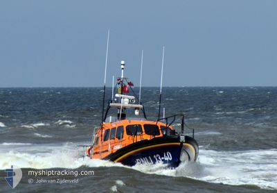
RNLI LIFEBOAT 13-40
Search and Rescue vessel
Current Trip
LOWESTOFT
| Time Travelled | 9 days |
|---|---|
| Remaining Time | --- |
| Distance Travelled | 12.40 nm |
| Remaining Distance | --- |
| AVG Speed | 19.8 Knopen |
| MAX Speed | 26.7 Knopen |
| AVG Wind | 13.6 knots |
| MAX Wind | 15.3 knots |
| MIN Temp | 3°C / 37.4°F |
| MAX Temp | 6.5°C / 43.7°F |
| Diepgang | 1 M |
| Positie ontvangen | 2 m geleden |
Current Position
| Lengtegraad | 1.75253° |
|---|---|
| Breedtegraat | 52.47013° |
| Status | Under way using engine |
| Snelheid | 4.1 Knopen |
| Koers | 263.3° |
| Gebied | North Sea |
| Station | T-AIS |
| Positie ontvangen | 2 m geleden |
Info
Information
The current position of RNLI LIFEBOAT 13-40 is in North Sea with coordinates 52.47013° / 1.75253° as reported on 2025-02-19 00:57 by AIS to our vessel tracker app. The vessel's current speed is 4.1 Knopen
The vessel RNLI LIFEBOAT 13-40 (MMSI: 232025977) is a Search and Rescue vessel It's sailing under the flag of [GB] United Kingdom.
In this page you can find informations about the vessels current position, last detected port calls, and current voyage information. If the vessels is not in coverage by AIS you will find the latest position.
The current position of RNLI LIFEBOAT 13-40 is detected by our AIS receivers and we are not responsible for the reliability of the data. The last position was recorded while the vessel was in Coverage by the Ais receivers of our vessel tracking app.
The current draught of RNLI LIFEBOAT 13-40 as reported by AIS is 1 meters
Weather
| Temperature | 3.6°C / 38.48°F |
|---|---|
| Wind Speed | 16 knots |
| Direction | 133° SE |
| Pressure | 1020.7 hPa |
| Humidity | 64.4 % |
| Cloud Coverage | 98 % |
Featured Company
Last Trips
Events
| Tijd | Evenement | Details | Positie / Bestemming | Info |
|---|---|---|---|---|
| 2025-02-19 00:55 | Binnenbereik |
52.47185 / 1.75604
North Sea
|
Snelheid: 8.3 kn Koers: 117.9° |
|
| 2025-02-16 11:18 | Buitenbereik |
52.44781 / 1.74555
North Sea
|
Snelheid: 22.5 kn Koers: 294.2° |
|
| 2025-02-16 11:02 | Start beweging | 2.17 nm, East of LOWESTOFT |
52.46078 / 1.79435
LOWESTOFT
|
Snelheid: 6.9 kn Koers: 272.7° |
| 2025-02-16 10:37 | Stop beweging | 2.3 nm, East of LOWESTOFT |
52.46137 / 1.79842
LOWESTOFT
|
Snelheid: 0.2 kn Koers: 511° |
| 2025-02-16 10:16 | Binnenbereik |
52.47017 / 1.76742
North Sea
|
Snelheid: 15.8 kn Koers: 82.6° |
|
| 2025-02-09 11:43 | Buitenbereik |
52.47185 / 1.75597
North Sea
|
Snelheid: 12.4 kn Koers: 300.7° |
|
| 2025-02-09 11:36 | Binnenbereik |
52.44873 / 1.77667
North Sea
|
Snelheid: 25.4 kn Koers: 0.7° |
|
| 2025-02-09 10:25 | Buitenbereik |
52.46288 / 1.75062
North Sea
|
Snelheid: 2.1 kn Koers: 92.3° |
|
| 2025-02-09 10:23 | Vertrekhaven |
|
52.46909 / 1.75900
LOWESTOFT
|
Snelheid: 1.9 kn Koers: 511° |
| 2025-02-09 10:19 | Binnenbereik |
52.47229 / 1.75429
North Sea
[GB] LOWESTOFT
|
Snelheid: 1.9 kn Koers: 124.6° |