
ROTTERDAM
Trailing Suction Hopper Dredger
Current Trip
| Time Travelled | 17 days |
|---|---|
| Remaining Time | 2 h, 18 mins |
| Distance Travelled | 2827.66 nm |
| Remaining Distance | 35.38 nm |
| AVG Speed | 10.1 Knopen |
| MAX Speed | 15.2 Knopen |
| AVG Wind | 9.5 knots |
| MAX Wind | 29 knots |
| MIN Temp | 18.9°C / 66.02°F |
| MAX Temp | 25.9°C / 78.62°F |
| Diepgang | 6.4 M |
| Positie ontvangen | 3 m geleden |
Current Position
| Lengtegraad | 54.64975° |
|---|---|
| Breedtegraat | 25.46098° |
| Status | Restricted manoeuverability |
| Snelheid | 1.9 Knopen |
| Koers | 30° |
| Gebied | Persian Gulf |
| Station | T-AIS |
| Positie ontvangen | 3 m geleden |
Info
Information
The current position of ROTTERDAM is in Persian Gulf with coordinates 25.46098° / 54.64975° as reported on 2026-01-03 18:31 by AIS to our vessel tracker app. The vessel's current speed is 1.9 Knopen and is heading at the port of DUBAI. The estimated time of arrival as calculated by MyShipTracking vessel tracking app is 2026-01-04 00:53 LT
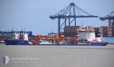
The vessel ROTTERDAM (IMO: 9229582, MMSI: 245450000) is a Trailing Suction Hopper Dredger that was built in 2001 ( 25 Jaar oud ). It's sailing under the flag of [NL] Netherlands.
In this page you can find informations about the vessels current position, last detected port calls, and current voyage information. If the vessels is not in coverage by AIS you will find the latest position.
The current position of ROTTERDAM is detected by our AIS receivers and we are not responsible for the reliability of the data. The last position was recorded while the vessel was in Coverage by the Ais receivers of our vessel tracking app.
The current draught of ROTTERDAM as reported by AIS is 6.4 meters
Weather
| Temperature | 23.2°C / 73.76°F |
|---|---|
| Wind Speed | 12 knots |
| Direction | 304° NW |
| Pressure | 1019.6 hPa |
| Humidity | 62.6 % |
| Cloud Coverage | 3 % |
Featured Company
Last Trips
| Origin | Departure | Destination | Arrival | Distance |
|---|
Events
| Tijd | Evenement | Details | Positie / Bestemming | Info |
|---|---|---|---|---|
| 2026-01-03 18:26 | Status Changed | Restricted manoeuverability Default |
25.45876 / 54.64821
AEDXB
|
Snelheid: 2 kn Koers: 39° |
| 2026-01-03 18:21 | Status Changed | Default Restricted manoeuverability |
25.45639 / 54.64588
AEDXB
|
Snelheid: 12.4 kn Koers: 300.4° |
| 2026-01-03 18:16 | Status Changed | Restricted manoeuverability Default |
25.44937 / 54.65653
AEDXB
|
Snelheid: 13.5 kn Koers: 300° |
| 2026-01-03 17:57 | Status Changed | Default Restricted manoeuverability |
25.41296 / 54.72555
AEDXB
|
Snelheid: 13.3 kn Koers: 300.1° |
| 2026-01-03 17:56 | Status Changed | Restricted manoeuverability Default |
25.41205 / 54.72726
AEDXB
|
Snelheid: 13.3 kn Koers: 301° |
| 2026-01-03 17:53 | Status Changed | Default Restricted manoeuverability |
25.40579 / 54.73902
AEDXB
|
Snelheid: 13.6 kn Koers: 300.2° |
| 2026-01-03 15:34 | Start beweging | 2.48 nm, West of JUMEIRAH |
25.19651 / 55.20197
AEDXB
|
Snelheid: 8.5 kn Koers: 285.6° |
| 2026-01-03 13:16 | Stop beweging | 2.36 nm, South West of JUMEIRAH |
25.19626 / 55.20432
AEDXB
|
Snelheid: 0.3 kn Koers: 209° |
| 2026-01-03 11:22 | Status Changed | Restricted manoeuverability Default |
25.37143 / 54.90635
AEDXB
|
Snelheid: 13.1 kn Koers: 109° |
| 2026-01-03 11:21 | Status Changed | Default Restricted manoeuverability |
25.37266 / 54.90254
AEDXB
|
Snelheid: 13.1 kn Koers: 109.5° |