

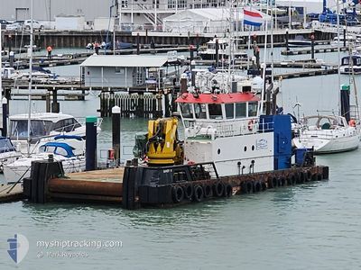
SANDY M
Utility Vessel

Current Trip
| Time Travelled | 4 h, 13 mins |
|---|---|
| Remaining Time | --- |
| Distance Travelled | 27.54 nm |
| Remaining Distance | --- |
| AVG Speed | 6.7 Knopen |
| MAX Speed | 7.7 Knopen |
| AVG Wind | 1.5 knots |
| MAX Wind | 2.1 knots |
| MIN Temp | 8.5°C / 47.3°F |
| MAX Temp | 9.7°C / 49.46°F |
| Diepgang | 2.3 M |
| Positie ontvangen | 15 m geleden |
Current Position
| Lengtegraad | -6.12214° |
|---|---|
| Breedtegraat | 57.56772° |
| Status | Under way using engine |
| Snelheid | 6.9 Knopen |
| Koers | 356.4° |
| Gebied | Inner Seas off the West Coast of Scotland |
| Station | T-AIS |
| Positie ontvangen | 15 m geleden |
Information
The current position of SANDY M is in Inner Seas off the West Coast of Scotland with coordinates 57.56772° / -6.12214° as reported on 2025-06-07 09:03 by AIS to our vessel tracker app. The vessel's current speed is 6.9 Knopen
The vessel SANDY M (IMO: 9640774, MMSI: 235090733) is a Utility Vessel that was built in 2012 ( 13 Jaar oud ). It's sailing under the flag of [GB] United Kingdom.
In this page you can find informations about the vessels current position, last detected port calls, and current voyage information. If the vessels is not in coverage by AIS you will find the latest position.
The current position of SANDY M is detected by our AIS receivers and we are not responsible for the reliability of the data. The last position was recorded while the vessel was in Coverage by the Ais receivers of our vessel tracking app.
The current draught of SANDY M as reported by AIS is 2.3 meters
Weather
| Temperature | 9.7°C / 49.46°F |
|---|---|
| Wind Speed | 1 knots |
| Direction | 307° NW |
| Pressure | 1003 hPa |
| Humidity | 67.6 % |
| Cloud Coverage | 99 % |


Featured Company
Last Port Calls
| Port | Arrival | Departure | Time In Port |
|---|---|---|---|
| 2025-06-06 15:48 | 2025-06-07 06:06 | 14 h | |
| 2025-06-02 11:40 | 2025-06-06 06:05 | 3 d | |
| 2025-05-30 22:13 | 2025-06-02 06:52 | 2 d | |
| 2025-05-28 09:10 | 2025-05-30 05:11 | 1 d | |
| 2025-05-28 08:01 | 2025-05-28 08:15 | 13 m | |
| 2025-05-28 06:46 | 2025-05-28 07:10 | 23 m | |
| 2025-05-27 14:13 | 2025-05-28 06:07 | 15 h | |
| 2025-05-27 13:20 | 2025-05-27 13:32 | 12 m | |
| 2025-05-27 09:11 | 2025-05-27 11:21 | 2 h | |
| 2025-05-27 08:06 | 2025-05-27 08:18 | 11 m |
Most Visited Ports (Last year)
| Port | Arrivals | |
|---|---|---|
| 251 | ||
| 21 | ||
| 19 | ||
| 12 | ||
| 1 | ||
| 1 |
Last Trips
| Origin | Departure | Destination | Arrival | Distance | |
|---|---|---|---|---|---|
| 2025-06-06 06:05 | 2025-06-06 15:48 | 64.25 nm | |||
| 2025-06-02 06:52 | 2025-06-02 11:40 | 32.58 nm | |||
| 2025-05-30 05:11 | 2025-05-30 22:13 | 120.45 nm | |||
| 2025-05-28 08:15 | 2025-05-28 09:10 | 5.72 nm | |||
| 2025-05-28 07:10 | 2025-05-28 08:01 | 3.94 nm | |||
| 2025-05-28 06:07 | 2025-05-28 06:46 | 5.63 nm | |||
| 2025-05-27 13:32 | 2025-05-27 14:13 | 5.42 nm | |||
| 2025-05-27 11:21 | 2025-05-27 13:20 | 9.08 nm | |||
| 2025-05-27 08:18 | 2025-05-27 09:11 | 5.95 nm | |||
| 2025-05-27 07:09 | 2025-05-27 08:06 | 3.70 nm |
Events
| Tijd | Evenement | Details | Positie / Bestemming | Info |
|---|---|---|---|---|
| 2025-06-07 09:05 | Status Changed | Default Under way using engine |
57.56998 / -6.12249
KYLE OF LOCHALSH
|
Snelheid: 6.9 kn Koers: 356.4° |
| 2025-06-07 09:03 | Status Changed | Under way using engine Default |
57.56772 / -6.12214
KYLE OF LOCHALSH
|
Snelheid: 6.8 kn Koers: 348° |
| 2025-06-07 08:57 | Binnenbereik |
57.56772 / -6.12214
Inner Seas off the West Coast of Scotland
|
Snelheid: 6.9 kn Koers: 356.4° |
|
| 2025-06-07 07:37 | Status Changed | Default Under way using engine |
57.40405 / -6.10114
KYLE OF LOCHALSH
|
Snelheid: 7.1 kn Koers: 356.7° |
| 2025-06-07 07:31 | Buitenbereik |
57.39298 / -6.09978
Inner Seas off the West Coast of Scotland
|
Snelheid: 7.1 kn Koers: 356.7° |
|
| 2025-06-07 05:06 | Vertrekhaven |
|
57.27762 / -5.72204
KYLE OF LOCHALSH
|
Snelheid: 5.7 kn Koers: 261° |
| 2025-06-07 05:04 | Start beweging |
57.27831 / -5.71712
[GB] KYLE OF LOCHALSH
|
Snelheid: 5.2 kn Koers: 251° |
|
| 2025-06-06 14:53 | Stop beweging |
57.27976 / -5.71445
[GB] KYLE OF LOCHALSH
|
Snelheid: Koers: 353° |
|
| 2025-06-06 14:48 | Aankomsthaven |
|
57.27839 / -5.71826
[GB] KYLE OF LOCHALSH
|
Snelheid: 6.5 kn Koers: 72° |
| 2025-06-06 11:21 | Status Changed | Under way using engine Default |
57.61796 / -5.88467
KYLE OF LOCHALSH
|
Snelheid: 6.8 kn Koers: 182° |