
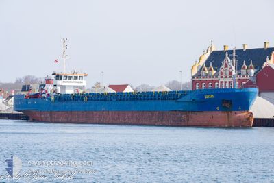
SARGAS
General Cargo
Current Trip
BARTYN
| Time Travelled | 20 h, 59 mins |
|---|---|
| Remaining Time | --- |
| Distance Travelled | 145.81 nm |
| Remaining Distance | --- |
| AVG Speed | 7.2 Knopen |
| MAX Speed | 8.3 Knopen |
| AVG Wind | 10.6 knots |
| MAX Wind | 19 knots |
| MIN Temp | 9.3°C / 48.74°F |
| MAX Temp | 17.6°C / 63.68°F |
| Diepgang | 3.1 M |
| Positie ontvangen | 23 m geleden |
Current Position
| Lengtegraad | 25.33333° |
|---|---|
| Breedtegraat | 38.92745° |
| Status | Under way using engine |
| Snelheid | 7.2 Knopen |
| Koers | 25.3° |
| Gebied | Aegean Sea |
| Station | T-AIS |
| Positie ontvangen | 23 m geleden |
Information
The current position of SARGAS is in Aegean Sea with coordinates 38.92745° / 25.33333° as reported on 2025-03-08 12:02 by AIS to our vessel tracker app. The vessel's current speed is 7.2 Knopen
The vessel SARGAS (IMO: 8104541, MMSI: 352002417) is a General Cargo that was built in 1981 ( 44 Jaar oud ). It's sailing under the flag of [PA] Panama.
In this page you can find informations about the vessels current position, last detected port calls, and current voyage information. If the vessels is not in coverage by AIS you will find the latest position.
The current position of SARGAS is detected by our AIS receivers and we are not responsible for the reliability of the data. The last position was recorded while the vessel was in Coverage by the Ais receivers of our vessel tracking app.
The current draught of SARGAS as reported by AIS is 3.1 meters
Weather
| Temperature | 13.3°C / 55.94°F |
|---|---|
| Wind Speed | 19 knots |
| Direction | 15° NNE |
| Pressure | 1013.6 hPa |
| Humidity | 61.5 % |
| Cloud Coverage | --- |
Featured Company
Last Trips
| Origin | Departure | Destination | Arrival | Distance | |
|---|---|---|---|---|---|
| 2025-03-05 12:09 | 2025-03-07 10:49 | 267.58 nm | |||
| 2025-02-18 18:45 | 2025-02-28 06:23 | 946.84 nm | |||
| 2025-01-24 18:45 | 2025-02-01 18:57 | 475.52 nm |
Events
| Tijd | Evenement | Details | Positie / Bestemming | Info |
|---|---|---|---|---|
| 2025-03-08 12:12 | Status Changed | Default Under way using engine |
38.94615 / 25.34505
BARTYN
|
Snelheid: 7.2 kn Koers: 25.3° |
| 2025-03-08 11:25 | Binnenbereik |
38.86246 / 25.29164
Aegean Sea
BARTYN
|
Snelheid: 7 kn Koers: 25.5° |
|
| 2025-03-08 09:55 | Status Changed | Default Under way using engine |
38.70446 / 25.19929
BARTYN
|
Snelheid: 6.8 kn Koers: 26.4° |
| 2025-03-08 09:47 | Status Changed | Under way using engine Default |
38.69113 / 25.19228
BARTYN
|
Snelheid: 7.3 kn Koers: 16° |
| 2025-03-08 09:47 | Buitenbereik |
38.69113 / 25.19228
Aegean Sea
BARTYN
|
Snelheid: 6.8 kn Koers: 26.4° |
|
| 2025-03-08 09:35 | Status Changed | Default Under way using engine |
38.66866 / 25.18410
BARTYN
|
Snelheid: 7 kn Koers: 17.7° |
| 2025-03-08 09:23 | Status Changed | Under way using engine Default |
38.64483 / 25.17443
BARTYN
|
Snelheid: 6.7 kn Koers: 26° |
| 2025-03-08 09:23 | Binnenbereik |
38.64483 / 25.17443
Aegean Sea
BARTYN
|
Snelheid: 7 kn Koers: 17.7° |
|
| 2025-03-08 08:57 | Status Changed | Default Under way using engine |
38.59904 / 25.15093
BARTYN
|
Snelheid: 6.6 kn Koers: 27.5° |
| 2025-03-08 08:23 | Buitenbereik |
38.54196 / 25.11544
Aegean Sea
BARTYN
|
Snelheid: 6.6 kn Koers: 27.5° |