
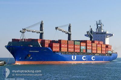
SC MONTREAL
Container Ship
Current Trip
PANAMA CANAL
| Time Travelled | 16 days |
|---|---|
| Remaining Time | --- |
| Distance Travelled | 6415.49 nm |
| Remaining Distance | --- |
| AVG Speed | 16.5 Knopen |
| MAX Speed | 19.7 Knopen |
| AVG Wind | 14.1 knots |
| MAX Wind | 34.9 knots |
| MIN Temp | 4.4°C / 39.92°F |
| MAX Temp | 26.6°C / 79.88°F |
| Diepgang | 10.8 M |
| Positie ontvangen | Nu |
Current Position
| Lengtegraad | -107.00003° |
|---|---|
| Breedtegraat | 20.20044° |
| Status | Under way using engine |
| Snelheid | 16.9 Knopen |
| Koers | 124.5° |
| Gebied | North Pacific Ocean |
| Station | T-AIS |
| Positie ontvangen | Nu |
Information
The current position of SC MONTREAL is in North Pacific Ocean with coordinates 20.20044° / -107.00003° as reported on 2025-06-08 22:03 by AIS to our vessel tracker app. The vessel's current speed is 16.9 Knopen
The vessel SC MONTREAL (IMO: 9311830, MMSI: 636018193) is a Container Ship that was built in 2004 ( 21 Jaar oud ). It's sailing under the flag of [LR] Liberia.
In this page you can find informations about the vessels current position, last detected port calls, and current voyage information. If the vessels is not in coverage by AIS you will find the latest position.
The current position of SC MONTREAL is detected by our AIS receivers and we are not responsible for the reliability of the data. The last position was recorded while the vessel was in Coverage by the Ais receivers of our vessel tracking app.
The current draught of SC MONTREAL as reported by AIS is 10.8 meters
Weather
| Temperature | 26.4°C / 79.52°F |
|---|---|
| Wind Speed | 7 knots |
| Direction | 235° SW |
| Pressure | 1009.4 hPa |
| Humidity | 73 % |
| Cloud Coverage | 16 % |
Featured Company
Last Port Calls
| Port | Arrival | Departure | Time In Port |
|---|---|---|---|
| 2025-05-23 03:14 | 2025-05-24 02:39 | 23 h | |
| 2025-04-22 05:09 | 2025-04-23 06:51 | 1 d | |
| 2025-04-10 03:44 | 2025-04-11 07:32 | 1 d | |
| 2025-04-07 10:42 | 2025-04-08 23:48 | 1 d | |
| 2025-04-03 13:11 | 2025-04-04 18:36 | 1 d |
Most Visited Ports (Last year)
| Port | Arrivals | |
|---|---|---|
| 12 | ||
| 12 | ||
| 11 | ||
| 11 | ||
| 1 |
Last Trips
| Origin | Departure | Destination | Arrival | Distance | |
|---|---|---|---|---|---|
| 2025-04-23 06:51 | 2025-05-23 03:14 | 6510.37 nm | |||
| 2025-04-11 07:32 | 2025-04-22 05:09 | 2311.38 nm | |||
| 2025-04-08 23:48 | 2025-04-10 03:44 | 475.64 nm | |||
| 2025-04-04 18:36 | 2025-04-07 10:42 | 437.46 nm | |||
| 2025-03-26 17:23 | 2025-04-03 13:11 | 2642.44 nm |
Events
| Tijd | Evenement | Details | Positie / Bestemming | Info |
|---|---|---|---|---|
| 2025-06-08 21:39 | Destination Changed | PANAMA CANAL PABLB |
20.26505 / -107.10010
PANAMA CANAL
|
Snelheid: 17.2 kn Koers: 122.6° |
| 2025-06-08 21:36 | Status Changed | Under way using engine Default |
20.27331 / -107.11367
PABLB
|
Snelheid: 16.9 kn Koers: 122° |
| 2025-06-08 21:20 | Binnenbereik |
20.27331 / -107.11367
North Pacific Ocean
PABLB
|
Snelheid: 17 kn Koers: 123.2° |
|
| 2025-06-08 13:06 | Status Changed | Default Under way using engine |
21.57738 / -109.30361
PABLB
|
Snelheid: 17.5 kn Koers: 126.2° |
| 2025-06-08 13:04 | Buitenbereik |
21.58582 / -109.31580
North Pacific Ocean
PABLB
|
Snelheid: 17.5 kn Koers: 126.2° |
|
| 2025-06-08 12:48 | Wijzig zee gebeid | Mexican part of the North Pacific Ocean Japanese part of the North Pacific Ocean |
21.63067 / -109.38343
North Pacific Ocean
PABLB
|
Snelheid: 17.5 kn Koers: 124° |
| 2025-06-08 12:48 | Status Changed | Under way using engine Default |
21.63067 / -109.38343
PABLB
|
Snelheid: 17.3 kn Koers: 124° |
| 2025-06-08 12:28 | Binnenbereik |
21.63067 / -109.38343
North Pacific Ocean
PABLB
|
Snelheid: 17.5 kn Koers: 124° |