
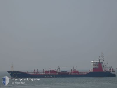
SCOT BERLIN
Oil/Chemical Tanker
Current Trip
BRFOR
| Time Travelled | 5 days |
|---|---|
| Remaining Time | --- |
| Distance Travelled | 1379.10 nm |
| Remaining Distance | --- |
| AVG Speed | 10.6 Knopen |
| MAX Speed | 12.1 Knopen |
| AVG Wind | 15.7 knots |
| MAX Wind | 20 knots |
| MIN Temp | 21.6°C / 70.88°F |
| MAX Temp | 28°C / 82.4°F |
| Diepgang | 6.3 M |
| Positie ontvangen | 5 d geleden |
Current Position
| Lengtegraad | -38.42643° |
|---|---|
| Breedtegraat | -3.51504° |
| Status | Under way using engine |
| Snelheid | 11.1 Knopen |
| Koers | 28.9° |
| Gebied | South Atlantic Ocean |
| Station | T-AIS |
| Positie ontvangen | 5 d geleden |
Info
Information
The current position of SCOT BERLIN is in South Atlantic Ocean with coordinates -3.51504° / -38.42643° as reported on 2025-02-03 12:10 by AIS to our vessel tracker app. The vessel's current speed is 11.1 Knopen
The vessel SCOT BERLIN (IMO: 9255804, MMSI: 249085000) is a Oil/Chemical Tanker that was built in 2003 ( 22 Jaar oud ). It's sailing under the flag of [MT] Malta.
In this page you can find informations about the vessels current position, last detected port calls, and current voyage information. If the vessels is not in coverage by AIS you will find the latest position.
The current position of SCOT BERLIN is detected by our AIS receivers and we are not responsible for the reliability of the data. The last position was recorded while the vessel was in Coverage by the Ais receivers of our vessel tracking app.
The current draught of SCOT BERLIN as reported by AIS is 6.3 meters
Weather
| Temperature | 21.6°C / 70.88°F |
|---|---|
| Wind Speed | 19 knots |
| Direction | 60° ENE |
| Pressure | 1016.4 hPa |
| Humidity | 65.9 % |
| Cloud Coverage | 32 % |
Featured Company
Last Trips
Events
| Tijd | Evenement | Details | Positie / Bestemming | Info |
|---|---|---|---|---|
| 2025-02-03 12:17 | Status Changed | Default Under way using engine |
-3.49694 / -38.41597
BRFOR
|
Snelheid: 11.1 kn Koers: 28.9° |
| 2025-02-03 12:10 | Buitenbereik |
-3.51504 / -38.42643
South Atlantic Ocean
|
Snelheid: 11.1 kn Koers: 28.9° |
|
| 2025-02-03 11:01 | Vertrekhaven |
|
-3.69680 / -38.48938
BRFOR
|
Snelheid: 5.9 kn Koers: 324° |
| 2025-02-03 10:43 | Binnenbereik |
-3.70829 / -38.47550
South Atlantic Ocean
[BR] FORTALEZA
|
Snelheid: 1.9 kn Koers: 201.1° |
|
| 2025-01-31 00:02 | Status Changed | Default Under way using engine |
-3.70818 / -38.47391
[BR] FORTALEZA
|
Snelheid: 1.6 kn Koers: 29° |
| 2025-01-30 23:48 | Buitenbereik |
-3.70891 / -38.47483
South Atlantic Ocean
[BR] FORTALEZA
|
Snelheid: 1.6 kn Koers: 118.1° |
|
| 2025-01-30 23:25 | Aankomsthaven |
|
-3.69974 / -38.48709
[BR] FORTALEZA
|
Snelheid: 6 kn Koers: 180.7° |
| 2025-01-30 22:13 | Start beweging | 6.25 nm, North East of FORTALEZA |
-3.65133 / -38.41752
BRFOR
|
Snelheid: 3.1 kn Koers: 221° |
| 2025-01-30 22:11 | Status Changed | Under way using engine Default |
-3.65023 / -38.41788
BRFOR
|
Snelheid: 0.5 kn Koers: 97° |
| 2025-01-30 22:11 | Binnenbereik |
-3.65024 / -38.41781
South Atlantic Ocean
|
Snelheid: 0.8 kn Koers: 116.4° |