
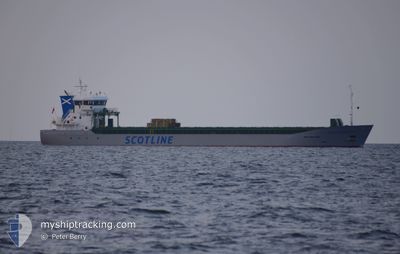
SCOT LEADER
Cargo
Current Trip
| Time Travelled | 14 h, 55 mins |
|---|---|
| Remaining Time | --- |
| Distance Travelled | 108.01 nm |
| Remaining Distance | --- |
| AVG Speed | 10.1 Knopen |
| MAX Speed | 11.5 Knopen |
| AVG Wind | 19.6 knots |
| MAX Wind | 35 knots |
| MIN Temp | 4.4°C / 39.92°F |
| MAX Temp | 7.8°C / 46.04°F |
| Diepgang | 3.9 M |
| Positie ontvangen | 3 h, 59 m geleden |
Current Position
| Lengtegraad | -6.03447° |
|---|---|
| Breedtegraat | 53.98676° |
| Status | Under way using engine |
| Snelheid | 1.1 Knopen |
| Koers | 354° |
| Gebied | Irish Sea and St. George's Channel |
| Station | T-AIS |
| Positie ontvangen | 3 h, 59 m geleden |
Info
Information
The current position of SCOT LEADER is in Irish Sea and St. George's Channel with coordinates 53.98676° / -6.03447° as reported on 2025-02-05 01:51 by AIS to our vessel tracker app. The vessel's current speed is 1.1 Knopen
The vessel SCOT LEADER (IMO: 9963267, MMSI: 232054955) is a Cargo It's sailing under the flag of [GB] United Kingdom.
In this page you can find informations about the vessels current position, last detected port calls, and current voyage information. If the vessels is not in coverage by AIS you will find the latest position.
The current position of SCOT LEADER is detected by our AIS receivers and we are not responsible for the reliability of the data. The last position was recorded while the vessel was in Coverage by the Ais receivers of our vessel tracking app.
The current draught of SCOT LEADER as reported by AIS is 3.9 meters
Weather
| Temperature | 4.3°C / 39.74°F |
|---|---|
| Wind Speed | 12 knots |
| Direction | 254° WSW |
| Pressure | 1029.9 hPa |
| Humidity | 84.7 % |
| Cloud Coverage | 20 % |
Featured Company
Last Port Calls
| Port | Arrival | Departure | Time In Port |
|---|---|---|---|
| 2025-01-30 11:00 | 2025-02-04 14:55 | 5 d | |
| 2025-01-21 12:23 | 2025-01-24 09:40 | 2 d | |
| 2025-01-05 12:42 | 2025-01-08 00:38 | 2 d | |
| 2024-12-30 10:54 | 2025-01-03 13:08 | 4 d | |
| 2024-12-25 19:32 | 2024-12-27 18:34 | 1 d | |
| 2024-12-19 15:38 | 2024-12-23 23:36 | 4 d | |
| 2024-12-14 23:39 | 2024-12-16 18:48 | 1 d | |
| 2024-12-05 14:15 | 2024-12-06 15:34 | 1 d | |
| 2024-12-01 06:39 | 2024-12-03 00:20 | 1 d |
Last Trips
| Origin | Departure | Destination | Arrival | Distance | |
|---|---|---|---|---|---|
| 2025-01-24 09:40 | 2025-01-30 11:00 | 932.42 nm | |||
| 2025-01-08 01:38 | 2025-01-21 12:23 | 2368.16 nm | |||
| 2025-01-03 13:08 | 2025-01-05 13:42 | 371.83 nm | |||
| 2024-12-27 19:34 | 2024-12-30 10:54 | 555.95 nm | |||
| 2024-12-23 23:36 | 2024-12-25 20:32 | 530.21 nm | |||
| 2024-12-16 19:48 | 2024-12-19 15:38 | 607.11 nm | |||
| 2024-12-06 15:34 | 2024-12-15 00:39 | 1194.49 nm | |||
| 2024-12-03 01:20 | 2024-12-05 14:15 | 556.09 nm | |||
| 2024-11-21 19:20 | 2024-12-01 07:39 | 1403.81 nm |
Events
| Tijd | Evenement | Details | Positie / Bestemming | Info |
|---|---|---|---|---|
| 2025-02-05 01:58 | Status Changed | Default Under way using engine |
53.98813 / -6.03308
GBWPT
|
Snelheid: 1.1 kn Koers: 354° |
| 2025-02-05 01:58 | Stop beweging | 3.86 nm, South East of GREENCASTLE |
53.98813 / -6.03308
GBWPT
|
Snelheid: 0.3 kn Koers: 227° |
| 2025-02-05 01:51 | Buitenbereik |
53.98676 / -6.03447
Irish Sea and St. George's Channel
GBWPT
|
Snelheid: 1.1 kn Koers: 71° |
|
| 2025-02-05 01:24 | Status Changed | Under way using engine Default |
54.00570 / -5.97479
GBWPT
|
Snelheid: 10 kn Koers: 240° |
| 2025-02-05 01:15 | Status Changed | Default Under way using engine |
54.01963 / -5.93920
GBWPT
|
Snelheid: 10 kn Koers: 225.6° |
| 2025-02-05 01:10 | Status Changed | Under way using engine Default |
54.02898 / -5.92148
GBWPT
|
Snelheid: 10.1 kn Koers: 228° |
| 2025-02-05 01:03 | Status Changed | Default Under way using engine |
54.04207 / -5.89720
GBWPT
|
Snelheid: 10.2 kn Koers: 227.7° |
| 2025-02-05 00:58 | Status Changed | Under way using engine Default |
54.05204 / -5.87833
GBWPT
|
Snelheid: 10.2 kn Koers: 228° |
| 2025-02-05 00:51 | Status Changed | Default Under way using engine |
54.06515 / -5.85374
GBWPT
|
Snelheid: 10.2 kn Koers: 227.2° |
| 2025-02-05 00:32 | Status Changed | Under way using engine Default |
54.10233 / -5.78627
GBWPT
|
Snelheid: 10.6 kn Koers: 226° |