

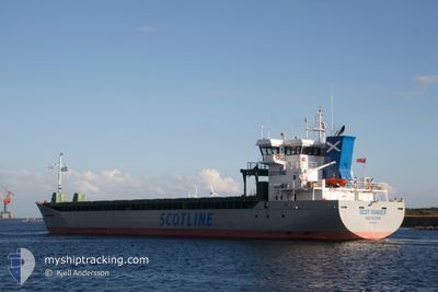
SCOT RANGER
Cargo

Current Trip
| Time Travelled | 2 days |
|---|---|
| Remaining Time | 1 day |
| Distance Travelled | 197.77 nm |
| Remaining Distance | 478.68 nm |
| AVG Speed | 9.8 Knopen |
| MAX Speed | 14.8 Knopen |
| AVG Wind | 11.1 knots |
| MAX Wind | 19.1 knots |
| MIN Temp | 11°C / 51.8°F |
| MAX Temp | 18.2°C / 64.76°F |
| Diepgang | 4.1 M |
| Positie ontvangen | 14 h, 27 m geleden |
Current Position
| Lengtegraad | 2.20299° |
|---|---|
| Breedtegraat | 52.54715° |
| Status | Under way using engine |
| Snelheid | 10.4 Knopen |
| Koers | 21.6° |
| Gebied | North Sea |
| Station | T-AIS |
| Positie ontvangen | 14 h, 27 m geleden |
Information
The current position of SCOT RANGER is in North Sea with coordinates 52.54715° / 2.20299° as reported on 2025-06-09 20:15 by AIS to our vessel tracker app. The vessel's current speed is 10.4 Knopen and is heading at the port of VARBERG. The estimated time of arrival as calculated by MyShipTracking vessel tracking app is 2025-06-11 20:20 LT
The vessel SCOT RANGER (IMO: 9851220, MMSI: 232031538) is a Cargo It's sailing under the flag of [GB] United Kingdom.
In this page you can find informations about the vessels current position, last detected port calls, and current voyage information. If the vessels is not in coverage by AIS you will find the latest position.
The current position of SCOT RANGER is detected by our AIS receivers and we are not responsible for the reliability of the data. The last position was recorded while the vessel was in Coverage by the Ais receivers of our vessel tracking app.
The current draught of SCOT RANGER as reported by AIS is 4.1 meters
Weather
| Temperature | 12.8°C / 55.04°F |
|---|---|
| Wind Speed | 19 knots |
| Direction | 260° W |
| Pressure | 1006 hPa |
| Humidity | 95.7 % |
| Cloud Coverage | 100 % |


Featured Company
Last Port Calls
| Port | Arrival | Departure | Time In Port |
|---|---|---|---|
| 2025-06-05 11:03 | 2025-06-07 15:21 | 2 d | |
| 2025-05-31 17:07 | 2025-06-02 19:19 | 2 d | |
| 2025-05-26 20:03 | 2025-05-30 12:40 | 3 d | |
| 2025-05-21 18:56 | 2025-05-23 21:39 | 2 d | |
| 2025-05-17 22:27 | 2025-05-20 14:12 | 2 d | |
| 2025-05-13 21:36 | 2025-05-15 14:54 | 1 d | |
| 2025-05-10 23:53 | 2025-05-11 22:40 | 22 h | |
| 2025-05-09 07:08 | 2025-05-10 13:48 | 1 d | |
| 2025-05-07 21:55 | 2025-05-08 21:38 | 23 h | |
| 2025-04-25 13:36 | 2025-04-25 13:39 | 3 m |
Most Visited Ports (Last year)
| Port | Arrivals | |
|---|---|---|
| 14 | ||
| 11 | ||
| 6 | ||
| 3 | ||
| 3 | ||
| 2 |
Last Trips
| Origin | Departure | Destination | Arrival | Distance | |
|---|---|---|---|---|---|
| 2025-06-02 19:19 | 2025-06-05 11:03 | 620.19 nm | |||
| 2025-05-30 12:40 | 2025-05-31 17:07 | 108.89 nm | |||
| 2025-05-23 21:39 | 2025-05-26 20:03 | 705.98 nm | |||
| 2025-05-20 14:12 | 2025-05-21 18:56 | 83.73 nm | |||
| 2025-05-15 14:54 | 2025-05-17 22:27 | 613.93 nm | |||
| 2025-05-11 22:40 | 2025-05-13 21:36 | 555.42 nm | |||
| 2025-05-10 13:48 | 2025-05-10 23:53 | 104.23 nm | |||
| 2025-05-08 21:38 | 2025-05-09 07:08 | 105.60 nm | |||
| 2025-04-25 13:39 | 2025-05-07 21:55 | 2101.07 nm | |||
| 2025-04-22 11:37 | 2025-04-25 13:36 | 427.18 nm |
Events
| Tijd | Evenement | Details | Positie / Bestemming | Info |
|---|---|---|---|---|
| 2025-06-09 20:23 | Status Changed | Default Under way using engine |
52.56799 / 2.21658
SEVAG
|
Snelheid: 10.4 kn Koers: 21.6° |
| 2025-06-09 20:15 | Buitenbereik |
52.54715 / 2.20299
North Sea
SEVAG
|
Snelheid: 10.4 kn Koers: 21.6° |
|
| 2025-06-09 19:55 | Status Changed | Under way using engine Default |
52.49244 / 2.16838
SEVAG
|
Snelheid: 10.4 kn Koers: 18° |
| 2025-06-09 19:07 | Status Changed | Default Under way using engine |
52.36175 / 2.09402
SEVAG
|
Snelheid: 10.5 kn Koers: 18.8° |
| 2025-06-09 18:55 | Status Changed | Under way using engine Default |
52.33071 / 2.07676
SEVAG
|
Snelheid: 10.5 kn Koers: 19° |
| 2025-06-09 18:11 | Status Changed | Default Under way using engine |
52.20478 / 2.00554
SEVAG
|
Snelheid: 10.9 kn Koers: 19.7° |
| 2025-06-09 14:45 | Draught Changed | 4.1 3.8 |
51.72011 / 1.39008
SEVAG
|
Snelheid: 13.5 kn Koers: 44.5° |
| 2025-06-09 13:14 | ETA Changed | 2025/06/11 20:00 2025/06/07 20:00 |
51.50161 / .94183
SEVAG
|
Snelheid: 14.5 kn Koers: 55.8° |
| 2025-06-09 13:12 | Destination Changed | SEVAG MOUSE ANCH |
51.49777 / .93275
SEVAG
|
Snelheid: 14.4 kn Koers: 55.9° |
| 2025-06-09 11:06 | Start beweging | 0.9 nm, East of STROOD |
51.38603 / .51749
MOUSE ANCH
|
Snelheid: 5.2 kn Koers: 107.4° |