
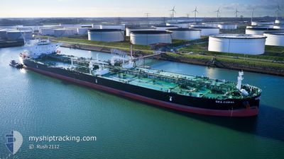
SEA CORAL
Tanker
Current Trip
AO GIR
| Time Travelled | 5 days |
|---|---|
| Remaining Time | --- |
| Distance Travelled | 44.95 nm |
| Remaining Distance | --- |
| AVG Speed | 8.3 Knopen |
| MAX Speed | 13 Knopen |
| AVG Wind | 8.2 knots |
| MAX Wind | 13 knots |
| MIN Temp | 24.6°C / 76.28°F |
| MAX Temp | 29.5°C / 85.1°F |
| Diepgang | 9.5 M |
| Positie ontvangen | 10 d geleden |
Current Position
| Lengtegraad | -21.17865° |
|---|---|
| Breedtegraat | -12.60578° |
| Status | Under way using engine |
| Snelheid | 13 Knopen |
| Koers | 266° |
| Gebied | South Atlantic Ocean |
| Station | T-AIS |
| Positie ontvangen | 10 d geleden |
Info
Information
The current position of SEA CORAL is in South Atlantic Ocean with coordinates -12.60578° / -21.17865° as reported on 2025-01-29 14:37 by AIS to our vessel tracker app. The vessel's current speed is 13 Knopen
The vessel SEA CORAL (IMO: 9935650, MMSI: 636021874) is a Tanker It's sailing under the flag of [LR] Liberia.
In this page you can find informations about the vessels current position, last detected port calls, and current voyage information. If the vessels is not in coverage by AIS you will find the latest position.
The current position of SEA CORAL is detected by our AIS receivers and we are not responsible for the reliability of the data. The last position was recorded while the vessel was in Coverage by the Ais receivers of our vessel tracking app.
The current draught of SEA CORAL as reported by AIS is 9.5 meters
Weather
| Temperature | 26.3°C / 79.34°F |
|---|---|
| Wind Speed | 4 knots |
| Direction | 185° S |
| Pressure | 1014 hPa |
| Humidity | 75 % |
| Cloud Coverage | 100 % |
Featured Company
Last Port Calls
| Port | Arrival | Departure | Time In Port |
|---|---|---|---|
| 2025-02-02 05:54 | 2025-02-04 06:34 | 2 d | |
| 2025-01-01 09:16 | 2025-01-03 12:56 | 2 d |
Most Visited Ports (Last year)
| Port | Arrivals | |
|---|---|---|
| 4 | ||
| 3 | ||
| 1 | ||
| 1 | ||
| 1 | ||
| 1 |
Last Trips
| Origin | Departure | Destination | Arrival | Distance | |
|---|---|---|---|---|---|
| 2025-01-03 12:56 | 2025-02-02 05:54 | 5042.84 nm | |||
| 2024-11-21 23:43 | 2025-01-01 09:16 | 6445.49 nm |
Events
| Tijd | Evenement | Details | Positie / Bestemming | Info |
|---|---|---|---|---|
| 2025-02-06 21:58 | Start beweging | 3.31 nm, West of SALVADOR |
-12.95451 / -38.56911
AO GIR
|
Snelheid: 4.4 kn Koers: 170° |
| 2025-02-06 20:54 | Stop beweging | 3.48 nm, West of SALVADOR |
-12.94776 / -38.56994
AO GIR
|
Snelheid: 0.2 kn Koers: 156° |
| 2025-02-04 12:26 | Stop beweging | 9.18 nm, South West of SALVADOR |
-13.06979 / -38.63141
AO GIR
|
Snelheid: 0.1 kn Koers: 80° |
| 2025-02-04 09:34 | Start beweging | 0.53 nm, South East of MADRE DE DEUS |
-12.75721 / -38.61404
AO GIR
|
Snelheid: 7 kn Koers: 95° |
| 2025-02-04 09:34 | Vertrekhaven |
|
-12.75721 / -38.61404
AO GIR
|
Snelheid: 0.8 kn Koers: 98° |
| 2025-02-02 08:54 | Stop beweging |
-12.75538 / -38.61980
[BR] MADRE DE DEUS
|
Snelheid: 0.2 kn Koers: 86° |
|
| 2025-02-02 08:54 | Aankomsthaven |
|
-12.75538 / -38.61980
[BR] MADRE DE DEUS
|
Snelheid: 1 kn Koers: 83° |