

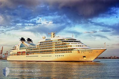
SEABOURN SOJOURN
Passengers Ship

Current Trip
| Time Travelled | 4 days |
|---|---|
| Remaining Time | --- |
| Distance Travelled | 808.08 nm |
| Remaining Distance | --- |
| AVG Speed | 11.6 Knopen |
| MAX Speed | 20.3 Knopen |
| AVG Wind | 8.4 knots |
| MAX Wind | 21 knots |
| MIN Temp | 5.3°C / 41.54°F |
| MAX Temp | 14.5°C / 58.1°F |
| Diepgang | 6.6 M |
| Positie ontvangen | 1 m geleden |
Current Position
| Lengtegraad | -2.01475° |
|---|---|
| Breedtegraat | 56.01091° |
| Status | Under way using engine |
| Snelheid | 13.6 Knopen |
| Koers | 132.5° |
| Gebied | North Sea |
| Station | T-AIS |
| Positie ontvangen | 1 m geleden |
Information
The current position of SEABOURN SOJOURN is in North Sea with coordinates 56.01091° / -2.01475° as reported on 2025-06-11 23:00 by AIS to our vessel tracker app. The vessel's current speed is 13.6 Knopen
The vessel SEABOURN SOJOURN (IMO: 9417098, MMSI: 311027100) is a Passengers Ship that was built in 2010 ( 15 Jaar oud ). It's sailing under the flag of [BS] Bahamas.
In this page you can find informations about the vessels current position, last detected port calls, and current voyage information. If the vessels is not in coverage by AIS you will find the latest position.
The current position of SEABOURN SOJOURN is detected by our AIS receivers and we are not responsible for the reliability of the data. The last position was recorded while the vessel was in Coverage by the Ais receivers of our vessel tracking app.
The current draught of SEABOURN SOJOURN as reported by AIS is 6.6 meters
Weather
| Temperature | 12.8°C / 55.04°F |
|---|---|
| Wind Speed | 19 knots |
| Direction | 149° SSE |
| Pressure | 1016.9 hPa |
| Humidity | 88.7 % |
| Cloud Coverage | 5 % |


Featured Company
Last Port Calls
| Port | Arrival | Departure | Time In Port |
|---|---|---|---|
| 2025-06-06 07:16 | 2025-06-07 00:24 | 17 h | |
| 2025-06-03 07:31 | 2025-06-03 18:27 | 10 h | |
| 2025-06-03 06:48 | 2025-06-03 06:56 | 7 m | |
| 2025-06-01 04:50 | 2025-06-01 19:15 | 14 h | |
| 2025-05-31 05:26 | 2025-05-31 17:15 | 11 h | |
| 2025-05-30 06:59 | 2025-05-30 18:46 | 11 h | |
| 2025-05-27 07:39 | 2025-05-27 17:12 | 9 h | |
| 2025-05-25 06:00 | 2025-05-26 20:04 | 1 d | |
| 2025-05-23 07:24 | 2025-05-23 18:32 | 11 h | |
| 2025-05-22 07:13 | 2025-05-22 16:25 | 9 h |
Last Trips
| Origin | Departure | Destination | Arrival | Distance | |
|---|---|---|---|---|---|
| 2025-06-03 18:27 | 2025-06-06 07:16 | 369.17 nm | |||
| 2025-06-03 06:56 | 2025-06-03 07:31 | 2.30 nm | |||
| 2025-06-01 19:15 | 2025-06-03 06:48 | 303.88 nm | |||
| 2025-05-31 17:15 | 2025-06-01 04:50 | 163.66 nm | |||
| 2025-05-30 18:46 | 2025-05-31 05:26 | 143.93 nm | |||
| 2025-05-27 17:12 | 2025-05-30 06:59 | 536.62 nm | |||
| 2025-05-26 20:04 | 2025-05-27 07:39 | 94.84 nm | |||
| 2025-05-23 18:32 | 2025-05-25 06:00 | 406.62 nm | |||
| 2025-05-22 16:25 | 2025-05-23 07:24 | 213.49 nm | |||
| 2025-05-21 17:37 | 2025-05-22 07:13 | 190.80 nm |
Events
| Tijd | Evenement | Details | Positie / Bestemming | Info |
|---|---|---|---|---|
| 2025-06-11 22:19 | Binnenbereik |
56.10328 / -2.23507
North Sea
GBNCL
|
Snelheid: 14.1 kn Koers: 89.5° |
|
| 2025-06-11 20:46 | Buitenbereik |
56.08784 / -2.88383
North Sea
GBNCL
|
Snelheid: 14.7 kn Koers: 62° |
|
| 2025-06-11 19:50 | Start beweging | 1.3 nm, North of LEITH |
56.00665 / -3.18400
GBNCL
|
Snelheid: 4.3 kn Koers: 72° |
| 2025-06-11 19:46 | Status Changed | Under way using engine At anchor |
56.00607 / -3.18729
GBNCL
|
Snelheid: 0.4 kn Koers: 46° |
| 2025-06-11 19:41 | Status Changed | At anchor Default |
56.00554 / -3.18845
GBNCL
|
Snelheid: 0.2 kn Koers: 23° |
| 2025-06-11 19:23 | Status Changed | Default At anchor |
56.00544 / -3.18788
GBNCL
|
Snelheid: 0.2 kn Koers: 40° |
| 2025-06-11 18:12 | ETA Changed | 2025/06/12 07:00 2025/06/11 05:30 |
56.00585 / -3.18865
GBNCL
|
Snelheid: Koers: 338° |
| 2025-06-11 17:59 | Destination Changed | GBNCL GBNHV |
56.00571 / -3.18858
GBNCL
|
Snelheid: Koers: 328° |
| 2025-06-11 17:41 | Status Changed | At anchor Default |
56.00590 / -3.18857
GBNHV
|
Snelheid: Koers: 329° |
| 2025-06-11 17:32 | Status Changed | Default At anchor |
56.00586 / -3.18862
GBNHV
|
Snelheid: Koers: 332° |