

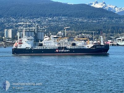
SEASPAN LIONS
Tanker
Current Trip
| Time Travelled | 3 h, 42 mins |
|---|---|
| Remaining Time | 3 days |
| Distance Travelled | 42.10 nm |
| Remaining Distance | 1158.17 nm |
| AVG Speed | 11.7 Knopen |
| MAX Speed | 14.3 Knopen |
| AVG Wind | 10.9 knots |
| MAX Wind | 17.3 knots |
| MIN Temp | 8.8°C / 47.84°F |
| MAX Temp | 11.4°C / 52.52°F |
| Diepgang | 5.6 M |
| Positie ontvangen | Nu |
Current Position
| Lengtegraad | -123.14701° |
|---|---|
| Breedtegraat | 48.73453° |
| Status | Under way using engine |
| Snelheid | 13.1 Knopen |
| Koers | 240.3° |
| Gebied | The Coastal Waters of Southeast Alaska and British Columbia |
| Station | T-AIS |
| Positie ontvangen | Nu |
Information
The current position of SEASPAN LIONS is in The Coastal Waters of Southeast Alaska and British Columbia with coordinates 48.73453° / -123.14701° as reported on 2025-04-26 17:17 by AIS to our vessel tracker app. The vessel's current speed is 13.1 Knopen and is heading at the port of LOS ANGELES. The estimated time of arrival as calculated by MyShipTracking vessel tracking app is 2025-04-30 09:50 LT
The vessel SEASPAN LIONS (IMO: 9974321, MMSI: 352004315) is a Tanker It's sailing under the flag of [PA] Panama.
In this page you can find informations about the vessels current position, last detected port calls, and current voyage information. If the vessels is not in coverage by AIS you will find the latest position.
The current position of SEASPAN LIONS is detected by our AIS receivers and we are not responsible for the reliability of the data. The last position was recorded while the vessel was in Coverage by the Ais receivers of our vessel tracking app.
The current draught of SEASPAN LIONS as reported by AIS is 5.6 meters
Weather
| Temperature | 10.8°C / 51.44°F |
|---|---|
| Wind Speed | 7 knots |
| Direction | 80° E |
| Pressure | 1011.2 hPa |
| Humidity | 81.8 % |
| Cloud Coverage | 52 % |
Featured Company
Last Port Calls
| Port | Arrival | Departure | Time In Port |
|---|---|---|---|
| 2025-04-20 21:15 | 2025-04-26 06:36 | 5 d | |
| 2025-04-17 06:11 | 2025-04-19 18:02 | 2 d | |
| 2025-04-08 06:49 | 2025-04-12 07:32 | 4 d | |
| 2025-03-30 09:02 | 2025-03-31 12:05 | 1 d | |
| 2025-03-16 15:34 | 2025-03-17 07:58 | 16 h | |
| 2025-03-03 11:12 | 2025-03-04 13:14 | 1 d | |
| 2025-02-11 09:44 | 2025-02-17 10:40 | 6 d | |
| 2025-02-09 21:53 | 2025-02-09 22:36 | 43 m | |
| 2025-02-07 09:55 | 2025-02-08 12:34 | 1 d | |
| 2025-01-31 16:28 | 2025-02-07 07:03 | 6 d |
Most Visited Ports (Last year)
| Port | Arrivals | |
|---|---|---|
| 5 | ||
| 4 | ||
| 4 |
Last Trips
| Origin | Departure | Destination | Arrival | Distance | |
|---|---|---|---|---|---|
| 2025-04-19 18:02 | 2025-04-20 21:15 | 41.81 nm | |||
| 2025-04-12 07:32 | 2025-04-17 06:11 | 86.06 nm | |||
| 2025-03-31 12:05 | 2025-04-08 06:49 | 1197.02 nm | |||
| 2025-03-17 07:58 | 2025-03-30 09:02 | 683.08 nm | |||
| 2025-03-04 13:14 | 2025-03-16 15:34 | 197.26 nm | |||
| 2025-02-17 10:40 | 2025-03-03 11:12 | 1311.19 nm | |||
| 2025-02-09 22:36 | 2025-02-11 09:44 | 37.32 nm | |||
| 2025-02-08 12:34 | 2025-02-09 21:53 | 6.92 nm | |||
| 2025-02-07 07:03 | 2025-02-07 09:55 | 31.49 nm | |||
| 2025-01-07 20:28 | 2025-01-31 16:28 | 1276.68 nm |
Events
| Tijd | Evenement | Details | Positie / Bestemming | Info |
|---|---|---|---|---|
| 2025-04-26 16:50 | Wijzig zee gebeid | Canadian part of the The Coastal Waters of Southeast Alaska and British Columbia United States part of the The Coastal Waters of Southeast Alaska and British Columbia |
48.78335 / -123.01685
The Coastal Waters of Southeast Alaska and British Columbia
US LGB
|
Snelheid: 12.4 kn Koers: 219.7° |
| 2025-04-26 16:38 | Wijzig zee gebeid | United States part of the The Coastal Waters of Southeast Alaska and British Columbia Canadian part of the The Coastal Waters of Southeast Alaska and British Columbia |
48.82113 / -123.00386
The Coastal Waters of Southeast Alaska and British Columbia
US LGB
|
Snelheid: 13.4 kn Koers: 144.8° |
| 2025-04-26 16:26 | Wijzig zee gebeid | Canadian part of the The Coastal Waters of Southeast Alaska and British Columbia United States part of the The Coastal Waters of Southeast Alaska and British Columbia |
48.85204 / -123.05074
The Coastal Waters of Southeast Alaska and British Columbia
US LGB
|
Snelheid: 12.8 kn Koers: 130° |
| 2025-04-26 16:22 | Wijzig zee gebeid | United States part of the The Coastal Waters of Southeast Alaska and British Columbia Canadian part of the The Coastal Waters of Southeast Alaska and British Columbia |
48.86173 / -123.06830
The Coastal Waters of Southeast Alaska and British Columbia
US LGB
|
Snelheid: 13.2 kn Koers: 130.9° |
| 2025-04-26 16:18 | Wijzig zee gebeid | Canadian part of the The Coastal Waters of Southeast Alaska and British Columbia United States part of the The Coastal Waters of Southeast Alaska and British Columbia |
48.87031 / -123.08398
The Coastal Waters of Southeast Alaska and British Columbia
US LGB
|
Snelheid: 13.2 kn Koers: 128.5° |
| 2025-04-26 15:29 | Wijzig zee gebeid | United States part of the The Coastal Waters of Southeast Alaska and British Columbia Canadian part of the The Coastal Waters of Southeast Alaska and British Columbia |
48.99673 / -123.29108
The Coastal Waters of Southeast Alaska and British Columbia
US LGB
|
Snelheid: 14.2 kn Koers: 139.1° |
| 2025-04-26 13:36 | Vertrekhaven |
|
49.14385 / -123.04111
US LGB
|
Snelheid: 5.7 kn Koers: 247° |
| 2025-04-26 13:34 | Start beweging |
49.14511 / -123.03704
[CA] TILBURY ISLAND
|
Snelheid: 3.4 kn Koers: 247° |
|
| 2025-04-26 13:26 | Draught Changed | 5.6 4 |
49.14520 / -123.03535
[CA] TILBURY ISLAND
|
Snelheid: 1 kn Koers: 117° |
| 2025-04-26 13:26 | Destination Changed | US LGB CA TLB |
49.14520 / -123.03535
[CA] TILBURY ISLAND
|
Snelheid: 1 kn Koers: 117° |