
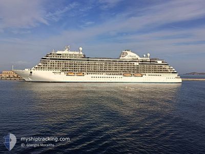
SEVEN SEAS SPLENDOR
Passenger
Current Trip
ADMIRALTY BAY,ANTARC
| Time Travelled | 2 days |
|---|---|
| Remaining Time | --- |
| Distance Travelled | 842.57 nm |
| Remaining Distance | --- |
| AVG Speed | 15.7 Knopen |
| MAX Speed | 19 Knopen |
| AVG Wind | 13.8 knots |
| MAX Wind | 36 knots |
| MIN Temp | 0.7°C / 33.26°F |
| MAX Temp | 19.9°C / 67.82°F |
| Diepgang | 7.2 M |
| Positie ontvangen | 1 d geleden |
Current Position
| Lengtegraad | -66.31991° |
|---|---|
| Breedtegraat | -55.30779° |
| Status | Under way using engine |
| Snelheid | 17.2 Knopen |
| Koers | 169.7° |
| Gebied | South Atlantic Ocean |
| Station | T-AIS |
| Positie ontvangen | 1 d geleden |
Info
Information
The current position of SEVEN SEAS SPLENDOR is in South Atlantic Ocean with coordinates -55.30779° / -66.31991° as reported on 2026-01-04 19:18 by AIS to our vessel tracker app. The vessel's current speed is 17.2 Knopen
The vessel SEVEN SEAS SPLENDOR (IMO: 9807085, MMSI: 538007673) is a Passenger It's sailing under the flag of [MH] Marshall Is.
In this page you can find informations about the vessels current position, last detected port calls, and current voyage information. If the vessels is not in coverage by AIS you will find the latest position.
The current position of SEVEN SEAS SPLENDOR is detected by our AIS receivers and we are not responsible for the reliability of the data. The last position was recorded while the vessel was in Coverage by the Ais receivers of our vessel tracking app.
The current draught of SEVEN SEAS SPLENDOR as reported by AIS is 7.2 meters
Weather
| Temperature | 1.2°C / 34.16°F |
|---|---|
| Wind Speed | 7 knots |
| Direction | 172° S |
| Pressure | 988.6 hPa |
| Humidity | 89.4 % |
| Cloud Coverage | 100 % |
Featured Company
Last Port Calls
| Port | Arrival | Departure | Time In Port |
|---|---|---|---|
| 2026-01-02 15:28 | 2026-01-03 16:09 | 1 d | |
| 2025-12-31 06:21 | 2025-12-31 16:16 | 9 h | |
| 2025-12-27 04:58 | 2025-12-28 18:51 | 1 d | |
| 2025-12-25 11:53 | 2025-12-26 17:32 | 1 d | |
| 2025-12-24 07:43 | 2025-12-24 17:07 | 9 h | |
| 2025-12-21 06:43 | 2025-12-21 16:31 | 9 h | |
| 2025-12-16 13:23 | 2025-12-17 23:17 | 1 d | |
| 2025-12-14 09:34 | 2025-12-14 18:16 | 8 h | |
| 2025-12-13 06:20 | 2025-12-13 16:21 | 10 h | |
| 2025-12-12 06:26 | 2025-12-12 19:38 | 13 h |
Most Visited Ports (Last year)
| Port | Arrivals | |
|---|---|---|
| 7 | ||
| 6 | ||
| 6 | ||
| 5 | ||
| 4 | ||
| 4 |
Last Trips
| Origin | Departure | Destination | Arrival | Distance | |
|---|---|---|---|---|---|
| 2025-12-31 16:16 | 2026-01-02 15:28 | 758.12 nm | |||
| 2025-12-28 18:51 | 2025-12-31 06:21 | 814.61 nm | |||
| 2025-12-26 17:32 | 2025-12-27 04:58 | 139.06 nm | |||
| 2025-12-24 17:07 | 2025-12-25 11:53 | 318.33 nm | |||
| 2025-12-21 16:31 | 2025-12-24 07:43 | 730.24 nm | |||
| 2025-12-17 23:17 | 2025-12-21 06:43 | 565.93 nm | |||
| 2025-12-14 18:16 | 2025-12-16 13:23 | 748.18 nm | |||
| 2025-12-13 16:21 | 2025-12-14 09:34 | 282.55 nm | |||
| 2025-12-12 19:38 | 2025-12-13 06:20 | 131.00 nm | |||
| 2025-12-10 17:13 | 2025-12-12 06:26 | 430.24 nm |
Events
| Tijd | Evenement | Details | Positie / Bestemming | Info |
|---|---|---|---|---|
| 2026-01-04 19:25 | Status Changed | Default Under way using engine |
-55.34145 / -66.30894
ADMIRALTY BAY,ANTARC
|
Snelheid: 17.2 kn Koers: 169.7° |
| 2026-01-04 19:18 | Status Changed | Under way using engine Default |
-55.30779 / -66.31991
ADMIRALTY BAY,ANTARC
|
Snelheid: 17 kn Koers: 170° |
| 2026-01-04 19:18 | Buitenbereik |
-55.30779 / -66.31991
South Atlantic Ocean
|
Snelheid: 17.2 kn Koers: 169.7° |
|
| 2026-01-04 19:10 | Status Changed | Default Under way using engine |
-55.27299 / -66.33119
ADMIRALTY BAY,ANTARC
|
Snelheid: 17 kn Koers: 170.1° |
| 2026-01-04 19:08 | Wijzig zee gebeid | Chilean (disputed - Chilean point of view) part of the South Atlantic Ocean Chilean (disputed - Chilean point of view) part of the South Pacific Ocean |
-55.26326 / -66.33413
South Atlantic Ocean
|
Snelheid: 17 kn Koers: 170.1° |
| 2026-01-04 19:03 | Status Changed | Under way using engine Default |
-55.24059 / -66.34109
ADMIRALTY BAY,ANTARC
|
Snelheid: 16.8 kn Koers: 171° |
| 2026-01-04 19:01 | Status Changed | Default Under way using engine |
-55.23085 / -66.34385
ADMIRALTY BAY,ANTARC
|
Snelheid: 16.6 kn Koers: 169.7° |
| 2026-01-04 18:56 | Wijzig zee gebeid | Chilean (disputed - Chilean point of view) part of the South Pacific Ocean Argentinean part of the South Pacific Ocean |
-55.20882 / -66.35067
South Pacific Ocean
|
Snelheid: 16.6 kn Koers: 169.7° |
| 2026-01-04 18:56 | Status Changed | Under way using engine Default |
-55.20882 / -66.35067
ADMIRALTY BAY,ANTARC
|
Snelheid: 17 kn Koers: 171° |
| 2026-01-04 18:56 | Binnenbereik |
-55.20882 / -66.35067
South Pacific Ocean
|
Snelheid: 16.6 kn Koers: 169.7° |