

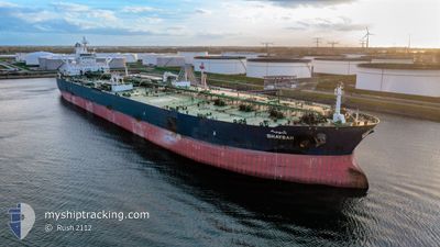
SHAYBAH
Crude Oil Tanker

Current Trip
| Time Travelled | 2 days |
|---|---|
| Remaining Time | --- |
| Distance Travelled | 504.02 nm |
| Remaining Distance | --- |
| AVG Speed | 13 Knopen |
| MAX Speed | 14.3 Knopen |
| AVG Wind | 8.2 knots |
| MAX Wind | 15.3 knots |
| MIN Temp | 19.1°C / 66.38°F |
| MAX Temp | 29.4°C / 84.92°F |
| Diepgang | 20.8 M |
| Positie ontvangen | 1 d geleden |
Current Position
| Lengtegraad | 33.04076° |
|---|---|
| Breedtegraat | 28.64367° |
| Status | Under way using engine |
| Snelheid | 14.2 Knopen |
| Koers | 335.9° |
| Gebied | Gulf of Suez |
| Station | T-AIS |
| Positie ontvangen | 1 d geleden |
Information
The current position of SHAYBAH is in Gulf of Suez with coordinates 28.64367° / 33.04076° as reported on 2025-04-01 21:16 by AIS to our vessel tracker app. The vessel's current speed is 14.2 Knopen
The vessel SHAYBAH (IMO: 9384203, MMSI: 403561000) is a Crude Oil Tanker that was built in 2008 ( 17 Jaar oud ). It's sailing under the flag of [SA] Saudi Arabia.
In this page you can find informations about the vessels current position, last detected port calls, and current voyage information. If the vessels is not in coverage by AIS you will find the latest position.
The current position of SHAYBAH is detected by our AIS receivers and we are not responsible for the reliability of the data. The last position was recorded while the vessel was in Coverage by the Ais receivers of our vessel tracking app.
The current draught of SHAYBAH as reported by AIS is 20.8 meters
Weather
| Temperature | 18.6°C / 65.48°F |
|---|---|
| Wind Speed | 8 knots |
| Direction | 313° NW |
| Pressure | 1015.2 hPa |
| Humidity | 44.9 % |
| Cloud Coverage | --- |


Featured Company
Last Port Calls
| Port | Arrival | Departure | Time In Port |
|---|---|---|---|
| 2025-03-30 01:48 | 2025-03-31 11:59 | 1 d | |
| 2025-03-22 12:55 | 2025-03-24 03:22 | 1 d | |
| 2025-03-13 20:51 | 2025-03-15 06:15 | 1 d | |
| 2025-03-03 16:47 | 2025-03-05 11:46 | 1 d | |
| 2025-02-24 06:14 | 2025-02-25 16:23 | 1 d | |
| 2025-02-12 09:54 | 2025-02-13 21:20 | 1 d |
Most Visited Ports (Last year)
| Port | Arrivals | |
|---|---|---|
| 19 | ||
| 8 | ||
| 1 |
Last Trips
| Origin | Departure | Destination | Arrival | Distance | |
|---|---|---|---|---|---|
| 2025-03-24 03:22 | 2025-03-30 01:48 | 1097.61 nm | |||
| 2025-03-15 06:15 | 2025-03-22 12:55 | 1002.05 nm | |||
| 2025-03-05 11:46 | 2025-03-13 20:51 | 981.07 nm | |||
| 2025-02-25 16:23 | 2025-03-03 16:47 | 1085.04 nm | |||
| 2025-02-13 21:20 | 2025-02-24 06:14 | 1503.04 nm | |||
| 2025-01-31 06:42 | 2025-02-12 09:54 | 1579.56 nm |
Events
| Tijd | Evenement | Details | Positie / Bestemming | Info |
|---|---|---|---|---|
| 2025-04-02 04:29 | Stop beweging | 4.85 nm, South of SOKHNA |
29.56725 / 32.38145
EG AIS
|
Snelheid: 0.3 kn Koers: 345° |
| 2025-04-01 21:21 | Status Changed | Default Under way using engine |
28.66200 / 33.03193
EG AIS
|
Snelheid: 14.2 kn Koers: 335.9° |
| 2025-04-01 21:16 | Buitenbereik |
28.64367 / 33.04076
Gulf of Suez
EG AIS
|
Snelheid: 14.2 kn Koers: 335.9° |
|
| 2025-04-01 19:32 | Status Changed | Under way using engine Default |
28.30215 / 33.25705
EG AIS
|
Snelheid: 13.7 kn Koers: 326° |
| 2025-04-01 19:32 | Binnenbereik |
28.30215 / 33.25705
Gulf of Suez
EG AIS
|
Snelheid: 13.8 kn Koers: 328.9° |
|
| 2025-04-01 15:20 | Status Changed | Default Under way using engine |
27.65028 / 33.95667
EG AIS
|
Snelheid: 12.9 kn Koers: 310° |
| 2025-04-01 15:07 | Buitenbereik |
27.62057 / 33.99547
Gulf of Suez
EG AIS
|
Snelheid: 12.9 kn Koers: 310° |
|
| 2025-04-01 14:34 | Wijzig zee gebeid | Egyptian part of the Gulf of Suez Egyptian part of the Red Sea |
27.54888 / 34.10133
Gulf of Suez
EG AIS
|
Snelheid: 11.6 kn Koers: 307° |
| 2025-04-01 04:31 | Wijzig zee gebeid | Egyptian part of the Red Sea Saudi Arabian part of the Red Sea |
25.80573 / 35.56542
Red Sea
EG AIS
|
Snelheid: 13.1 kn Koers: 324° |
| 2025-04-01 00:14 | Status Changed | Under way using engine Default |
25.00500 / 36.15498
EG AIS
|
Snelheid: 13.5 kn Koers: 317° |