
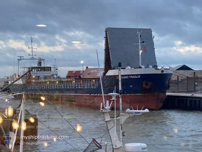
SHETLAND TRADER
General Cargo
Current Trip
GBKLN
| Time Travelled | 2 days |
|---|---|
| Remaining Time | --- |
| Distance Travelled | 228.18 nm |
| Remaining Distance | --- |
| AVG Speed | 7.9 Knopen |
| MAX Speed | 10.7 Knopen |
| AVG Wind | 9.3 knots |
| MAX Wind | 16.8 knots |
| MIN Temp | 7.9°C / 46.22°F |
| MAX Temp | 16.6°C / 61.88°F |
| Diepgang | 2.6 M |
| Positie ontvangen | 1 d geleden |
Current Position
| Lengtegraad | 0.62899° |
|---|---|
| Breedtegraat | 53.28363° |
| Status | Under way using engine |
| Snelheid | 10.5 Knopen |
| Koers | 182.8° |
| Gebied | North Sea |
| Station | T-AIS |
| Positie ontvangen | 1 d geleden |
Information
The current position of SHETLAND TRADER is in North Sea with coordinates 53.28363° / 0.62899° as reported on 2025-04-12 15:56 by AIS to our vessel tracker app. The vessel's current speed is 10.5 Knopen
The vessel SHETLAND TRADER (IMO: 9030486, MMSI: 636023864) is a General Cargo that was built in 1992 ( 33 Jaar oud ). It's sailing under the flag of [LR] Liberia.
In this page you can find informations about the vessels current position, last detected port calls, and current voyage information. If the vessels is not in coverage by AIS you will find the latest position.
The current position of SHETLAND TRADER is detected by our AIS receivers and we are not responsible for the reliability of the data. The last position was recorded while the vessel was in Coverage by the Ais receivers of our vessel tracking app.
The current draught of SHETLAND TRADER as reported by AIS is 2.6 meters
Weather
| Temperature | 9.9°C / 49.82°F |
|---|---|
| Wind Speed | 16 knots |
| Direction | 115° ESE |
| Pressure | 1003.9 hPa |
| Humidity | 85.2 % |
| Cloud Coverage | 65 % |
Featured Company
Last Port Calls
| Port | Arrival | Departure | Time In Port |
|---|---|---|---|
| 2025-04-10 12:25 | 2025-04-11 13:03 | 1 d | |
| 2025-04-05 03:51 | 2025-04-07 20:31 | 2 d | |
| 2025-04-04 02:28 | 2025-04-04 15:13 | 12 h | |
| 2025-04-02 12:50 | 2025-04-03 14:14 | 1 d | |
| 2025-03-29 10:29 | 2025-04-01 14:22 | 3 d | |
| 2025-03-18 04:00 | 2025-03-29 09:51 | 11 d | |
| 2025-03-14 14:07 | 2025-03-16 02:53 | 1 d | |
| 2025-03-05 14:49 | 2025-03-08 08:13 | 2 d | |
| 2025-03-01 02:26 | 2025-03-02 03:23 | 1 d | |
| 2025-02-25 22:35 | 2025-02-26 11:33 | 12 h |
Most Visited Ports (Last year)
| Port | Arrivals | |
|---|---|---|
| 10 | ||
| 9 | ||
| 6 | ||
| 5 | ||
| 5 | ||
| 4 |
Last Trips
| Origin | Departure | Destination | Arrival | Distance | |
|---|---|---|---|---|---|
| 2025-04-07 21:31 | 2025-04-10 13:25 | 393.39 nm | |||
| 2025-04-04 16:13 | 2025-04-05 04:51 | 96.80 nm | |||
| 2025-04-03 16:14 | 2025-04-04 03:28 | 51.33 nm | |||
| 2025-04-01 16:22 | 2025-04-02 14:50 | 147.91 nm | |||
| 2025-03-29 10:51 | 2025-03-29 11:29 | 3.29 nm | |||
| 2025-03-16 02:53 | 2025-03-18 05:00 | 390.75 nm | |||
| 2025-03-08 08:13 | 2025-03-14 14:07 | 521.00 nm | |||
| 2025-03-02 03:23 | 2025-03-05 14:49 | 507.48 nm | |||
| 2025-02-26 11:33 | 2025-03-01 02:26 | 397.30 nm | |||
| 2025-02-24 17:22 | 2025-02-25 22:35 | 204.32 nm |
Events
| Tijd | Evenement | Details | Positie / Bestemming | Info |
|---|---|---|---|---|
| 2025-04-12 15:56 | Buitenbereik |
53.28363 / .62899
North Sea
|
Snelheid: 10.5 kn Koers: 182.8° |
|
| 2025-04-12 13:51 | Binnenbereik |
53.60915 / .52227
North Sea
|
Snelheid: 9.2 kn Koers: 153.8° |
|
| 2025-04-12 11:55 | Buitenbereik |
53.84537 / .27535
North Sea
|
Snelheid: 8 kn Koers: 147.1° |
|
| 2025-04-12 08:41 | Binnenbereik |
54.17053 / -.07800
North Sea
|
Snelheid: 6.7 kn Koers: 143.9° |
|
| 2025-04-12 05:27 | Buitenbereik |
54.52701 / -.54423
North Sea
|
Snelheid: 9.5 kn Koers: 136° |
|
| 2025-04-12 05:17 | Binnenbereik |
54.54060 / -.56821
North Sea
|
Snelheid: 9.6 kn Koers: 133.8° |
|
| 2025-04-12 03:44 | Buitenbereik |
54.71323 / -.90247
North Sea
|
Snelheid: 9.7 kn Koers: 131.9° |
|
| 2025-04-12 00:38 | Binnenbereik |
55.11955 / -1.31043
North Sea
|
Snelheid: 9.1 kn Koers: 164.7° |
|
| 2025-04-11 22:29 | Buitenbereik |
55.42626 / -1.45639
North Sea
|
Snelheid: 7.9 kn Koers: 166.7° |
|
| 2025-04-11 17:12 | Binnenbereik |
55.95117 / -2.14091
North Sea
|
Snelheid: 9.1 kn Koers: 115.7° |