
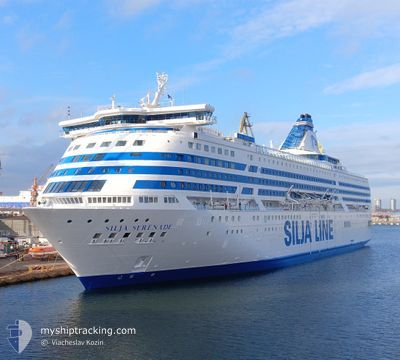
SILJA SERENADE
Ro-Ro/Passenger Ship
Current Trip
| Time Travelled | 5 h, 49 mins |
|---|---|
| Remaining Time | 4 h, 46 mins |
| Distance Travelled | 95.00 nm |
| Remaining Distance | 87.53 nm |
| AVG Speed | 15.2 Knopen |
| MAX Speed | 17.5 Knopen |
| AVG Wind | 10.9 knots |
| MAX Wind | 16 knots |
| MIN Temp | 2.5°C / 36.5°F |
| MAX Temp | 3.4°C / 38.12°F |
| Diepgang | 7.1 M |
| Positie ontvangen | 1 m geleden |
Current Position
| Lengtegraad | 22.20923° |
|---|---|
| Breedtegraat | 59.56408° |
| Status | Under way using engine |
| Snelheid | 17.4 Knopen |
| Koers | 259° |
| Gebied | Baltic Sea |
| Station | T-AIS |
| Positie ontvangen | 1 m geleden |
Info
Information
The current position of SILJA SERENADE is in Baltic Sea with coordinates 59.56408° / 22.20923° as reported on 2025-03-23 20:56 by AIS to our vessel tracker app. The vessel's current speed is 17.4 Knopen and is heading at the port of MARIEHAMN. The estimated time of arrival as calculated by MyShipTracking vessel tracking app is 2025-03-24 03:43 LT
The vessel SILJA SERENADE (IMO: 8715259, MMSI: 230184000) is a Ro-Ro/Passenger Ship that was built in 1990 ( 35 Jaar oud ). It's sailing under the flag of [FI] Finland.
In this page you can find informations about the vessels current position, last detected port calls, and current voyage information. If the vessels is not in coverage by AIS you will find the latest position.
The current position of SILJA SERENADE is detected by our AIS receivers and we are not responsible for the reliability of the data. The last position was recorded while the vessel was in Coverage by the Ais receivers of our vessel tracking app.
The current draught of SILJA SERENADE as reported by AIS is 7.1 meters
Weather
| Temperature | 3.4°C / 38.12°F |
|---|---|
| Wind Speed | 16 knots |
| Direction | 118° ESE |
| Pressure | 1026.1 hPa |
| Humidity | 66.1 % |
| Cloud Coverage | 29 % |
Featured Company
Last Port Calls
| Port | Arrival | Departure | Time In Port |
|---|---|---|---|
| 2025-03-23 10:09 | 2025-03-23 17:08 | 6 h | |
| 2025-03-22 23:33 | 2025-03-22 23:54 | 21 m | |
| 2025-03-22 09:44 | 2025-03-22 16:53 | 7 h | |
| 2025-03-22 04:00 | 2025-03-22 04:23 | 23 m | |
| 2025-03-21 10:13 | 2025-03-21 17:06 | 6 h | |
| 2025-03-20 23:36 | 2025-03-21 00:00 | 24 m | |
| 2025-03-20 09:40 | 2025-03-20 16:49 | 7 h | |
| 2025-03-20 03:58 | 2025-03-20 04:22 | 24 m | |
| 2025-03-19 10:07 | 2025-03-19 17:09 | 7 h | |
| 2025-03-18 23:35 | 2025-03-18 23:57 | 21 m |
Last Trips
| Origin | Departure | Destination | Arrival | Distance | |
|---|---|---|---|---|---|
| 2025-03-22 23:54 | 2025-03-23 10:09 | 184.03 nm | |||
| 2025-03-22 16:53 | 2025-03-22 23:33 | 77.75 nm | |||
| 2025-03-22 04:23 | 2025-03-22 09:44 | 79.59 nm | |||
| 2025-03-21 17:06 | 2025-03-22 04:00 | 183.21 nm | |||
| 2025-03-21 00:00 | 2025-03-21 10:13 | 184.30 nm | |||
| 2025-03-20 16:49 | 2025-03-20 23:36 | 77.89 nm | |||
| 2025-03-20 04:22 | 2025-03-20 09:40 | 79.57 nm | |||
| 2025-03-19 17:09 | 2025-03-20 03:58 | 183.19 nm | |||
| 2025-03-18 23:57 | 2025-03-19 10:07 | 184.15 nm | |||
| 2025-03-18 16:46 | 2025-03-18 23:35 | 77.76 nm |
Events
| Tijd | Evenement | Details | Positie / Bestemming | Info |
|---|---|---|---|---|
| 2025-03-23 19:26 | Wijzig zee gebeid | Finnish part of the Baltic Sea Finnish part of the Gulf of Finland |
59.64556 / 23.04316
Baltic Sea
FIHEL<>FIMHQ<>SESTO
|
Snelheid: 17.4 kn Koers: 259.8° |
| 2025-03-23 15:08 | Vertrekhaven |
|
60.15787 / 24.98652
FIHEL<>FIMHQ<>SESTO
|
Snelheid: 11.6 kn Koers: 115° |
| 2025-03-23 15:02 | Start beweging |
60.16383 / 24.96189
[FI] HELSINKI
|
Snelheid: 3.1 kn Koers: 110° |
|
| 2025-03-23 14:52 | Status Changed | Under way using engine Moored |
60.16139 / 24.95995
[FI] HELSINKI
|
Snelheid: Koers: 138° |
| 2025-03-23 08:28 | ETA Changed | 2025/03/24 09:00 2025/03/23 08:30 |
60.16142 / 24.95969
[FI] HELSINKI
|
Snelheid: Koers: 138° |
| 2025-03-23 08:27 | Status Changed | Moored Under way using engine |
60.16142 / 24.95969
[FI] HELSINKI
|
Snelheid: Koers: 138° |
| 2025-03-23 08:22 | Stop beweging |
60.16125 / 24.96018
[FI] HELSINKI
|
Snelheid: 0.3 kn Koers: 141° |
|
| 2025-03-23 08:09 | Aankomsthaven |
|
60.15851 / 24.98283
[FI] HELSINKI
|
Snelheid: 10.7 kn Koers: 298.1° |
| 2025-03-23 04:04 | Wijzig zee gebeid | Finnish part of the Gulf of Finland Finnish part of the Baltic Sea |
59.66592 / 23.03879
Gulf of Finland
FIHEL<>FIMHQ<>SESTO
|
Snelheid: 18.1 kn Koers: 78.4° |
| 2025-03-23 00:59 | Status Changed | Under way using engine Default |
59.58227 / 21.21733
FIHEL<>FIMHQ<>SESTO
|
Snelheid: 18.4 kn Koers: 102° |