

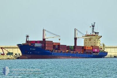
SKY LIGHT
Container Ship
Current Trip
| Time Travelled | 16 h, 16 mins |
|---|---|
| Remaining Time | --- |
| Distance Travelled | 134.34 nm |
| Remaining Distance | --- |
| AVG Speed | 10.1 Knopen |
| MAX Speed | 11.8 Knopen |
| AVG Wind | 8.8 knots |
| MAX Wind | 11.9 knots |
| MIN Temp | 21.3°C / 70.34°F |
| MAX Temp | 25.3°C / 77.54°F |
| Diepgang | 6.7 M |
| Positie ontvangen | 2 h, 45 m geleden |
Current Position
| Lengtegraad | 12.54143° |
|---|---|
| Breedtegraat | 36.27334° |
| Status | Under way using engine |
| Snelheid | 11.4 Knopen |
| Koers | 114.2° |
| Gebied | Mediterranean Sea - Eastern Basin |
| Station | T-AIS |
| Positie ontvangen | 2 h, 45 m geleden |
Information
The current position of SKY LIGHT is in Mediterranean Sea - Eastern Basin with coordinates 36.27334° / 12.54143° as reported on 2025-06-06 10:30 by AIS to our vessel tracker app. The vessel's current speed is 11.4 Knopen
The vessel SKY LIGHT (IMO: 9118513, MMSI: 312991000) is a Container Ship that was built in 1996 ( 29 Jaar oud ). It's sailing under the flag of [BZ] Belize.
In this page you can find informations about the vessels current position, last detected port calls, and current voyage information. If the vessels is not in coverage by AIS you will find the latest position.
The current position of SKY LIGHT is detected by our AIS receivers and we are not responsible for the reliability of the data. The last position was recorded while the vessel was in Coverage by the Ais receivers of our vessel tracking app.
The current draught of SKY LIGHT as reported by AIS is 6.7 meters
Weather
| Temperature | 22.3°C / 72.14°F |
|---|---|
| Wind Speed | 8 knots |
| Direction | 152° SSE |
| Pressure | 1019.8 hPa |
| Humidity | 76 % |
| Cloud Coverage | --- |
Featured Company
Most Visited Ports (Last year)
| Port | Arrivals | |
|---|---|---|
| 17 | ||
| 9 | ||
| 6 | ||
| 4 | ||
| 2 | ||
| 2 |
Events
| Tijd | Evenement | Details | Positie / Bestemming | Info |
|---|---|---|---|---|
| 2025-06-06 10:30 | Buitenbereik |
36.27334 / 12.54143
Mediterranean Sea - Eastern Basin
LYMRA
|
Snelheid: 11.4 kn Koers: 114.2° |
|
| 2025-06-06 10:27 | Wijzig zee gebeid | Italian part of the Mediterranean Sea - Eastern Basin Tunisian part of the Mediterranean Sea - Eastern Basin |
36.27781 / 12.52934
Mediterranean Sea - Eastern Basin
LYMRA
|
Snelheid: 11.5 kn Koers: 113.5° |
| 2025-06-06 10:25 | Binnenbereik |
36.28096 / 12.52088
Mediterranean Sea - Eastern Basin
LYMRA
|
Snelheid: 11.5 kn Koers: 114.6° |
|
| 2025-06-06 05:28 | Buitenbereik |
36.75414 / 11.58838
Mediterranean Sea - Eastern Basin
LYMRA
|
Snelheid: 4.6 kn Koers: 267.7° |
|
| 2025-06-06 05:26 | Start beweging | 17.57 nm, West of PANTELLERIA |
36.75314 / 11.59115
LYMRA
|
Snelheid: 4 kn Koers: 296° |
| 2025-06-06 05:14 | Stop beweging | 17.54 nm, West of PANTELLERIA |
36.75082 / 11.59264
LYMRA
|
Snelheid: 0.2 kn Koers: 65° |
| 2025-06-06 05:13 | Binnenbereik |
36.75091 / 11.59235
Mediterranean Sea - Eastern Basin
LYMRA
|
Snelheid: 0.7 kn Koers: 122.2° |
|
| 2025-06-06 02:41 | Buitenbereik |
37.07325 / 11.22869
Mediterranean Sea - Eastern Basin
LYMRA
|
Snelheid: 10.9 kn Koers: 123.2° |
|
| 2025-06-06 02:40 | Gevonden in zee | Tunisian part of the Mediterranean Sea - Eastern Basin |
37.07522 / 11.22498
Mediterranean Sea - Eastern Basin
LYMRA
|
Snelheid: 10.9 kn Koers: 123° |
| 2025-06-06 00:40 | Draught Changed | 6.7 8.3 |
37.18101 / 10.79141
LYMRA
|
Snelheid: 11.8 kn Koers: 73.2° |