
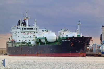
SOLAR ALICE
Tanker
Current Trip
| Time Travelled | 12 h, 18 mins |
|---|---|
| Remaining Time | 2 h, 48 mins |
| Distance Travelled | 128.83 nm |
| Remaining Distance | 32.69 nm |
| AVG Speed | 9.4 Knopen |
| MAX Speed | 12.2 Knopen |
| AVG Wind | 12.1 knots |
| MAX Wind | 18.9 knots |
| MIN Temp | 1.7°C / 35.06°F |
| MAX Temp | 3.5°C / 38.3°F |
| Diepgang | 8.2 M |
| Positie ontvangen | 1 m geleden |
Current Position
| Lengtegraad | 3.36556° |
|---|---|
| Breedtegraat | 51.90122° |
| Status | Under way using engine |
| Snelheid | 8.4 Knopen |
| Koers | 83.7° |
| Gebied | North Sea |
| Station | T-AIS |
| Positie ontvangen | 1 m geleden |
Info
Information
The current position of SOLAR ALICE is in North Sea with coordinates 51.90122° / 3.36556° as reported on 2025-02-16 10:42 by AIS to our vessel tracker app. The vessel's current speed is 8.4 Knopen and is heading at the port of ROTTERDAM. The estimated time of arrival as calculated by MyShipTracking vessel tracking app is 2025-02-16 13:31 LT
The vessel SOLAR ALICE (IMO: 9887384, MMSI: 636020365) is a Tanker It's sailing under the flag of [LR] Liberia.
In this page you can find informations about the vessels current position, last detected port calls, and current voyage information. If the vessels is not in coverage by AIS you will find the latest position.
The current position of SOLAR ALICE is detected by our AIS receivers and we are not responsible for the reliability of the data. The last position was recorded while the vessel was in Coverage by the Ais receivers of our vessel tracking app.
The current draught of SOLAR ALICE as reported by AIS is 8.2 meters
Weather
| Temperature | 1.9°C / 35.42°F |
|---|---|
| Wind Speed | 18 knots |
| Direction | 91° E |
| Pressure | 1022.1 hPa |
| Humidity | 68.9 % |
| Cloud Coverage | 63 % |
Featured Company
Last Port Calls
| Port | Arrival | Departure | Time In Port |
|---|---|---|---|
| 2025-02-14 15:48 | 2025-02-15 22:25 | 1 d | |
| 2025-02-10 15:53 | 2025-02-12 00:53 | 1 d | |
| 2025-02-01 13:49 | 2025-02-02 13:22 | 23 h | |
| 2025-01-29 08:34 | 2025-01-30 13:42 | 1 d | |
| 2025-01-25 04:49 | 2025-01-26 17:21 | 1 d | |
| 2025-01-23 13:08 | 2025-01-24 12:59 | 23 h | |
| 2025-01-19 08:52 | 2025-01-20 23:31 | 1 d | |
| 2025-01-14 14:25 | 2025-01-16 02:44 | 1 d | |
| 2025-01-08 16:40 | 2025-01-10 19:20 | 2 d | |
| 2025-01-04 18:36 | 2025-01-06 02:13 | 1 d |
Most Visited Ports (Last year)
| Port | Arrivals | |
|---|---|---|
| 8 | ||
| 8 | ||
| 5 | ||
| 5 | ||
| 4 | ||
| 4 |
Last Trips
| Origin | Departure | Destination | Arrival | Distance | |
|---|---|---|---|---|---|
| 2025-02-12 01:53 | 2025-02-14 15:48 | 180.24 nm | |||
| 2025-02-02 14:22 | 2025-02-10 16:53 | 563.61 nm | |||
| 2025-01-30 14:42 | 2025-02-01 14:49 | 527.69 nm | |||
| 2025-01-26 18:21 | 2025-01-29 09:34 | 660.40 nm | |||
| 2025-01-24 13:59 | 2025-01-25 05:49 | 45.03 nm | |||
| 2025-01-21 00:31 | 2025-01-23 14:08 | 678.54 nm | |||
| 2025-01-16 03:44 | 2025-01-19 09:52 | 550.73 nm | |||
| 2025-01-10 20:20 | 2025-01-14 15:25 | 174.92 nm | |||
| 2025-01-06 03:13 | 2025-01-08 17:40 | 191.31 nm | |||
| 2025-01-03 07:21 | 2025-01-04 19:36 | 382.25 nm |
Events
| Tijd | Evenement | Details | Positie / Bestemming | Info |
|---|---|---|---|---|
| 2025-02-16 09:23 | ETA Changed | 2025/02/16 12:00 2025/02/16 12:30 |
51.85403 / 2.99982
NLRTM
|
Snelheid: 10.5 kn Koers: 82.4° |
| 2025-02-16 08:50 | ETA Changed | 2025/02/16 12:30 2025/02/16 12:00 |
51.82876 / 2.86499
NLRTM
|
Snelheid: 9.4 kn Koers: 68.6° |
| 2025-02-16 07:22 | Wijzig zee gebeid | Dutch part of the North Sea United Kingdom part of the North Sea |
51.86559 / 2.54895
North Sea
NLRTM
|
Snelheid: 9.8 kn Koers: 127.1° |
| 2025-02-15 22:25 | Vertrekhaven |
|
51.47007 / .30809
NLRTM
|
Snelheid: 4.8 kn Koers: 94° |
| 2025-02-15 22:24 | Start beweging |
51.46964 / .30460
[GB] SOUTH STIFFORD
|
Snelheid: 3.2 kn Koers: 77° |
|
| 2025-02-15 22:01 | Status Changed | Under way using engine Moored |
51.47125 / .30263
[GB] SOUTH STIFFORD
|
Snelheid: Koers: 257° |
| 2025-02-15 18:39 | Status Changed | Moored Default |
51.47125 / .30264
[GB] SOUTH STIFFORD
|
Snelheid: Koers: 257° |
| 2025-02-15 18:33 | Status Changed | Default Moored |
51.47126 / .30265
[GB] SOUTH STIFFORD
|
Snelheid: Koers: 257° |
| 2025-02-15 16:59 | Status Changed | Moored Default |
51.47125 / .30262
[GB] SOUTH STIFFORD
|
Snelheid: Koers: 257° |
| 2025-02-15 16:56 | Status Changed | Default Moored |
51.47125 / .30263
[GB] SOUTH STIFFORD
|
Snelheid: Koers: 257° |