
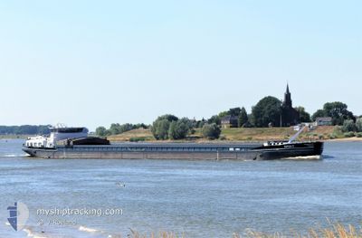
SPIRIT
Cargo
Current Trip
| Time Travelled | 7 days |
|---|---|
| Remaining Time | --- |
| Distance Travelled | 250.01 nm |
| Remaining Distance | --- |
| AVG Speed | 7 Knopen |
| MAX Speed | 8.3 Knopen |
| AVG Wind | 8.4 knots |
| MAX Wind | 12.2 knots |
| MIN Temp | 2.1°C / 35.78°F |
| MAX Temp | 6.6°C / 43.88°F |
| Diepgang | 2.3 M |
| Positie ontvangen | 3 d geleden |
Current Position
| Lengtegraad | 11.05289° |
|---|---|
| Breedtegraat | 49.69878° |
| Status | Under way using engine |
| Snelheid | 5.4 Knopen |
| Koers | 12.3° |
| Gebied | North Sea |
| Station | T-AIS |
| Positie ontvangen | 3 d geleden |
Info
Information
The current position of SPIRIT is in North Sea with coordinates 49.69878° / 11.05289° as reported on 2025-02-11 14:46 by AIS to our vessel tracker app. The vessel's current speed is 5.4 Knopen and is heading at the port of NEUSS. The estimated time of arrival as calculated by MyShipTracking vessel tracking app is 2025-02-17 16:20 LT
The vessel SPIRIT (MMSI: 244660955) is a Cargo It's sailing under the flag of [NL] Netherlands.
In this page you can find informations about the vessels current position, last detected port calls, and current voyage information. If the vessels is not in coverage by AIS you will find the latest position.
The current position of SPIRIT is detected by our AIS receivers and we are not responsible for the reliability of the data. The last position was recorded while the vessel was in Coverage by the Ais receivers of our vessel tracking app.
The current draught of SPIRIT as reported by AIS is 2.3 meters
Weather
| Temperature | 2.7°C / 36.86°F |
|---|---|
| Wind Speed | 5 knots |
| Direction | 103° ESE |
| Pressure | 1023 hPa |
| Humidity | 78.3 % |
| Cloud Coverage | 99 % |
Featured Company
Last Port Calls
| Port | Arrival | Departure | Time In Port |
|---|---|---|---|
| 2025-02-07 10:01 | |||
| 2025-01-28 11:25 | 2025-01-28 12:00 | 35 m | |
| 2025-01-28 09:59 | 2025-01-28 10:24 | 24 m | |
| 2025-01-28 09:18 | 2025-01-28 09:51 | 33 m | |
| 2025-01-27 22:27 | 2025-01-28 05:21 | 6 h | |
| 2025-01-26 22:32 | 2025-01-27 05:16 | 6 h | |
| 2025-01-26 00:01 | 2025-01-26 00:46 | 44 m | |
| 2025-01-25 18:23 | 2025-01-25 18:51 | 28 m | |
| 2025-01-21 12:53 | 2025-01-25 14:24 | 4 d | |
| 2025-01-20 18:32 | 2025-01-21 07:28 | 12 h |
Most Visited Ports (Last year)
| Port | Arrivals | |
|---|---|---|
| 16 | ||
| 14 | ||
| 12 | ||
| 10 | ||
| 10 | ||
| 9 |
Last Trips
| Origin | Departure | Destination | Arrival | Distance | |
|---|---|---|---|---|---|
| 2025-01-28 10:24 | 2025-01-28 11:25 | 5.06 nm | |||
| 2025-01-28 09:51 | 2025-01-28 09:59 | 0.51 nm | |||
| 2025-01-28 05:21 | 2025-01-28 09:18 | 17.61 nm | |||
| 2025-01-27 05:16 | 2025-01-27 22:27 | 76.69 nm | |||
| 2025-01-26 00:46 | 2025-01-26 22:32 | 104.30 nm | |||
| 2025-01-25 18:51 | 2025-01-26 00:01 | 30.63 nm | |||
| 2025-01-25 14:24 | 2025-01-25 18:23 | 30.93 nm | |||
| 2025-01-21 07:28 | 2025-01-21 12:53 | 35.67 nm | |||
| 2025-01-20 10:47 | 2025-01-20 18:32 | 34.34 nm | |||
| 2025-01-18 10:19 | 2025-01-18 13:06 | 27.62 nm |
Events
| Tijd | Evenement | Details | Positie / Bestemming | Info |
|---|---|---|---|---|
| 2025-02-11 14:46 | Buitenbereik |
49.69878 / 11.05289
North Sea
HAFEN NEUSS
|
Snelheid: 5.4 kn Koers: 12.3° |
|
| 2025-02-11 14:37 | Start beweging | 13.8 nm, South East of BAMBERG |
49.68789 / 11.04142
HAFEN NEUSS
|
Snelheid: 5 kn Koers: 42.9° |
| 2025-02-11 14:33 | Status Changed | Under way using engine Moored |
49.68550 / 11.03816
HAFEN NEUSS
|
Snelheid: Koers: 511° |
| 2025-02-11 14:14 | Status Changed | Moored Under way using engine |
49.68491 / 11.03734
HAFEN NEUSS
|
Snelheid: 0.1 kn Koers: 511° |
| 2025-02-11 14:13 | Stop beweging | 13.9 nm, South East of BAMBERG |
49.68491 / 11.03735
HAFEN NEUSS
|
Snelheid: 0.2 kn Koers: 511° |
| 2025-02-11 13:32 | Binnenbereik |
49.64223 / 10.99886
North Sea
HAFEN NEUSS
|
Snelheid: 5 kn Koers: 42.3° |
|
| 2025-02-08 14:13 | Buitenbereik |
48.31861 / 14.20749
North Sea
HAFEN NEUSS
|
Snelheid: 6.7 kn Koers: 324° |
|
| 2025-02-08 13:15 | Draught Changed | 2.3 2.4 |
48.29595 / 14.33979
HAFEN NEUSS
|
Snelheid: 8.1 kn Koers: 343.4° |
| 2025-02-08 13:15 | Destination Changed | HAFEN NEUSS POCHLARN |
48.29595 / 14.33979
HAFEN NEUSS
|
Snelheid: 8.1 kn Koers: 343.4° |
| 2025-02-08 13:15 | ETA Changed | 2025/02/17 15:20 2025/02/04 23:45 |
48.29595 / 14.33979
HAFEN NEUSS
|
Snelheid: 8.1 kn Koers: 343.4° |